Australia's transport network spans some of the world's most diverse and challenging terrains, making horizontal alignment road design Australia a critical component of safe and efficient roadway infrastructure. Under the Austroads Guide to Road Design Part 3 (AGRD03), engineers carefully design curves, tangents, sight distance, and superelevation to create roads that align with driver expectations and operating speeds.
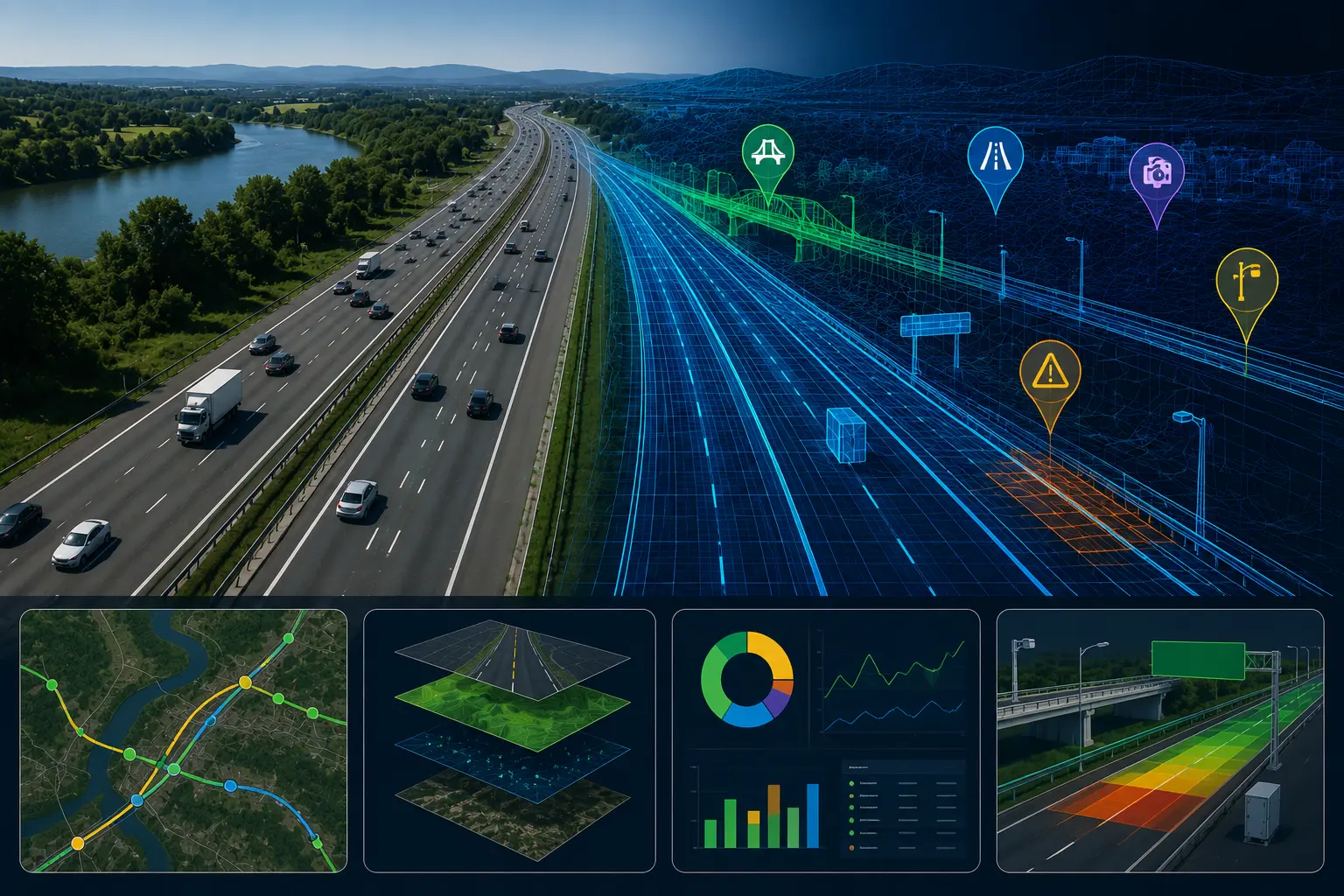
As road networks become more complex, digital technologies are transforming how roadway geometry is evaluated and maintained. AI road alignment assessment Australia and automated road geometry audit Australia solutions now help transport agencies analyze alignment performance, identify potential safety risks, and improve compliance with geometric design standards. By combining established engineering principles with intelligent data-driven insights, Australian authorities can build safer, more resilient, and future-ready transport infrastructure.
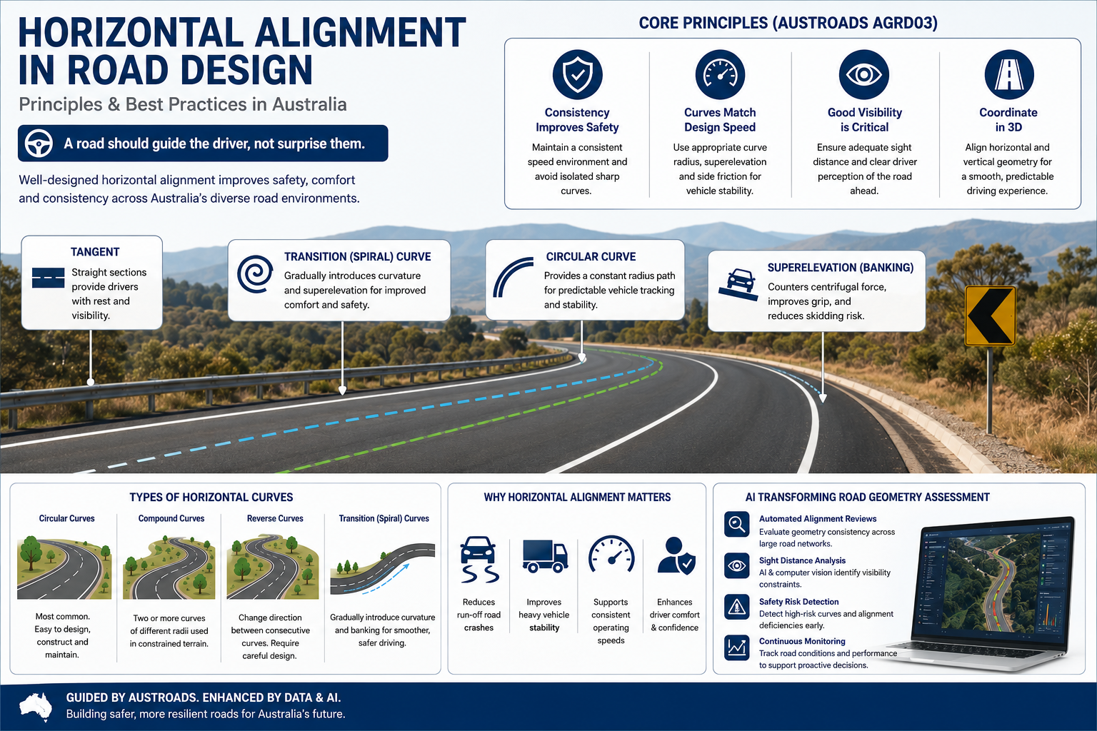
Horizontal alignment refers to the road's path when viewed from above. It consists of:
Together, these geometric elements influence:
Proper alignment ensures drivers can intuitively understand the road ahead and react safely to changing conditions.
Australia presents unique road design challenges due to:
Poorly designed curves or inconsistent geometry often contribute to:
Modern AI road alignment assessment Australia solutions now help engineers evaluate roadway geometry more accurately and identify safety risks before they contribute to incidents.
Drivers naturally develop expectations based on the road environment.
When road geometry suddenly changes:
Austroads recommends maintaining a consistent speed environment and avoiding isolated sharp curves along otherwise high-speed corridors.
This principle is increasingly supported through automated road geometry audit Australia platforms that analyse alignment consistency across entire networks.
Curve radius selection directly affects vehicle stability.
The Austroads relationship between radius, speed, superelevation, and side friction is:
R = V² / 127(e + f)
Where:
Correct application ensures vehicles can safely negotiate curves without excessive lateral forces.
Modern AI road design speed analysis systems help agencies evaluate whether existing alignments remain suitable for actual operating speeds.
Circular curves are the most common alignment element in horizontal alignment road design Australia projects.
They provide:
Compound curves consist of two or more adjoining curves with different radii.
They are commonly used when:
However, sudden changes in curvature can reduce driver comfort if not carefully designed.
Reverse curves change direction between consecutive bends.
These require:
Poorly designed reverse curves can increase driver workload and reduce vehicle stability.
Transition curves gradually introduce curvature and road banking.
Benefits include:
Austroads considers spiral transitions best practice for higher-speed highways and major arterial roads.
Superelevation is the intentional banking of a roadway to counteract centrifugal forces.
Benefits include:
Under Austroads guidance:
Today, AI horizontal curve safety detection tools can automatically identify locations where inadequate superelevation may contribute to safety issues.
One of the most important aspects of geometric design is ensuring drivers can see far enough ahead to react safely.
Key requirements include:
Drivers must have sufficient visibility to:
Additional visibility may be required at:
Drivers should be able to visually recognize upcoming curvature before entering it.
Advanced AI sight distance analysis roads technology enables engineers to evaluate visibility limitations using computer vision and digital road surveys.
Road geometry should always be considered in three dimensions.
Poor combinations can create:
Austroads recommends harmonizing horizontal and vertical alignment to create a smooth, predictable driving experience.
Many agencies now use AI geometric road design audit platforms to identify alignment conflicts that may not be obvious during traditional inspections.
Modern road authorities are increasingly adopting intelligent monitoring technologies to support geometric design reviews.
RoadVision AI enables:
Using smart road geometry assessment Australia capabilities, engineers can evaluate roadway consistency across thousands of kilometres.
Automated road safety audit Austroads workflows help identify:
Through AI-powered road safety systems, authorities can:
Automated sight distance compliance audit tools help agencies ensure roads continue meeting safety standards as vegetation, roadside development, or environmental conditions change over time.
Despite established guidance, several challenges remain:
Many regional highways require design solutions for isolated environments with limited maintenance access.
Australia's geography ranges from coastal plains to mountainous regions and desert corridors.
Flooding, heat, and erosion can affect roadway geometry and long-term performance.
Heavy vehicle traffic places additional demands on alignment design and safety management.
Digital assessment tools help engineers address these challenges more efficiently than traditional field inspections alone.
Horizontal alignment is one of the most important elements of road safety and geometric design. When curves, tangents, sight distance, and superelevation work together harmoniously, roads become safer, smoother, and more predictable for all users.
Guided by Austroads AGRD03, Australian engineers continue to refine roadway geometry using data-driven approaches that improve both safety and operational performance.
By combining Austroads best practices with artificial intelligence, road agencies can create more resilient, safer, and future-ready transport networks.
Ready to modernise your roadway design reviews and safety assessments?
Discover how RoadVision AI helps transport authorities, consultants, and infrastructure teams perform automated geometric audits, roadway inspections, sight distance analysis, and safety compliance assessments across Australia's road network.
Book a demo today and see how AI can transform road design, safety auditing, and infrastructure management.
Horizontal alignment refers to the path a road follows in plan view and includes straight sections, circular curves, and transition curves that guide vehicle movement and driver perception.
Transition curves gradually introduce curvature and superelevation, improving vehicle stability, driver comfort, and safety—particularly on higher-speed roads.
AI can automate curve analysis, sight distance evaluation, safety audits, and compliance reviews, helping engineers identify risks and improve roadway performance more efficiently.

The Autonomous Road Engineer
AI that is transforming road infrastructure, from reactive to predictive.
.webp)
.webp)