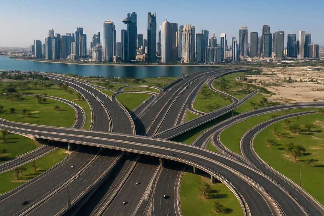
Rajamahendravaram — known widely as Rajahmundry — is one of Andhra Pradesh's oldest and most culturally significant cities. It is also a growing urban centre whose road network must support expanding commerce, daily commuter movement, and increasingly heavy freight traffic. The Rajamahendravaram Municipal Corporation (RMC) carries the responsibility for this network, but the methods it relied on were not keeping pace with the city's growth.
Traditional road inspections were slow, labour-intensive, and subject to the inconsistencies of human judgment. Field teams could assess only what they could see, log only what they could record manually, and produce reports that offered no reliable basis for year-on-year comparison. Defects were identified reactively — after deterioration had already become visible to residents or caused safety incidents.
There was no standardised condition baseline. No GPS-tagged defect inventory. No way to objectively prioritise which corridors needed structural intervention versus routine maintenance. RMC needed a system that could change this — not in years, but immediately — using AI-powered road assessment and intelligent road analytics.

RMC and RoadVision AI partnered to conduct a pilot covering 100 kilometres of Rajamahendravaram's road network — one of the larger single-city pilot deployments in RoadVision AI's India programme. The objective was clear: demonstrate AI-powered assessment at scale, generate actionable outputs for RMC's engineering teams, and build the foundation for city-wide continuous monitoring through smart infrastructure monitoring systems.

Data was collected using the RoadVision AI mobile app mounted on survey vehicles via a standard suction windshield device. Vehicles drove Rajamahendravaram's roads at regular traffic speed — capturing continuous high-resolution video, images, and GPS coordinates across all 100 kilometres without lane closures, specialist equipment, or any disruption to daily movement.
Footage was processed through RoadVision AI's intelligence platform, which automatically identified and classified road conditions and distress types — ravelling, rutting, cracking, potholes, shoving, and settlements — in line with IRC guidelines. Pavement distress ratings were calculated for every segment. Road signage compliance was assessed. Every defect was geotagged to a precise GPS coordinate, enabling automated road condition detection at scale.
RMC received AI-generated condition reports in IRC-compliant formats, a web-based GIS platform with colour-coded road segmentation by condition severity, and a comprehensive road signage inventory flagging compliant and missing signs. Three key corridors — Jawaharlal Nehru Road, Korukonda Road, and Gandhipuram — received detailed, corridor-level assessments with specific intervention recommendations.
The pilot assessment of Rajamahendravaram's 100 kilometre network revealed a road system carrying the full spectrum of urban distress — from surface-level ravelling that points to widespread coating deterioration, to structural problems like rutting and settlements that demand investigation below the pavement layer. No corridor came back clean. Every stretch now has an IRC score and a mapped defect inventory.

Specific roads including Jawaharlal Nehru Road, Korukonda Road, and Gandhipuram showed varying degrees of wear and tear comprehensively detailed in the AI-generated reports — giving RMC, for the first time, a corridor-by-corridor picture of where to act, in what order, and with what intervention type.

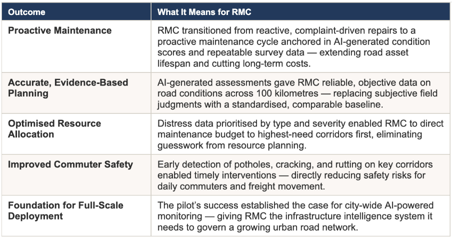
The pilot delivered more than a snapshot of road conditions. It gave RMC a new operational capability — the ability to manage infrastructure based on evidence rather than estimation. That shift, from reactive to proactive, from subjective to standardised, is what the outcomes below reflect.
Rajamahendravaram's 100 KM pilot is significant not just for what it found, but for what it proved: that a mid-sized Andhra Pradesh city with a motivated municipal corporation can deploy AI-powered road assessment at meaningful scale, produce IRC-standardised outputs, and build a live GIS layer of its road network — all through a smartphone-based system that requires no specialist infrastructure.
The corridors assessed — Jawaharlal Nehru Road, Korukonda Road, Gandhipuram — are among the city's most economically and socially significant. Getting those right first, with verifiable data, gives RMC both the operational wins and the institutional confidence to extend the system city-wide.
The baseline now exists. The methodology is proven. The path to continuous, city-wide road monitoring is open — and Rajamahendravaram is already on it.

The Autonomous Road Engineer
AI that is transforming road infrastructure, from reactive to predictive.