.webp)
AI agent that analyzes traffic flow, composition, and origin
destination patterns—converting video feeds to traffic intelligence.
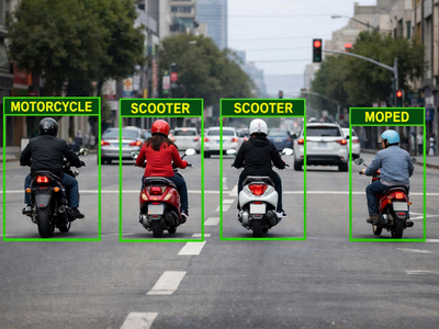
Motorcycles, scooters, and mopeds
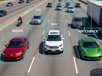
Sedans, SUVs, and vans
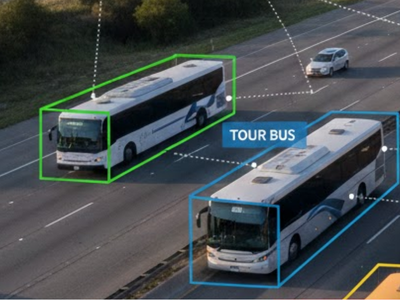
Public and private buses
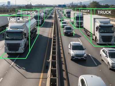
Heavy commercial vehicles
Motorcycles, scooters, and mopeds
Sedans, SUVs, and vans
Public and private buses
Heavy commercial vehicles
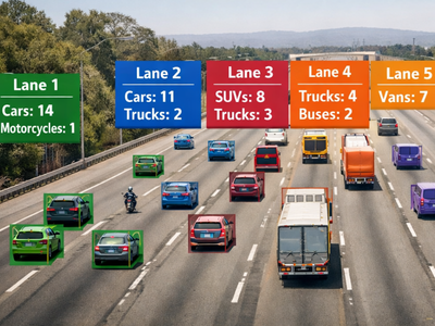
Vehicle counts by type and lane
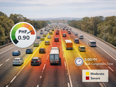
PHF and congestion patterns
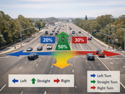
Directional distribution at junctions
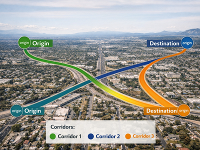
Travel patterns and corridors
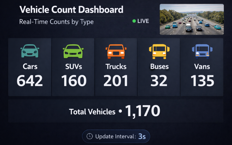
Total vehicles by type with real-time counts
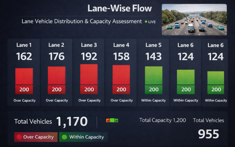
Per-lane vehicle distribution and capacity assessment
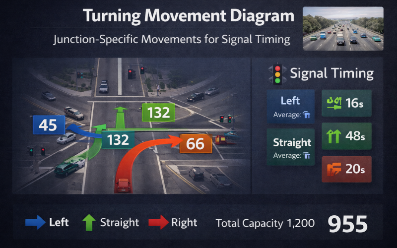
Junction-specific movements for signal timing
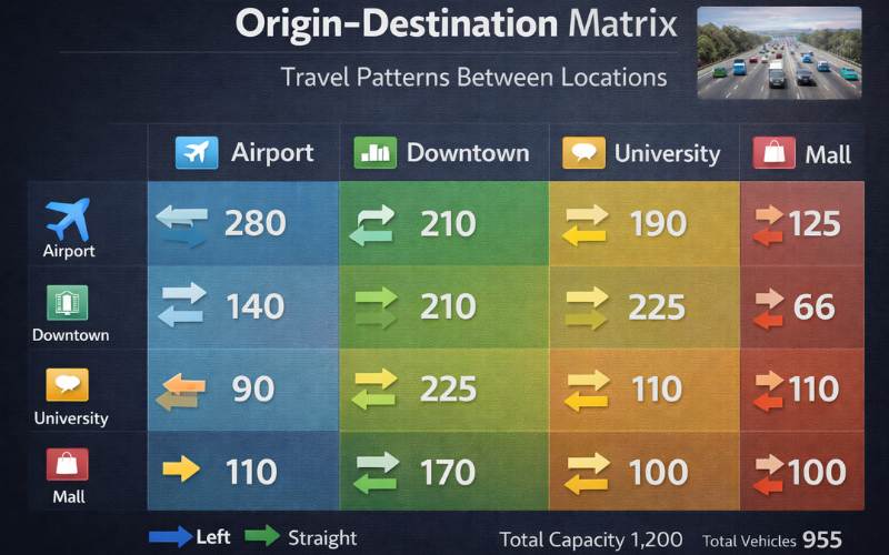
Travel patterns between locations
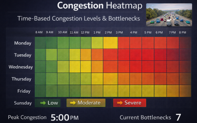
Time-based congestion levels and bottlenecks
Your data is portable. Your system is future-proof.

The Autonomous Road Engineer
AI that is transforming road infrastructure, from reactive to predictive.