The Kingdom of Saudi Arabia is undergoing an unprecedented transformation under Vision 2030, investing heavily in transport infrastructure to create a safer, smarter, and more efficient national road network. With thousands of kilometres of highways, urban corridors, and rural roads expanding rapidly, the demand for accurate, timely, and scalable road inventory data has never been greater.
Traditional manual road inspections—though long relied upon—can no longer keep pace with the scale and complexity of today's infrastructure. This is where AI-driven road inventory inspection and LiDAR technologies step in, offering a leap toward precision, automation, and long-term asset sustainability. As the proverb goes, "A stitch in time saves nine," and these technologies are helping Saudi agencies detect issues early, saving costs, time, and lives.
Road inventory data forms the backbone of modern road asset management. In the Saudi context, where highways traverse deserts, urban megaprojects grow rapidly, and extreme climate conditions challenge infrastructure durability, having reliable asset information is essential.
Up-to-date road inventory data supports:
Manual methods often fall short due to the vastness of the network, remote terrain, and the potential for human error. Digital approaches powered by AI and LiDAR resolve these gaps by delivering accuracy, speed, and consistency at scale.
Saudi Arabia aligns many of its safety and geometric design principles with global best practices, including guidance from the Indian Roads Congress (IRC) and regional codes such as SHC 101 and SHC 202.
Key principles relevant to digital road inventory include:
2.1 Accuracy and Completeness of Asset Data
Both IRC guidelines and Saudi highway codes emphasise capturing all road assets with precise geolocation, including signage, barriers, lighting, markings, and drainage structures.
2.2 Objective, Technology-Driven Assessments
Standards call for consistent, unbiased assessments—something automated systems excel at through computer vision and LiDAR, eliminating the subjectivity of human inspections.
2.3 Lifecycle-Based Asset Management
From design to operation, inventory data should support preventive maintenance, not reactive repairs. Accurate asset records enable prediction of deterioration and optimal intervention timing.
2.4 Safety-Centric Infrastructure Evaluation
Both IRC and Saudi codes highlight the need to identify roadside hazards such as worn pavement, missing guardrails, or improper drainage that could contribute to crashes.
2.5 Standardisation Across Networks
Consistent data formats and classification systems ensure that asset information can be compared across regions and used for national-level planning.
AI and LiDAR naturally reinforce these principles with unmatched detail and reliability through the Roadside Assets Inventory Agent.
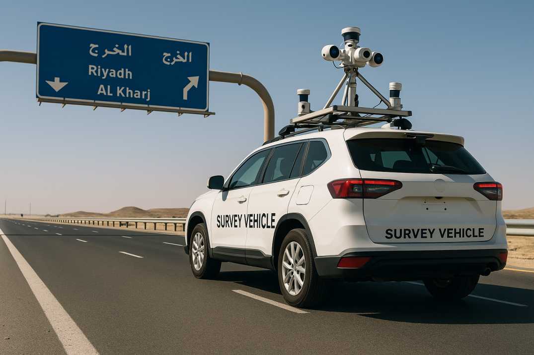
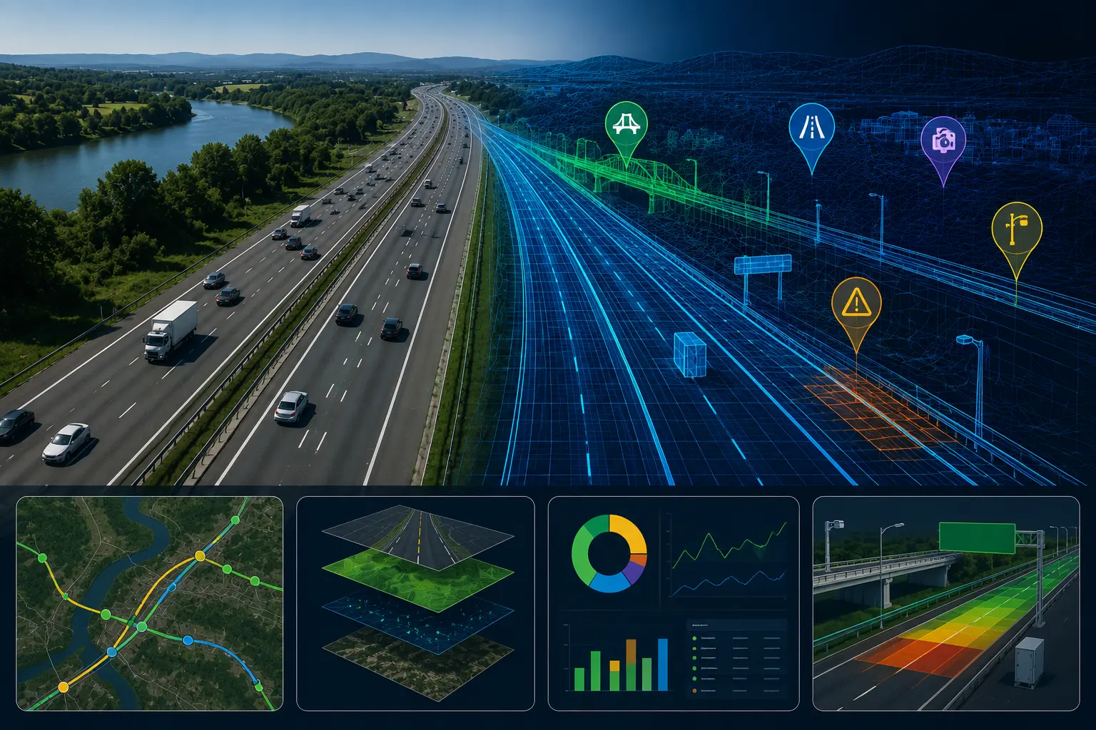
RoadVision AI brings together Artificial Intelligence, advanced computer vision, digital twins, and LiDAR mapping to revolutionise road inventory inspection across the Kingdom through its integrated suite of AI agents.
3.1 Automated Asset Detection and Classification
The Roadside Assets Inventory Agent uses high-definition cameras and AI models to detect and classify:
This ensures complete compliance with MOT and GSO standards while avoiding human oversight and data gaps.
3.2 Real-Time Pavement and Defect Analysis
The Pavement Condition Intelligence Agent identifies:
Instead of waiting for problems to worsen—"don't let small sparks become wildfires"—maintenance teams can take swift, data-driven action based on objective condition scores.
3.3 LiDAR-Driven 3D Mapping for Complex Terrain
LiDAR technology enhances precision by capturing:
This is especially critical for desert highways, where shifting sands and harsh conditions accelerate asset deterioration, and for mountainous terrain where geometry is complex.
3.4 Seamless Digital Integration for Saudi Agencies
All captured data feeds into digital asset systems, enabling:
RoadVision AI ensures full compliance with IRC principles and Saudi highway codes (SHC 101 & 202), making it an ideal fit for national infrastructure development under Vision 2030.
3.5 High-Speed Data Collection
Mobile mapping systems equipped with LiDAR and cameras operate at traffic speeds, covering:
Even with strong benefits, digital transformation comes with challenges:
4.1 Harsh Environmental Conditions
Challenge: High heat exceeding 50°C, dust storms, and intense glare can affect manual inspections and sensor performance.
AI & LiDAR Advantage: Sensor-based systems are designed for extreme environments, with algorithms calibrated for Middle Eastern conditions. The Roadside Assets Inventory Agent maintains accuracy despite environmental challenges.
4.2 Surveying Vast and Remote Networks
Challenge: Saudi Arabia's expansive highways across desert regions are difficult and costly to cover manually.
AI & LiDAR Advantage: High-speed scanning covers long distances in hours, not days, using vehicle-mounted systems that operate during normal patrols—no dedicated survey missions required.
4.3 Data Overload
Challenge: Large datasets from LiDAR and imaging can overwhelm traditional asset management systems and staff.
AI Advantage: Automated classification, prioritisation, and dashboard visualisation simplify decision-making, presenting only actionable insights to engineers and planners.
4.4 Integration with Legacy Systems
Challenge: Older asset platforms may resist modern data formats and high-frequency updates.
RoadVision AI Solution: Interoperable architecture with flexible export options ensures smooth migration and coexistence with existing systems through APIs and standardised outputs.
4.5 Workforce Training and Adoption
Challenge: Staff need training to effectively use new technologies and interpret AI-generated insights.
RoadVision AI Solution: Comprehensive onboarding, user-friendly interfaces, and ongoing support ensure successful adoption across agencies.
4.6 Standardisation Across Regions
Challenge: Different regions may use varying asset classification systems.
RoadVision AI Solution: Configurable classification mapping aligns local categories with national and international standards.
In every case, intelligent tools turn challenges into opportunities for improved efficiency and accuracy.
The combination of AI and LiDAR is redefining road inventory inspection in Saudi Arabia, delivering unparalleled accuracy, scalability, and cost efficiency. As the Kingdom accelerates its infrastructure development under Vision 2030, digital road asset management will be essential for maintaining safe, resilient, and future-ready networks.
RoadVision AI stands at the forefront of this transformation. With capabilities ranging from automated asset detection to 3D mapping and digital twins through the Roadside Assets Inventory Agent, Pavement Condition Intelligence Agent, and Road Safety Audit Agent, RoadVision AI empowers authorities to:
As they say, "The best time to plant a tree was 20 years ago; the second-best time is now." For Saudi agencies seeking to upgrade their road inventory processes, now is the time to embrace AI and LiDAR.
If your organisation is ready to transform road inventory management with cutting-edge technology, book a demo with RoadVision AI today and discover how our platform can support Saudi Arabia's journey toward smarter, safer, and more sustainable roads.
Q1. What is road inventory inspection in Saudi Arabia?
It is the process of collecting and updating detailed information on road assets such as signage, lighting, and pavements, required for compliance with MOT standards.
Q2. How does AI improve digital road inventory management?
AI automates the detection, classification, and condition assessment of assets, reducing time and human error in data collection.
Q3. Why is LiDAR important for road asset management?
LiDAR provides precise 3D mapping of roadside infrastructure, improving inventory accuracy and supporting safer road planning.

The Autonomous Road Engineer
AI that is transforming road infrastructure, from reactive to predictive.
.webp)
.webp)