As Australia expands its transport corridors and upgrades regional highways, road designers face a new level of complexity. Steeper terrains, growing freight volumes, climate-driven pavement stress, and increased safety expectations mean that traditional manual methods for horizontal and vertical alignment design are no longer enough.
Under Austroads guidelines, every curve radius, vertical crest, sag profile and sight distance requirement must align with strict safety and comfort criteria. But evaluating these parameters using manual calculations and periodic surveys can be time-consuming and prone to oversight.
Digital transformation is changing the game. Advanced AI-driven tools—such as AI roadway design automation, alignment optimisation engines, and high-resolution pavement condition analysis—are providing design teams with faster, deeper and more reliable insights. In a country where "a stitch in time saves nine," using AI early in the alignment workflow prevents costly redesigns and reduces geometric safety risks before they surface on the network.
Horizontal and vertical road alignment are not simply drafting exercises—they define how safely and comfortably a highway performs over decades. Poorly designed geometry can lead to:
Austroads geometric design principles emphasise:
When terrain, speed environment, traffic behaviour and corridor constraints are highly variable—as is common in Australian regional and peri-urban corridors—AI through the Road Safety Audit Agent provides the analytical horsepower needed to capture interactions that would otherwise go unnoticed.
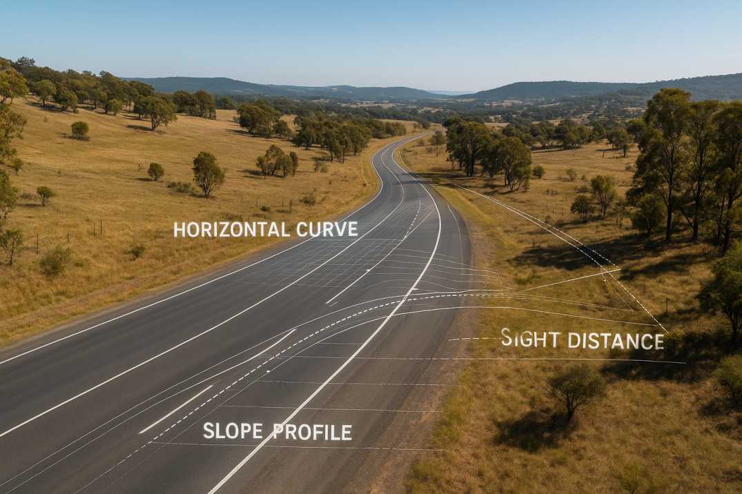
2.1 Horizontal Alignment
2.2 Vertical Alignment
2.3 Combined Effects
For Australian-specific terminology, the equivalent is the Austroads Guide to Road Design, which governs:
3.1 Horizontal Alignment Principles
3.2 Vertical Alignment Principles
3.3 Sight Distance & Safety Principles
3.4 Design Speed Consistency
These principles set the baseline. AI through the Road Safety Audit Agent enhances compliance by checking thousands of parameters automatically—something no manual workflow can match with equal speed or precision.
4.1 Data Integration
4.2 Geometric Analysis
4.3 Safety Assessment
RoadVision AI elevates geometric design from a manual engineering process to a predictive, data-driven discipline through its integrated suite of AI agents. Here's how RoadVision AI operationalises best-practice alignment design:
5.1 AI Roadway Design Automation
The Road Safety Audit Agent and Roadside Assets Inventory Agent scan LiDAR, DEMs and photogrammetry terrain data to:
5.2 AI Horizontal Curve Safety Assessment
The Road Safety Audit Agent evaluates:
5.3 AI-Based Vertical Geometry Validation
The Road Safety Audit Agent identifies:
5.4 Pavement Condition Intelligence Linked to Geometry
The Pavement Condition Intelligence Agent correlates pavement distress to geometric weaknesses:
5.5 Digital Road Inventory & Asset Management Integration
The Roadside Assets Inventory Agent creates a full geometric inventory including:
5.6 Traffic Integration
The Traffic Analysis Agent provides:
5.7 3D Alignment Visualization
Digital twins enable engineers to:
As the saying goes, "measure twice, cut once"—AI enables engineers to measure thousands of geometric parameters instantly, reducing risks and accelerating decision-making.
6.1 Horizontal Curve Issues
6.2 Vertical Curve Issues
6.3 Combined Issues
Despite its advantages, AI integration is not without hurdles:
7.1 Data Quality Variability
Inconsistent LiDAR, DEM or survey datasets may reduce model accuracy. High-precision terrain data is essential for reliable alignment automation.
AI Solution: Multi-source data fusion through RoadVision AI compensates for data gaps.
7.2 Change Management
Engineering teams accustomed to traditional workflows may need time to adopt AI-assisted design methodologies.
AI Solution: Comprehensive training programs ensure successful adoption.
7.3 Interoperability
Aligning AI outputs with CAD, BIM, digital twin and existing Austroads-based software frameworks can require new workflows.
AI Solution: Flexible export formats enable seamless integration.
7.4 Regulatory Adaptation
While Austroads encourages digital engineering, widespread adoption of automated geometric checks is still evolving.
AI Solution: Built-in compliance ensures outputs meet regulatory expectations.
7.5 Cost of High-Resolution Data Capture
Drone mapping, LiDAR scanning and continuous pavement surveys can require upfront investment.
AI Solution: Scalable deployment demonstrates ROI through improved design outcomes.
7.6 Validation Requirements
AI-generated alignments must be validated against field conditions.
AI Solution: Continuous monitoring validates design assumptions.
Nonetheless, the long-term benefits—fewer redesign cycles, safer geometry, reduced crashes, extended pavement life—consistently outweigh these challenges.
8.1 For Design Engineers
8.2 For Road Authorities
8.3 For Maintenance Teams
AI is fundamentally transforming how Australia approaches horizontal and vertical road alignment design. By integrating terrain analysis, crash data, pavement condition maps through the Pavement Condition Intelligence Agent, geometric modelling, and digital road inventories via the Roadside Assets Inventory Agent, AI ensures an unprecedented level of precision and foresight. It helps engineers evaluate design options "before the rubber hits the road," making early decisions more reliable, cost-effective and safety-driven.
The platform's ability to:
transforms how road alignment design is approached across Australia.
Platforms like RoadVision AI are leading this shift—delivering automated sight-distance checks, detecting alignment-linked hazards, enabling digital-twin simulations and ensuring full alignment with Austroads geometric design principles through the Road Safety Audit Agent and Traffic Analysis Agent.
As AI continues to evolve, Australian road agencies, consultants and contractors will gain powerful capabilities to:
If your organisation is exploring smarter alignment design, predictive safety assessments or digital twin-based corridor evaluation, book a demo with RoadVision AI today to see how our platform delivers next-generation geometric design intelligence.
AI enhances accuracy, safety and compliance by analysing terrain, speed behaviour, crash patterns and pavement condition to propose optimal alignments.
Yes. AI identifies curve-related risks early, helping engineers revise radii, transitions, super-elevation and advisory speeds.
AI inventory tools provide precise geometric data, enabling better assessment of compliance, wear patterns and long-term design needs.

The Autonomous Road Engineer
AI that is transforming road infrastructure, from reactive to predictive.
.webp)
.webp)
.png)