India is racing toward rapid urbanisation, expanding mobility demands, and increasing vehicle ownership. As cities grow vertically and mobility patterns diversify, road networks must evolve just as quickly. Yet a road designed for today's traffic may become obsolete tomorrow if future demand isn't accurately forecasted. That's why traffic projection, guided by IRC 64, remains one of the most critical foundations of highway and corridor design.
In an era of smart infrastructure, relying on manual counts and outdated forecasting models is like navigating a modern highway with a vintage map—you'll get somewhere, but not where you need to be. Modern India needs precision, adaptability, and predictive intelligence.
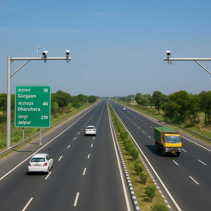
This is where AI-based traffic surveys and automated road asset management systems are rewriting the rules of road planning.
Traffic projections influence nearly every engineering decision, from lane widths to pavement thickness to interchange design. According to IRC 64, traffic forecasting plays a vital role in:
Simply put, poor projections lead to poor roads—either overdesigned (wasting money) or underdesigned (leading to premature failure).
Traditional manual surveys, although used for decades, often struggle to capture:
AI-based systems overcome these gaps by providing continuous, granular, and highly accurate traffic analysis.
2.1 Base-Year Traffic Data
Base-year traffic forms the foundation of all projections. Accurate data requires:
2.2 Growth Factors
Traffic growth is influenced by:
2.3 Design Traffic Loads
Forecasted traffic is converted into:
2.4 Planning Horizon
IRC 64 recommends forecasting traffic for:
IRC 64 outlines a structured, scientific approach to forecasting future traffic demand. Its core principles include:
3.1 Establishing Base-Year Traffic
Accurate base-year data is the backbone of any projection. IRC 64 requires:
3.2 Evaluating Growth Trends
Traffic growth is influenced by:
IRC 64 integrates these socio-economic indicators to estimate future growth with appropriate growth factors.
3.3 Applying Design Traffic Loads
Forecasted traffic is converted into:
These ensure the road remains structurally reliable during its entire design life.
3.4 Long-Term Planning Horizon
IRC recommends forecasting traffic for:
In modern large-scale mobility projects, accuracy becomes the difference between a resilient asset and early distress.
3.5 Axle Load Considerations
Commercial vehicle axle loads significantly affect pavement design. IRC 64 requires:
AspectTraditional Manual SurveysAI-Based SurveysData CollectionPeriodic, limited durationContinuous, 24/7CoverageSample locationsFull networkVehicle ClassificationManual counting, observer fatigueAutomated, consistentAccuracyVariable, subject to error95-98% accuracyData ProcessingWeeks to monthsReal-timeSeasonal VariationLimited captureFull annual patternsCostLabour-intensiveScalable, cost-effective
RoadVision AI brings cutting-edge automation and intelligence to the IRC 64 framework through its integrated suite of AI agents—eliminating guesswork and human error.
5.1 AI-Based Traffic Surveys with High Accuracy
The Traffic Analysis Agent uses computer vision and ML algorithms to:
This provides a richer, more reliable base-year traffic input for IRC 64 forecasting.
5.2 Digital Traffic Monitoring Across Large Networks
With AI-powered video analytics and automated alerts, the Traffic Analysis Agent enables:
This real-time data feeds directly into more accurate long-term projections.
5.3 Integrated Road Asset Management
RoadVision AI merges traffic projections with:
Such integration allows planners to schedule maintenance before deterioration spreads—living up to the saying, "A stitch in time saves nine."
5.4 Predictive Analytics for Future Mobility Scenarios
AI models through the Traffic Analysis Agent simulate:
This supports adaptive, future-proof road designs aligned with IRC 64 principles.
5.5 Data-Driven Planning and Budgeting
With precise traffic prediction and pavement loading estimates, RoadVision AI helps authorities:
5.6 Axle Load Analysis
The Traffic Analysis Agent provides:
6.1 Underestimation of Growth
6.2 Inadequate Base-Year Data
6.3 Wrong Growth Factors
6.4 Axle Load Assumptions
Despite its advantages, adoption comes with challenges:
7.1 Infrastructure Readiness
Remote areas may lack stable connectivity required for seamless live monitoring.
AI Solution: Offline-first data capture with automatic synchronization through RoadVision AI.
7.2 Change Management
Shifting from manual surveys to AI-driven analytics requires new skills and organisational adaptation.
AI Solution: Comprehensive training programs ensure successful adoption.
7.3 Data Integration
Combining data from sensors, cameras, and existing legacy systems demands robust integration frameworks.
AI Solution: Flexible APIs enable gradual integration without disrupting current operations.
7.4 Initial Investment
AI and digital systems require upfront investment—though they significantly reduce long-term maintenance costs.
AI Solution: Demonstrated ROI through optimised designs and extended pavement life.
7.5 Standardisation
Adoption of consistent formats for digital traffic data must align with IRC codes and govt. digital initiatives.
AI Solution: Built-in compliance ensures outputs meet regulatory expectations.
7.6 Data Privacy
Traffic data collection must respect privacy while providing necessary insights.
AI Solution: Anonymized data processing maintains public trust.
These challenges are real but manageable—especially when paired with strategic planning and the right technical partner through RoadVision AI.
8.1 Optimised Construction Costs
8.2 Extended Pavement Life
8.3 User Benefits
8.4 Safety Improvements
India's road infrastructure is entering a new era—one driven by AI, automation, digital monitoring, and predictive analytics through the Traffic Analysis Agent, Pavement Condition Intelligence Agent, and Roadside Assets Inventory Agent. By aligning IRC 64 traffic projection principles with AI-based traffic surveys and automated road asset management, authorities can design road networks that are:
The platform's ability to:
transforms how traffic projections inform road design across India.
As the proverb goes, "Measure twice, cut once." With AI in the picture, we're not just measuring twice—we're measuring continuously, intelligently, and accurately.
RoadVision AI is at the forefront of this evolution. Through its advanced computer vision technology, traffic analytics, pavement monitoring tools, and compliance with IRC standards, it empowers engineers and planners to design roads that meet the mobility demands of tomorrow.
Ready to transform your traffic management and road planning strategy? Book a demo with RoadVision AI today and discover how intelligent analytics can elevate your infrastructure planning.
1. What is IRC 64 and why is it important?
IRC 64 provides standardized methods for traffic projection and road design in India, ensuring that roads are built to handle future traffic growth efficiently.
2. How do AI-based traffic surveys improve upon traditional methods?
AI tools provide continuous, automated data collection with higher accuracy and classification capabilities, replacing error-prone manual surveys.
3. What role does automated road asset management play in sustainable infrastructure?
It integrates traffic, condition, and maintenance data to predict wear, optimize resources, and extend pavement lifespan, ensuring better ROI and road safety.

The Autonomous Road Engineer
AI that is transforming road infrastructure, from reactive to predictive.
.webp)
.webp)
.png)