Across Canada, rapidly growing populations, intensified freight movement, and evolving urban mobility patterns are reshaping the national transportation landscape. Cities such as Toronto, Vancouver, Montreal, Calgary and Ottawa now face unprecedented congestion pressure. With traffic volumes rising and roadway capacities strained, municipalities must be able to forecast congestion—not simply react to it.
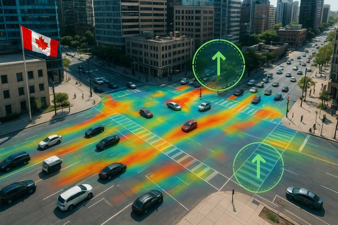
As the old saying goes, "forewarned is forearmed." Accurate congestion prediction empowers transportation agencies to minimize delays, optimize operations, and plan future corridors intelligently. Traditional monitoring methods—manual counts, historical averages, and occasional roadside surveys—simply cannot capture the complexity of Canada's modern mobility behaviour. Machine learning (ML) and AI-driven platforms fill this gap by analysing real-time traffic dynamics across entire cities with precision and speed.
This article explains why congestion prediction is essential, how IRC-aligned principles apply to predictive traffic analytics, how RoadVision AI delivers best-practice solutions, the challenges Canadian municipalities must consider, and how AI ultimately helps cities build smarter, safer and more efficient transportation systems.
Canada's major metropolitan areas are experiencing:
Accurate congestion prediction helps cities:
Traditional approaches—relying heavily on manual observations or static historical averages—cannot keep up with highly dynamic conditions driven by weather, events, commuting trends and real-time behaviour shifts. Machine learning through the Traffic Analysis Agent offers the precision, scalability and foresight required to manage complex Canadian traffic networks effectively.
2.1 Toronto (GTA)
2.2 Vancouver
2.3 Montreal
2.4 Calgary
2.5 Ottawa
3.1 Weather Conditions
3.2 Seasonal Patterns
3.3 Special Events
3.4 Infrastructure Constraints
Although IRC (Indian Roads Congress) standards originate outside Canada, their engineering and traffic management principles are widely recognized worldwide and align closely with modern data-driven transportation strategies. Several IRC-aligned concepts directly support Canadian congestion forecasting:
4.1 Data-Driven Decision Making
IRC frameworks emphasize using structured, high-granularity datasets to drive operational decisions. Machine learning through the Traffic Analysis Agent mirrors this principle by ingesting vast multi-modal datasets—traffic counts, speeds, weather conditions, signal phases, and more.
4.2 Network-Level Assessment
IRC best practices encourage corridor-wide evaluation instead of isolated intersection studies. ML models replicate this by analysing full network behaviour, identifying bottlenecks, and predicting congestion propagation.
4.3 Continuous Monitoring and Adaptive Response
In IRC methodology, roadway performance must be monitored continuously. ML and AI tools through the Traffic Analysis Agent provide real-time, adaptive insights that allow Canadian municipalities to update timing plans or reroute flows instantly.
4.4 Integrated Safety and Mobility Evaluation
IRC procedures emphasize the interplay between congestion and safety. ML-driven traffic analytics through the Road Safety Audit Agent combine road safety audits, geometric analysis, and congestion mapping to identify areas where risk and delay overlap.
4.5 Capacity Analysis
Understanding the relationship between volume, speed, and density enables accurate congestion prediction.
5.1 Data Sources
5.2 ML Models Used
5.3 Prediction Horizons
RoadVision AI applies these principles through its integrated suite of AI agents, delivering comprehensive congestion prediction solutions for Canadian cities.
6.1 AI Traffic Prediction with Real-Time Behaviour Analysis
The Traffic Analysis Agent captures video streams, detector outputs and vehicle timelines to model queue formation, lane occupancy, stop-and-go patterns, and speed variations across Canadian arterials and highways. ML algorithms identify early congestion triggers, giving operators the insight they need to adjust timing or operations before delays escalate.
6.2 Integration with AI-Based Traffic Survey and Inventory Tools
The platform collects high-accuracy data on:
These data streams feed predictive ML models that forecast peak loads, holiday surges, and recurring congestion cycles—essential for Canadian cities where weather variability plays a significant role.
6.3 Predictive Traffic Analytics Across Multi-City Networks
RoadVision AI models through the Traffic Analysis Agent how events, incidents, closures, transit changes, or land-use developments influence congestion. Municipalities can simulate future scenarios and evaluate long-term impacts before investing in multi-million-dollar infrastructure projects.
6.4 Smart Mobility Integration
By supporting adaptive signal control, multimodal transport planning, and congestion classification, RoadVision AI aligns with Canada's smart transportation initiatives and sustainability goals.
6.5 Winter Condition Integration
AI models account for:
6.6 Asset Condition Correlation
The Pavement Condition Intelligence Agent identifies where pavement condition contributes to congestion through speed reductions.
Together, these best practices create a robust, data-rich ecosystem that makes congestion prediction actionable.
7.1 For Traffic Operators
7.2 For Planners
7.3 For Road Users
7.4 For the Environment
While machine learning offers immense benefits, several challenges must be managed carefully:
8.1 Weather-Driven Variability
Canadian traffic behaviour changes drastically with snowstorms, freezing rain, fog and extreme cold. ML models require large, high-quality datasets to account for these fluctuations.
AI Solution: Models trained on Canadian conditions account for regional weather patterns.
8.2 Data Integration from Multiple Sources
Municipalities often operate legacy systems for detection, signals, asset inventories, and safety records. Integrating these systems into a unified AI ecosystem through RoadVision AI requires coordination and modernization.
AI Solution: Flexible APIs enable gradual integration without disrupting current operations.
8.3 Privacy and Compliance Requirements
AI solutions must comply with Canadian privacy regulations when processing imagery, video, and vehicle movement data.
AI Solution: Anonymized data processing and secure storage protocols maintain public trust.
8.4 Operational Readiness
Traffic engineers and city planners must be equipped to interpret ML outputs and incorporate them into everyday operations and long-term policy decisions.
AI Solution: Comprehensive training programs ensure successful adoption.
8.5 Budget Allocation for Digital Modernization
While AI offers major cost savings long-term, initial investments in digital transformation must be justified and strategically planned.
AI Solution: Scalable deployment demonstrates ROI through improved operations.
8.6 Real-Time Data Requirements
Accurate prediction requires continuous, high-quality real-time data.
AI Solution: Continuous monitoring through RoadVision AI ensures data currency.
As the proverb goes, "you can't manage what you don't measure." Municipalities that modernize their measurement systems through RoadVision AI now will gain long-lasting advantages.
Machine learning provides a powerful pathway for Canadian cities to predict congestion, strengthen operational efficiency and plan long-term transportation networks more intelligently. By fusing real-time analytics, predictive modelling, and automated monitoring through the Traffic Analysis Agent, Pavement Condition Intelligence Agent, and Road Safety Audit Agent, AI enables agencies to anticipate issues before they occur, streamline daily operations and create safer, smoother, more sustainable journeys for residents.
The platform's ability to:
transforms how congestion is predicted and managed across Canada.
Platforms like RoadVision AI turn raw data into actionable intelligence—congestion forecasts, safety insights, digital inventories through the Roadside Assets Inventory Agent, and infrastructure performance models. Whether managing snow-impacted arterials, dense urban cores or fast-growing suburban corridors, AI-driven systems help municipalities stay ahead rather than play catch-up.
In short, AI equips Canada to "build for tomorrow, not yesterday."
If you're ready to see how predictive analytics can transform your mobility strategy, book a demo with RoadVision AI today and explore the future of congestion management firsthand.
AI analyses real-time data, historical trends and traffic behaviours to forecast congestion patterns with greater accuracy.
Yes. AI enables faster incident response, better signal timing and data-driven planning, directly reducing congestion.
AI provides predictive insights that help municipalities design future corridors, allocate budgets and optimise mobility systems.

The Autonomous Road Engineer
AI that is transforming road infrastructure, from reactive to predictive.
.webp)
.webp)
.png)