Rural roads in India form the backbone of socio-economic development by strengthening connectivity, enabling agricultural movement, and supporting village-to-market access. However, one critical challenge continues to undermine their durability—poor drainage. Waterlogging, erosion, and flood damage are among the primary causes of premature pavement failure.
To address these challenges, the Indian Roads Congress introduced IRC SP 50 – Guidelines for the Design of Cross-Drainage Structures for Rural Roads under PMGSY. These guidelines ensure that culverts, causeways, and small bridges are designed to safely convey water and protect rural roads throughout the monsoon cycle.
With the emergence of dashcam-based AI road survey systems such as RoadVision AI, road agencies now have modern tools to identify drainage failures early, streamline inspections, and enhance road asset management. As the saying goes, "A stitch in time saves nine," and timely drainage intervention can save years of road life.
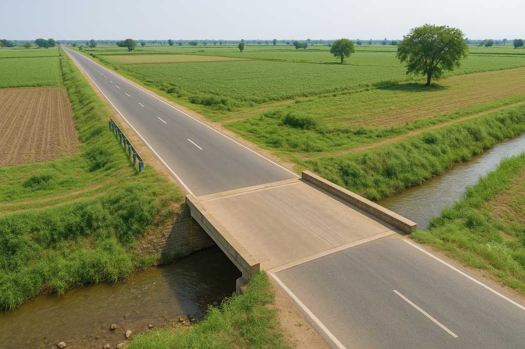
Cross-drainage structures (CDS) enable water from streams, catchments, or roadside drains to safely cross beneath or over the road without harming the pavement or embankment. As highlighted in IRC SP 50, proper CDS design is essential to:
Poor drainage is one of the fastest ways to destroy bituminous rural pavements, making CDS an indispensable part of rural road engineering. As every experienced engineer knows, "Water is the enemy of roads."
2.1 Hydrological Assessment
Determining design flood discharge using appropriate return periods (typically 25–50 years for rural roads) ensures structures can withstand major storm events. This involves catchment area analysis, rainfall data, and runoff calculations.
2.2 Adequate Waterway Width
Providing a clear opening prevents upstream flooding and reduces the risk of embankment overtopping. The waterway must be sized to pass the design flood without excessive afflux.
2.3 Scour and Foundation Depth
Designing foundations below predicted scour depth is crucial to prevent structural instability during high flows. IRC SP 50 specifies minimum foundation depths based on soil conditions and hydraulic factors.
2.4 Freeboard Requirements
The guideline specifies minimum clearance above high flood levels for safe passage, ensuring that debris and high water do not compromise the structure.
2.5 Approach Protection
Use of pitching, retaining walls, and energy dissipation helps avoid erosion around CDS entries and exits, preventing scour that could undermine the structure.
2.6 Material Standards
Use of RCC or Hume pipes as per IS 458 ensures durability and long-term service under repeated wet-dry cycles and heavy monsoon flows.
2.7 Maintenance Provisions
The guidelines emphasise the need for regular inspection and maintenance of CDS, including desilting, vegetation control, and structural repairs.
These principles ensure that cross-drainage structures perform reliably, even under extreme monsoon conditions. As engineers often remind themselves, "Well begun is half done." Proper design is the first defence against future road failures.
RoadVision AI operationalises IRC principles by transforming how rural road networks are inspected, monitored, and maintained through its integrated suite of AI agents.
3.1 Automated Dashcam-Based Inspection of CDS
The Roadside Assets Inventory Agent can automatically identify:
These issues are often missed during manual inspections until significant damage has occurred.
3.2 Continuous Condition Mapping
The platform builds digital asset inventories for culverts, causeways, and bridges, allowing engineers to visualise where drainage systems are failing across the entire network. Each asset is geo-tagged with photographs and condition data.
3.3 Predictive Flood and Waterlogging Insights
By analysing terrain, rainfall behaviour, and historical defects, the Pavement Condition Intelligence Agent flags potential flood-prone locations in advance, enabling pre-monsoon preventive action.
3.4 Integration with Road Safety Audits
The Road Safety Audit Agent detects:
This supports proactive safety interventions before accidents occur.
3.5 Lifecycle Planning for Rural Roads
By linking CDS inspection data to pavement performance, RoadVision AI helps agencies:
3.6 Integration with PMGSY Requirements
The platform produces reports aligned with PMGSY monitoring requirements, ensuring that drainage assets are properly documented and maintained throughout the project lifecycle.
This combination of automation and predictive analytics supports PMGSY's long-term vision for durable, cost-effective rural road development.
Despite strong IRC guidelines, rural drainage management still faces several roadblocks:
4.1 Manual Surveys Are Infrequent and Inconsistent
Human inspections often miss early-stage failures or hidden structural issues. Teams may inspect only a fraction of culverts each year, leaving many unchecked until failure.
4.2 Monsoon Variability and Extreme Weather Events
Changing rainfall patterns and more intense storms overwhelm poorly designed or poorly maintained drainage structures, causing unexpected failures.
4.3 Lack of Comprehensive Asset Inventories
Many rural roads lack updated, geo-tagged lists of culverts and causeways, making it impossible to plan systematic maintenance.
4.4 Budget and Capacity Constraints
Rural engineering teams often balance multiple responsibilities across vast networks, limiting time available for detailed drainage inspections.
4.5 Response Times During Emergencies
Blocked culverts during peak monsoon require instant attention—something only real-time monitoring can support. Delays in response can lead to road breaches and village isolation.
4.6 Post-Construction Documentation Gaps
As-built drawings and design details for CDS are often lost or unavailable when maintenance teams need them years later.
AI and computer vision offer powerful solutions to overcome these constraints and modernise rural drainage management through platforms like RoadVision AI.
Cross-drainage structures designed according to IRC SP 50 are vital for safeguarding India's rural roads. They protect pavements, ensure reliable connectivity year-round, and significantly reduce maintenance burdens. But design alone is not enough—regular, intelligent monitoring is essential to keep these assets functioning through the monsoon and beyond.
RoadVision AI transforms rural road asset management by:
As the proverb says, "Forewarned is forearmed." With RoadVision AI, engineers and authorities are always a step ahead—ready to prevent failures rather than fix them after damage occurs. The platform's ability to detect blocked culverts, monitor structural health, and predict flood-prone locations ensures that rural roads remain passable when communities need them most.
For advanced AI-powered road inspections and predictive maintenance planning, book a demo with RoadVision AI today and build stronger, safer, and longer-lasting rural roads that serve India's villages for generations to come.
Q1. What is the main purpose of cross-drainage structures in rural roads?
They allow safe passage of water under or over the road, preventing flooding and pavement damage.
Q2. Which is the most common type of cross-drainage structure in India?
Pipe culverts are widely used due to their low cost, easy installation, and suitability for small streams.
Q3. How does AI improve drainage maintenance in road asset management?
AI-based surveys detect blockages, waterlogging, and erosion early, allowing preventive maintenance before major failures occur.

The Autonomous Road Engineer
AI that is transforming road infrastructure, from reactive to predictive.

.webp)