Hill roads in India remain some of the most complex, vulnerable and maintenance-intensive corridors in the national highway and state highway network. Tight carriageways, steep gradients, unstable slopes and unpredictable weather make them particularly susceptible to crashes and failures. The IRC:52 guideline lays down essential safety checks covering geometric design, hazard identification, roadside protection, drainage adequacy and emergency readiness.
Yet traditional manual audits often fall short. Limited field coverage, subjective risk assessment and time-consuming measurements make it difficult for agencies to maintain up-to-date safety records. In a terrain where "a stitch in time saves nine", delayed detection can quickly escalate into landslides, edge collapses or fatal crashes.
This is where AI-driven inspection systems are bringing a paradigm shift. With digital tools increasingly used in road asset management across the country, platforms like RoadVision AI now allow engineers to conduct comprehensive, high-speed and highly accurate hill road safety audits fully aligned with IRC:52.
The IRC:52 guideline recognises that hill corridors face unique challenges:
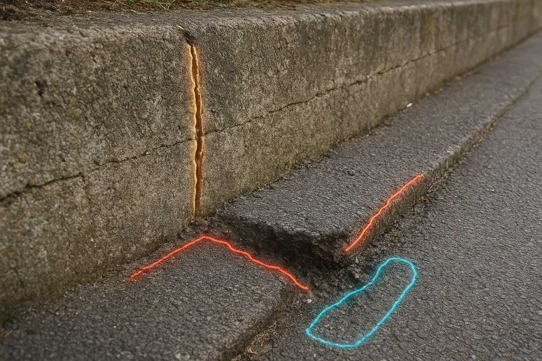
Conventional audit methods require engineers to manually identify hazards such as inadequate sight distance, rockfall points, broken parapets, failing drainage systems and alignment inconsistencies. In these environments, human observation alone is rarely enough.
AI-based inspections through the Road Safety Audit Agent and Pavement Condition Intelligence Agent resolve these gaps by generating measurable datasets instead of subjective observations. Using high-resolution video, LiDAR scanning and mobile-mapping sensors, auditors can evaluate alignment behaviour, pavement edges, slope conditions and visibility limitations at scale—ensuring that nothing "falls through the cracks".
2.1 Geometric Hazards
2.2 Slope and Terrain Hazards
2.3 Drainage Hazards
2.4 Protection Deficiencies
IRC:52 defines a systematic approach to hill road safety audits through the following core principles:
3.1 Comprehensive Hazard Identification
Audits must capture all risk-prone features: rockfall zones, unstable slopes, broken edges, narrow stretches, missing guardrails and roadside obstructions. The Road Safety Audit Agent automates this detection.
3.2 Geometric Evaluation
Horizontal curves, gradients, superelevation, sight distance, cross-slope and shoulder conditions must adhere to IRC standards.
3.3 Roadside Safety and Structural Protection
Crash barriers, parapets, retaining structures, catch-water drains and slope stabilisation measures must be functional.
3.4 Drainage and Environmental Readiness
Drainage systems must handle rainfall and prevent erosion or pavement weakening.
3.5 Emergency Preparedness and Route Continuity
The network must support safe evacuation, access to emergency services and maintain continuity even during adverse weather.
3.6 Slope Stability Assessment
Regular evaluation of cut slopes, embankments, and landslide-prone areas.
AI through the Road Safety Audit Agent brings precision, consistency and repeatability to each of these principles, ensuring evidence-based compliance with IRC:52 across every kilometre of surveyed terrain.
4.1 Himalayan Region
4.2 Western Ghats
4.3 Eastern Ghats
4.4 Northeast India
RoadVision AI applies AI to hill road audits through its integrated suite of AI agents, delivering comprehensive solutions for Indian hill road authorities.
5.1 Automated High-Risk Hazard Detection
The Road Safety Audit Agent scans thousands of frames per kilometre to detect:
These automated detections ensure early warnings—essential in terrain where hazards can change "as quickly as the weather".
5.2 Digital Road Inventory Mapping
The Roadside Assets Inventory Agent automatically maps essential roadside assets such as:
This enables agencies to maintain complete, accurate hill-road inventories without lengthy manual documentation.
5.3 AI-Enabled Geometry Assessment as Per IRC:52
The Road Safety Audit Agent uses computer vision and 3D mapping to measure:
Drone-based elevation models add another layer of detail, allowing engineers to visualise geometric inconsistencies instantly.
5.4 AI-Based Compliance Analytics
RoadVision AI benchmarks field reality against IRC:52 requirements for:
All results feed into structured dashboards offering traceable and repeatable compliance reports.
5.5 Integrated Pavement and Traffic Insights
The platform merges geometry and hazard insights with:
This multi-layered approach brings new engineering clarity to high-risk hill corridors.
5.6 Slope Movement Monitoring
AI detects:
5.7 Landslide Risk Assessment
Predictive models identify:
6.1 Geometric Deficiencies
6.2 Protection Deficiencies
6.3 Drainage Deficiencies
6.4 Pavement Deficiencies
7.1 Data Capture Limitations
Remote or forested terrains may reduce visibility for sensors, requiring hybrid capture methods such as drones and handheld devices.
AI Solution: Multi-modal surveys (ground, drone, handheld) through RoadVision AI ensure complete coverage.
7.2 Technology Adoption Gaps
Field teams may require training to integrate AI-based tools alongside traditional engineering workflows.
AI Solution: Comprehensive training programs ensure successful adoption.
7.3 Alignment With Legacy Systems
Agencies often use older CAD/GIS systems, demanding careful interoperability planning.
AI Solution: Flexible export formats enable integration with existing systems.
7.4 Weather and Environmental Interference
Fog, snow, and heavy rainfall can impact image quality, requiring multi-pass or multi-sensor capture strategies.
AI Solution: Multi-sensor fusion maintains accuracy despite environmental challenges.
7.5 Steep Terrain Access
Some areas may be difficult to access with ground vehicles.
AI Solution: Drone-based surveys provide access to challenging terrain.
7.6 Vegetation Overgrowth
Dense vegetation can obscure roadside features and hazards.
AI Solution: Vegetation clearing alerts and multi-season monitoring.
Even so, these challenges are diminishing rapidly as technology adoption and digital road policies expand.
8.1 For Engineers
8.2 For Road Authorities
8.3 For Road Users
AI is reshaping how India conducts hill road safety audits—bringing accuracy, speed and standardisation to a domain where "prevention is better than cure" has never been more relevant. With automated hazard detection through the Road Safety Audit Agent, digital road geometry modelling, asset mapping via the Roadside Assets Inventory Agent, and real-time analytics, platforms like RoadVision AI deliver unprecedented visibility across challenging corridors.
The platform's ability to:
transforms how hill road safety audits are conducted across India.
By leveraging digital twin technologies and advanced computer vision, RoadVision AI empowers agencies to detect risks early, prioritise repairs smarter, improve monsoon-season preparedness and enhance long-term corridor resilience through the Pavement Condition Intelligence Agent and Traffic Analysis Agent. The future of hill road safety lies in intelligent systems that convert every metre of roadway into actionable, measurable engineering intelligence.
To see how AI can strengthen your IRC:52 safety workflows and improve your hill road management outcomes, book a demo with RoadVision AI today—and experience first-hand how smarter audits can lead to safer mountain roads across India.
Yes, AI models trained for hill environments can detect hazards even in cloud, fog and mixed terrain conditions.
AI standardises hazard detection, geometry evaluation, drainage assessment and asset mapping exactly as prescribed in IRC:52 checklists.

The Autonomous Road Engineer
AI that is transforming road infrastructure, from reactive to predictive.
.webp)
.webp)
.png)