Across the African continent, governments are racing to expand highways, rehabilitate aging corridors and improve rural connectivity. Yet one persistent barrier continues to undermine road safety: outdated, incomplete or entirely non-digital road inventory data.
Without accurate information on pavement condition, geometric elements, signage, drainage structures, shoulders, barriers, road markings and traffic control devices, agencies cannot effectively plan maintenance, enforce engineering standards or reduce crash risks. In infrastructure, "what you don't know can hurt you"—and in this case, it can harm millions of road users.
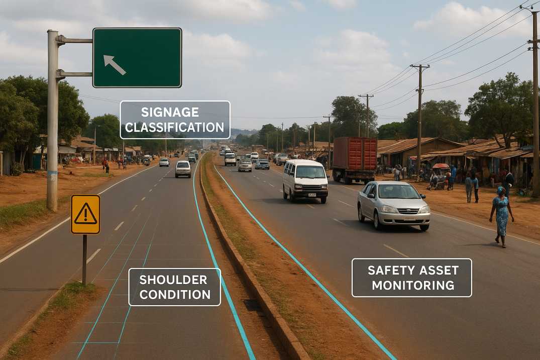
AI-powered road inventory mapping and condition monitoring are now emerging as the fastest and most reliable tools to modernise road safety management across Africa.
Road inventory data forms the backbone of highway and urban road safety management. In many African nations, these datasets suffer from being:
This creates several safety-critical challenges:
1.1 Difficulty Identifying High-Risk Segments
Missing guardrails, faded markings, broken signage or unsafe intersections can go undetected for years, allowing hazards to persist and contribute to crashes.
1.2 Weak Maintenance Planning
Roads deteriorate faster due to overloaded trucks, harsh climates and rapid urbanisation. Without updated datasets through the Roadside Assets Inventory Agent, proactive maintenance becomes impossible.
1.3 Poor Compliance with Engineering Standards
African road authorities rely on geometric and safety standards similar to global frameworks. Reliable inventory data is essential for validating design compliance.
1.4 Limited Visibility of Roadside Hazards
Unsafe shoulders, malfunctioning signals, inadequate lighting and damaged barriers increase crash severity when left undetected.
1.5 Inefficient Budget Allocation
When asset conditions are unclear, governments misdirect funds, repairing the wrong segments while high-risk corridors continue to deteriorate.
These challenges explain the growing shift toward automated, AI-driven road mapping across African regions.
2.1 High Crash Rates
2.2 Infrastructure Challenges
2.3 Data Gaps
While African nations follow their own national guidelines, many engineering principles align closely with the Indian Roads Congress (IRC) framework, which provides globally recognised standards for:
3.1 Geometric Design Requirements
3.2 Pavement Condition and Structural Performance
3.3 Roadside Safety and Traffic Control
3.4 Asset Inventory Documentation
Updated road inventory data through the Roadside Assets Inventory Agent is the foundation for implementing these IRC-aligned principles in African contexts. AI enables agencies to apply these standards more consistently, accurately and efficiently.
4.1 Pavement Assets
4.2 Traffic Control Assets
4.3 Safety Assets
4.4 Structural Assets
4.5 Roadside Assets
AI is transforming highway safety from a reactive process to a predictive, data-driven discipline. RoadVision AI enhances road inventory and safety frameworks by applying several best practices through its integrated suite of AI agents.
5.1 AI-Driven Road Inventory Mapping
The Roadside Assets Inventory Agent provides:
5.2 AI-Powered Road Condition Monitoring
The Pavement Condition Intelligence Agent enables:
5.3 AI for Geometric & Structural Safety Validation
The Road Safety Audit Agent handles:
5.4 Automated Road Safety Analytics
Combining inventory, condition and traffic datasets from the Traffic Analysis Agent to identify:
5.5 Integrated Asset Management
Unified platforms ensure:
As the proverb says, "A road well mapped is a risk half solved." AI through RoadVision AI finally gives road agencies the maps they need.
6.1 South Africa
6.2 Kenya
6.3 Nigeria
6.4 Rwanda
7.1 Limited Digital Infrastructure
Some regions lack reliable internet connectivity or data processing facilities for real-time analysis.
AI Solution: Offline-first data capture with automatic synchronization through RoadVision AI.
7.2 Budget Constraints
Traditional surveys are expensive; transitioning to AI requires upfront investment though long-term savings are substantial.
AI Solution: Scalable deployment demonstrates ROI through reduced maintenance costs.
7.3 Skill Gaps
Engineers and inspectors need training in AI-driven tools and digital asset management systems.
AI Solution: Comprehensive training programs ensure successful adoption.
7.4 Fragmented Legacy Records
Old paper-based inventories must be digitised before modernisation can begin.
AI Solution: Data migration tools enable gradual digitisation of legacy records.
7.5 Vast and Diverse Terrains
Africa's deserts, savannahs, tropical forests and mountainous regions require varied survey approaches.
AI Solution: Multi-modal surveys (ground, drone, satellite) adapt to terrain conditions.
7.6 Multi-Jurisdictional Coordination
Road networks often cross regional and national boundaries requiring coordinated inventory standards.
AI Solution: Standardised outputs enable seamless integration across jurisdictions.
AI through RoadVision AI provides a way around these obstacles by offering scalable, fast and standardised data collection.
8.1 For Road Users
8.2 For Maintenance Teams
8.3 For Transport Agencies
Accurate road inventory data is the heartbeat of road safety in Africa. Without it, maintenance becomes reactive, budgets become misaligned, safety devices go unnoticed, and geometric hazards remain hidden. AI tools through the Roadside Assets Inventory Agent, Pavement Condition Intelligence Agent, and Road Safety Audit Agent bring clarity where manual processes fall short—delivering fast, objective and standardised datasets across thousands of kilometres.
The platform's ability to:
transforms how road inventory is managed across Africa.
Platforms like RoadVision AI are modernising how African governments manage their road networks by integrating automated road inventory mapping, digital condition assessment, geometric safety analysis, predictive maintenance insights, compliance checks aligned with IRC-based principles, and traffic intelligence for congestion and safety planning.
As African nations strive for safer mobility, the path forward is clear: "If you want to go far, you must first know the road." AI through the Traffic Analysis Agent finally gives Africa the real-time, accurate picture needed to build resilient, safe and well-managed road networks.
For agencies seeking to modernise their national or regional road networks, adopting AI-driven solutions is no longer optional—it's the cornerstone of future-ready transport systems. Book a demo with RoadVision AI today to discover how our platform applies these capabilities across African corridors.
It ensures safer roads by helping agencies identify hazards, plan maintenance and maintain compliance with engineering guidelines.
AI automates asset detection, improves accuracy, speeds up data collection and integrates mapping with condition and safety insights.
Yes. AI identifies high-risk locations, missing safety assets and dangerous road geometry, enabling timely corrective actions.

The Autonomous Road Engineer
AI that is transforming road infrastructure, from reactive to predictive.
.webp)
.webp)
.png)