Saudi Arabia is undergoing a historic transformation in its transport and infrastructure landscape. Under Vision 2030, the Kingdom aims to create safer, smarter, and more sustainable mobility systems that match the ambitions of a thriving, globally connected economy. As cities like Riyadh and Jeddah grow at unprecedented speed—and giga-projects such as NEOM reshape urban mobility altogether—traditional traffic surveys simply cannot keep pace.
In modern infrastructure development, "what gets measured gets managed." Without accurate, continuous, and AI-powered traffic insights, achieving Vision 2030's ambitious mobility targets becomes significantly harder. That is why digital traffic surveys and AI-driven monitoring systems are no longer optional—they are mission-critical.
1.1 The Strategic Imperative
Saudi Arabia's transport authorities, including the General Authority for Roads, have adopted stringent guidelines such as the Saudi Road Code and SHC 603. These mandate systematic collection of traffic volumes, ADT/AADT, junction geometry, and crash data to support long-term planning and road asset management.
Legacy surveys—manual counting, sporadic measurements, and outdated reporting cycles—cannot deliver the precision required to support Vision 2030's targets, including reducing road fatalities to below five per 100,000 population.
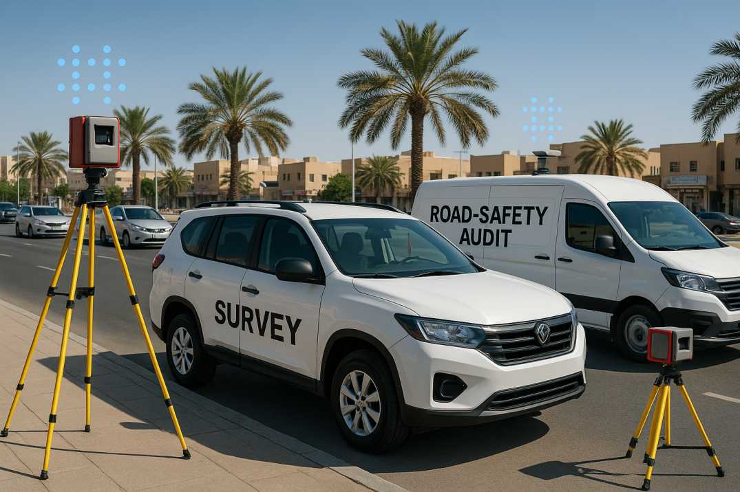
1.2 Accelerating the Shift Toward Smart Mobility
The Saudi Data and AI Authority has rolled out advanced platforms such as Sawaher and Smart-C to monitor traffic dynamically, detect congestion, and anticipate mobility patterns. These AI systems show how predictive analytics can transform urban transport, especially during seasonal fluctuations like Ramadan peak times and Hajj movements.
But to reap the full benefits, local municipalities and ministries must integrate comprehensive digital traffic surveying systems—bridging the gap between real-time observations and long-term infrastructure planning through the Traffic Analysis Agent.
Saudi Highway Codes—such as SHC 101, SHC 202, and SHC 603—share foundational principles with global road engineering standards:
2.1 Data-Driven Road Asset Management
Highway authorities must maintain up-to-date traffic, crash, and condition data to evaluate performance and schedule preventive maintenance. The Pavement Condition Intelligence Agent complements traffic data with pavement health insights for holistic asset management.
2.2 Safety-First Design
Intersection geometry, road class designations, and traffic flow parameters must be validated using empirical data rather than assumptions. The Road Safety Audit Agent combines traffic patterns with geometric analysis to identify risks.
2.3 Life-Cycle Efficiency
Infrastructure spending is optimized when planning is anchored in reliable ADT/AADT trends, enabling authorities to "fix the roof before it leaks"—addressing deterioration before failure occurs.
2.4 Integrated Mobility Planning
Roads, metro networks, bus rapid transit, pedestrian crossings, and micro-mobility must operate as an integrated ecosystem—enabled by continuous data streams that reveal how different modes interact.
2.5 Evidence-Based Policy Making
Traffic data informs decisions on speed limits, lane configurations, access management, and investment priorities—ensuring every riyal spent delivers maximum benefit.
These principles highlight why digital traffic surveys—rich in accuracy, frequency, and automation—are central to SHC compliance and Vision 2030's road modernization strategy.
RoadVision AI operationalizes SHC and IRC-aligned standards by combining AI, computer vision, and automated analytics through its integrated suite of AI agents:
3.1 AI-Enabled Traffic Surveys
The Traffic Analysis Agent provides continuous monitoring with computer vision to ensure:
This eliminates human error, provides 24/7 coverage, and supports annual forecasting requirements under SHC 603.
3.2 Digital Road Inventory & Pavement Surveys
The Pavement Condition Intelligence Agent and Roadside Assets Inventory Agent use high-resolution cameras and AI models to identify:
This enables municipalities to take preventive action rather than reactive maintenance, extending asset life and reducing costs.
3.3 Automated Road Safety Audits
The Road Safety Audit Agent combines:
This identifies safety risks before they turn into incidents, supporting Saudi Arabia's national target of reducing road traffic fatalities.
3.4 Predictive Analytics for Smart Mobility
Machine-learning models anticipate:
This allows cities to optimize signal timings, adjust response strategies, and proactively manage network capacity.
3.5 Integration with Digital Twins
RoadVision AI creates digital twins of road networks that integrate:
This provides a unified platform for scenario planning and investment optimization.
Despite major progress, the Kingdom still faces obstacles:
4.1 Rapid Urban Expansion
Fast-growing cities like Riyadh, Jeddah, and Dammam demand equally fast data collection cycles. Manual surveys are too slow to keep up with the pace of development and changing travel patterns.
4.2 Fragmented Data Sources
Different agencies collect traffic, crash, and inventory data, often in incompatible formats that prevent integrated analysis and coordinated decision-making.
4.3 Limited Real-Time Insights
Without live monitoring, authorities rely on outdated or snapshot information that doesn't reflect actual conditions during peak periods, events, or incidents.
4.4 Increasing Traffic from Mega-Projects
Expansions like Riyadh's ring road, metro integration, and connections to giga-projects like NEOM, the Red Sea Project, and Qiddiya will significantly reshape travel demand in ways traditional models cannot predict.
4.5 Extreme Climate Conditions
Heat, dust, and glare affect both traffic behaviour and sensor performance, requiring robust systems designed for local conditions.
Digital surveys and AI platforms address these barriers by consolidating real-time data and providing a unified analytical environment through RoadVision AI's integrated suite.
Saudi Arabia is standing at the crossroads of a historic mobility revolution. Vision 2030 calls for world-class roads, safer streets, and smarter mobility systems. Achieving these goals requires more than traditional approaches—it demands continuous, precise, AI-powered traffic intelligence that can keep pace with the Kingdom's ambitious transformation.
Digital traffic surveys enable planners to future-proof the Kingdom's infrastructure, ensuring every riyal invested yields maximum benefit through:
As the proverb says, "the best time to plant a tree was 20 years ago; the second-best time is now." For Saudi Arabia's Vision 2030 mobility goals, the time to adopt digital traffic surveys is now.
By adopting RoadVision AI, municipalities and transport authorities gain:
Smarter roads start with smarter data. RoadVision AI transforms raw information into actionable intelligence—helping build the safer, sustainable, and connected mobility network envisioned for Saudi Arabia's future under Vision 2030.
If your organization is ready to transform traffic management with AI-driven intelligence, book a demo with RoadVision AI today and discover how digital traffic surveys can accelerate your journey toward Vision 2030 mobility goals.
Q1. What is a digital traffic survey and how does it differ from manual surveys?
A digital traffic survey uses sensors, cameras, and AI tools to automatically collect traffic flow, volume, and classification data in real time. Manual surveys rely on human operators and take longer, with more errors.
Q2. How does AI traffic monitoring improve road safety in Saudi Arabia?
AI monitors violation patterns, accident hotspots, and peak traffic flows, enabling targeted interventions such as signage upgrades or signal optimization, aligned with SHC 603 safety audit frameworks.
Q3. Can digital traffic data help Vision 2030 road planning?
Yes. Accurate ADT/AADT volumes, vehicle classification and temporal patterns help planners allocate road resources efficiently, forecast demand growth, and support mega‑projects with smart mobility integration.

The Autonomous Road Engineer
AI that is transforming road infrastructure, from reactive to predictive.
.webp)
.webp)
.png)