As part of Qatar National Vision 2030, the nation is accelerating its transition toward sustainable, people-centric urban environments. With rapid urban expansion, rising mobility needs, and a national push toward lowering emissions, encouraging walking and cycling is no longer a "nice-to-have"—it is a strategic imperative.
However, designing safe, accessible, and inclusive non-motorized transport systems requires precise, reliable, and continuous data. This is where AI-powered infrastructure management becomes the driving force behind Qatar's next-generation transport planning.
As the saying goes, "What gets measured gets improved." AI ensures every metre of walkway, cycling track, and roadside asset is measured, analysed, and managed intelligently.
Traditional planning methods depend heavily on manual inspections, limited surveys, and assumptions about pedestrian and cyclist behaviour. These approaches often fall short in fast-changing, high-density corridors like those found in Doha and Lusail.
AI tools overcome these gaps by providing:
By integrating these technologies through the Traffic Analysis Agent, Qatar can create walkable districts and cycling networks that align with global best practices while supporting local mobility goals.
2.1 Qatar National Vision 2030
2.2 Active Mobility Initiatives
2.3 Current Infrastructure
Although walkability and cycling guidance within Qatar is informed by local and Gulf standards, modern mobility planning shares common global principles—much like the methods outlined in Indian Roads Congress guidelines, which emphasise evidence-based design.
Applying these principles to Qatar's context involves:
AI tools through the Traffic Analysis Agent and Road Safety Audit Agent ensure each of these steps is driven by actual data rather than estimates—leading to safer, more resilient walking and cycling environments.
4.1 Pedestrian Infrastructure
4.2 Cycling Infrastructure
4.3 Crossings and Intersections
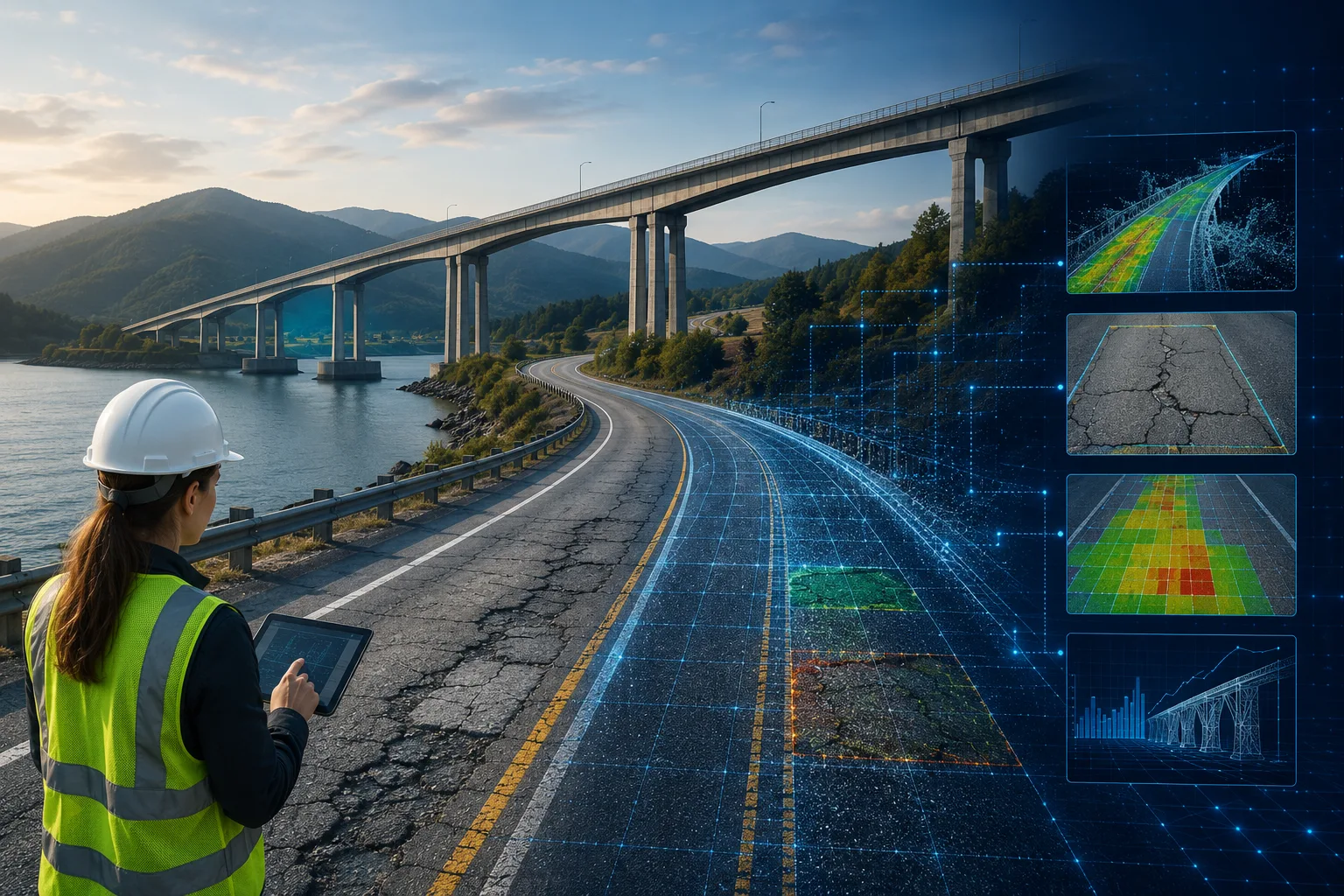
RoadVision AI applies advanced computer vision, digital twins, and automated survey capabilities through its integrated suite of AI agents to bring global best practices directly into Qatar's urban landscape.
5.1 Mapping High-Demand Pedestrian and Cycling Corridors
The Traffic Analysis Agent provides AI-based movement density analysis to help planners identify:
This ensures infrastructure is built where people truly need it, optimising investment and improving network connectivity.
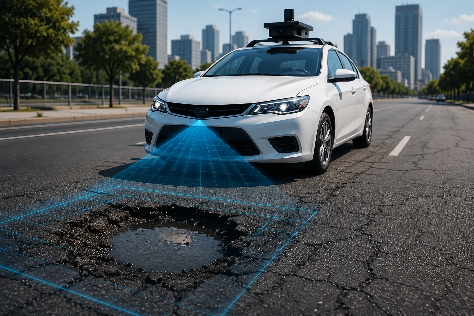
5.2 Predictive Asset Maintenance
The Pavement Condition Intelligence Agent and Roadside Assets Inventory Agent automatically detect issues such as:
Fixing issues early is cheaper—and keeps users safe. As the saying goes, "A stitch in time saves nine."
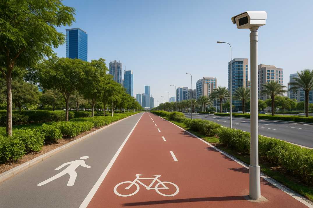
5.3 Safety Audits Using Real-Time Video Analytics
The Road Safety Audit Agent identifies near-miss events and high-risk intersections by analysing interactions between:
This leads to more robust design decisions like raised platforms, protected cycle lanes, shorter crossing distances, and improved signal timing.
5.4 Evaluating the Impact of Infrastructure Enhancements
RoadVision AI continuously monitors improvements through the Traffic Analysis Agent and compares "before vs. after" metrics:
This helps decision-makers validate investments and refine future designs.
5.5 School Zone Safety
AI monitors:
5.6 Thermal Comfort Assessment
For Qatar's climate, AI evaluates:
6.1 Doha Corniche
Popular walking and cycling destination requiring continuous monitoring of pedestrian-vehicle interactions and surface condition.
6.2 Lusail City
New development with integrated cycling and pedestrian networks requiring baseline data for performance monitoring.
6.3 Education City
High pedestrian volumes requiring safety assessment and crossing improvements.
6.4 Katara Cultural Village
Tourist destination with mixed pedestrian and vehicle traffic requiring continuous safety monitoring.
6.5 Msheireb Downtown Doha
Pedestrian-focused urban district requiring detailed movement analysis for network optimisation.
6.6 Doha Metro Stations
Last-mile connectivity requiring pedestrian and cyclist facility assessment.
Despite its benefits, deploying AI-driven mobility systems involves several challenges:
7.1 Data Integration Across Agencies
Multiple stakeholders—municipalities, transport authorities, smart-city operators—must share and synchronise data for optimal results.
AI Solution: Centralized platforms through RoadVision AI ensure all stakeholders work from the same data.
7.2 Environmental Adaptation
High heat, dust, and glare require robust AI models and hardware that perform consistently in Qatar's climate.
AI Solution: Models trained on local conditions maintain accuracy year-round.
7.3 Behavioural Variability
Pedestrian and cyclist behaviour in the Gulf differs from other regions, requiring localisation of AI models for accurate analysis.
AI Solution: Custom-trained models on Qatari conditions.
7.4 Infrastructure Transition Period
While Qatar expands its cycling and pedestrian networks, AI systems must adapt to rapidly changing construction and development environments.
AI Solution: Continuous updates capture infrastructure changes as they occur.
7.5 Privacy Considerations
Video monitoring of public spaces requires appropriate privacy protections.
AI Solution: Anonymized data processing maintains public trust.
7.6 Cultural Factors
Gender and cultural considerations in mobility patterns require nuanced analysis.
AI Solution: Context-aware analytics account for local factors.
RoadVision AI addresses these concerns by offering custom-trained models suited for Qatar's urban patterns and environmental conditions.
8.1 For Planners
8.2 For Authorities
8.3 For Users
8.4 For the Environment
With its commitment to smart, sustainable growth, Qatar stands at a pivotal moment. AI tools through the Traffic Analysis Agent, Pavement Condition Intelligence Agent, and Road Safety Audit Agent are shifting mobility planning from reactive decision-making to predictive, scientific, and human-centric strategy.
The platform's ability to:
transforms how walkability and cycling infrastructure are planned and maintained across Qatar.
RoadVision AI plays a vital role by delivering high-accuracy traffic and pedestrian surveys, detecting early infrastructure defects, ensuring compliance with local and international mobility standards, and supporting safer, more connected walking and cycling networks.
As Qatar moves toward a greener transport ecosystem, AI will act as the compass guiding its journey. After all, "The best time to plant a tree was twenty years ago; the second-best time is now." The same applies to building smarter, more walkable cities.
If you're ready to elevate Qatar's mobility infrastructure with cutting-edge AI, book a demo with RoadVision AI today and discover how tailored smart-city solutions can transform urban mobility for generations to come.
Q1. How can AI improve walkability in urban areas of Qatar?
AI enables continuous monitoring of pedestrian flows, helping planners identify where sidewalks, crossings, and safety features need enhancement.
Q2. Why is automated traffic analysis critical for cycling infrastructure?
Automated traffic analysis detects risk zones for cyclists and evaluates road-sharing behavior, allowing safer route planning and lane segregation.
Q3. What are the benefits of using AI-based infrastructure management?
AI-based Infrastructure management ensures timely maintenance, extends asset life, and supports data-backed investment decisions for walkways and cycling routes.

The Autonomous Road Engineer
AI that is transforming road infrastructure, from reactive to predictive.
.webp)