Road networks are the backbone of a nation's economy—quite literally the roads to growth. But as India's cities expand and its highways age under rising traffic loads and volatile climatic conditions, maintaining road infrastructure has become more complex, cost-heavy, and time-sensitive.
Traditional, manual inspection methods can no longer keep pace with the country's infrastructure ambitions. This is where remote sensing–powered AI road management systems step in, offering a faster, more accurate, and highly scalable approach to monitoring pavement health, safety features, and asset performance.
In an era where "a stitch in time saves nine," the fusion of remote sensing, automated road data capture, and AI ensures that agencies detect distress early, intervene proactively, and extend the life of their assets.
A modern Road Asset Management System (RAMS) depends on comprehensive, frequent, and objective data. Historically, engineers relied on physical inspections—labour-intensive, costly, and prone to inconsistency.
Remote sensing changes the game by enabling authorities to gather road data without direct physical contact through technologies such as:
When this multi-source data is processed by AI, road authorities can:
In short, remote sensing is the foundation of modern, data-driven infrastructure management.
While remote sensing brings scale and automation, effective road management in India must align with the technical principles prescribed by the Indian Roads Congress (IRC). Key IRC-aligned practices include:
2.1 Condition Monitoring and Pavement Evaluation
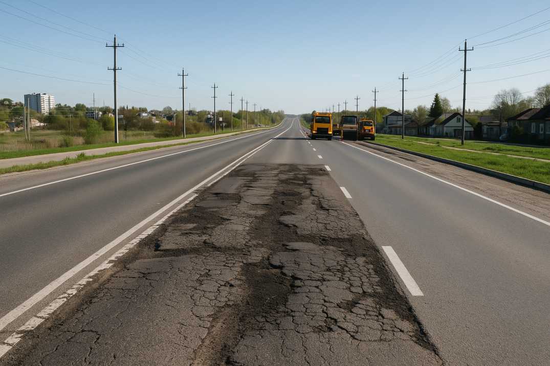
IRC guidelines emphasise regular pavement distress identification—cracking, potholes, rutting, bleeding, and ravelling—using measurable and repeatable methods such as roughness indices and visual assessments. The Pavement Condition Intelligence Agent processes remote sensing data to deliver standardised, objective, and region-independent assessments that meet these requirements.
2.2 Inventory and Classification of Road Assets
Whether culverts, pavements, road signs, or safety barriers, IRC standards require proper documentation of assets. The Roadside Assets Inventory Agent uses remote sensing to create accurate digital inventories, ensuring nothing is overlooked across thousands of kilometres.
2.3 Performance-Based Maintenance and Data-Driven Prioritisation
IRC encourages lifecycle-based planning over ad-hoc interventions. Remote sensing and AI jointly support:
2.4 Safety Audits and Hazard Identification
The Road Safety Audit Agent leverages remote sensing to identify:
2.5 Traffic Analysis and Usage Patterns
The Traffic Analysis Agent processes remote sensing data to provide vehicle counts, classifications, speed profiles, and congestion patterns—essential for understanding how roads are actually used.
Together, these principles help road agencies shift from short-term fixes to long-term asset stewardship.
RoadVision AI integrates multiple remote sensing modalities—satellites, drones, smartphones, and vehicle-mounted cameras—to create a unified digital ecosystem for road maintenance. The platform supports best practices by enabling:
3.1 Automated Distress Detection
AI models identify pavement distresses such as cracks, potholes, rutting, edge failures, and surface deformation with high precision from remote sensing imagery. As the saying goes, "Seeing is believing—but AI sees what humans often miss."
3.2 Intelligent Pavement Roughness and IRI Calculation
Remote sensing inputs paired with onboard sensors allow RoadVision AI to compute the International Roughness Index (IRI), a key performance metric used in IRC evaluations and maintenance prioritisation.
3.3 Complete Asset Digital Twin Creation
The system generates digital replicas of road corridors, integrating:
This enables engineers to visualise assets like never before and plan interventions with complete situational awareness.
3.4 Predictive Maintenance and Work Planning
By analysing historical and real-time data, the system forecasts:
With predictive analytics, agencies can intervene before failures escalate, reducing emergency repairs by up to 40%.
3.5 Smartphone-Based Surveys for Low-Budget Agencies
Using standard smartphones, engineers can capture high-quality imagery, GPS-tagged road condition data, and roughness indicators—making digital transformation accessible to all agencies regardless of budget constraints.
3.6 Multi-Scale Monitoring
The platform supports:
3.7 Temporal Change Detection
By comparing remote sensing data over time, RoadVision AI quantifies deterioration rates, measures the impact of maintenance interventions, and validates contractor performance with objective evidence.
While the benefits are significant, real-world implementation comes with operational challenges:
4.1 Training and Upskilling of Field Teams
Transitioning from manual inspections to digital workflows requires orientation, training, and capacity-building to ensure teams can effectively use new tools.
4.2 Integration with Legacy Systems
Older MIS or maintenance systems may lack APIs or formats compatible with modern digital tools, requiring middleware or data transformation layers.
4.3 Large-Scale Data Management
High-resolution images, videos, and sensor data demand robust storage, cloud systems, and high-speed processing infrastructure.
4.4 Change Management and Adoption
Institutions often hesitate to replace traditional workflows with automated systems, requiring demonstrated ROI and champion-led adoption strategies.
4.5 Connectivity in Remote Areas
Real-time data transmission from remote locations may be limited, requiring offline-capable solutions that synchronise when connectivity returns.
4.6 Standardisation Across Jurisdictions
Different states and agencies may use varying data formats and classification systems, requiring careful mapping to IRC standards.
RoadVision AI simplifies these challenges through cloud-based dashboards, plug-and-play integrations, offline capture capabilities, and end-to-end onboarding support, making digital adoption seamless and agency-friendly.
The future of road management in India lies in automation, remote sensing, and intelligent analytics. As traffic volumes rise and budgets remain constrained, agencies need systems that allow them to work smarter—not harder.
Remote sensing gives the bird's-eye view. AI provides the brainpower. Together, they unlock predictive, transparent, and cost-effective road asset management that aligns with IRC principles and national infrastructure goals.
RoadVision AI combines these strengths to offer a next-generation, IRC-compliant road asset management platform that supports:
Through the integrated capabilities of the Pavement Condition Intelligence Agent, Roadside Assets Inventory Agent, Road Safety Audit Agent, and Traffic Analysis Agent, RoadVision AI delivers a complete ecosystem for modern road management.
As the saying goes, "The road to success is always under construction." With tools like RoadVision AI, that road becomes safer, smarter, and more sustainable—built on a foundation of remote sensing and AI-driven intelligence.
Ready to transform your road asset management strategy? Book a demo with RoadVision AI today and see the future of smart road maintenance.
It is the collection of road condition and asset data using satellite, drone, and other non-contact technologies to create accurate, objective records.
AI analyzes remote sensing data to detect issues, predict failures, and optimize maintenance plans, reducing costs and improving safety.
Yes, in many cases, they can supplement or even replace manual surveys, especially for routine condition assessments and inventory updates.

The Autonomous Road Engineer
AI that is transforming road infrastructure, from reactive to predictive.
.webp)
.webp)
.png)