The road network across the United States spans deserts, mountains, forests, and dense urban regions—making it one of the most varied and challenging transportation systems in the world. Yet this diversity also brings danger. Certain highways regularly record higher crash rates due to sharp curves, steep grades, ageing infrastructure, heavy traffic volumes, and extreme weather conditions. As agencies look for smarter ways to protect drivers, AI-driven monitoring and roadway risk assessment tools are emerging as powerful allies.
With modern road asset management USA initiatives and advanced digital monitoring frameworks, transportation departments can analyse hazardous corridors, identify risk hotspots, and act before conditions worsen. AI-based road safety solutions and automated roadway assessments are changing how high-risk segments are evaluated and managed—proving that an ounce of prevention is worth a pound of cure.
High-risk routes—including mountainous passes, congested urban expressways, desert corridors, and rural freeways—are subject to a unique mix of dangers. These include:
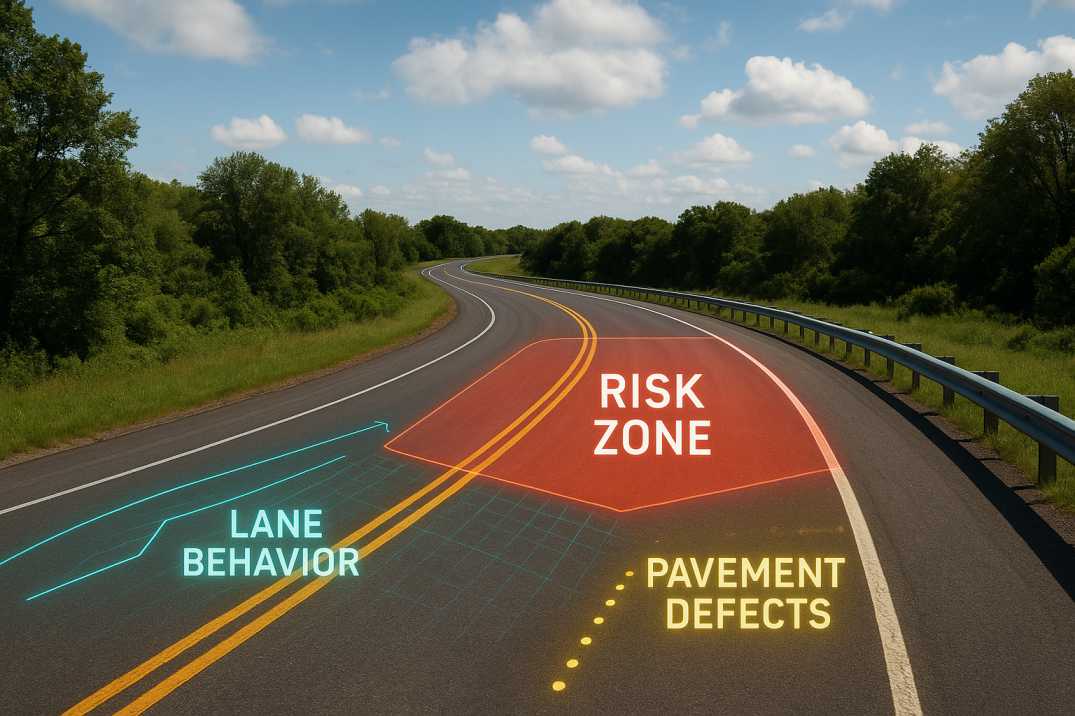
Standard roadway protocols in the USA emphasise continuous monitoring of geometry, pavement health, signage visibility, and real-time traffic behaviour through the Traffic Analysis Agent. However, manual inspections alone often lack frequency and depth. AI-based monitoring through the Pavement Condition Intelligence Agent fills this gap by converting video feeds, sensor data, and traffic insights into quantifiable metrics that can be analysed instantly.
2.1 Mountain Passes
2.2 Desert Highways
2.3 Urban Expressways
2.4 Rural Highways
2.5 Coastal Roads
While IRC guidelines are referenced internationally, safety assessment in the U.S. aligns closely with federal and state-specific safety frameworks, AASHTO design principles, and FHWA roadway safety standards. Broadly, American road safety assessment follows these core principles:
3.1 Continuous Condition Monitoring
Highways must be assessed frequently to monitor surface distress, drainage capacity, and visibility through the Pavement Condition Intelligence Agent.
3.2 Geometric and Structural Compliance
Curves, slopes, barrier systems, and shoulders must align with federal safety design expectations.
3.3 Predictive Risk Identification
Crash histories, environmental impacts, and traffic behaviour must be analysed to predict future hazards through the Road Safety Audit Agent.
3.4 Asset-Based Decision Making
Maintenance and rehabilitation should be based on objective pavement and structural asset data.
3.5 Proactive Safety Intervention
Safety improvements must target corridors with high crash likelihood, not just historical patterns.
3.6 Roadside Hazard Management
Clear zones, barrier protection, and hazard removal must be prioritised.
AI through the Traffic Analysis Agent elevates each of these principles by providing real-time performance insights and predictive intelligence.
4.1 Geometric Deficiencies
4.2 Pavement Deficiencies
4.3 Traffic Operation Issues
4.4 Environmental Factors
RoadVision AI enhances safety on America's most dangerous roads through its integrated suite of AI agents, delivering comprehensive solutions for transportation agencies.
5.1 AI-Based Road Monitoring for Hazard Detection
The Road Safety Audit Agent continuously analyses high-speed imagery and sensor data to identify:
This level of automation ensures that hazards are detected far earlier than periodic inspections allow.
5.2 Digital Roadway Condition Analysis at Scale
The platform captures thousands of data points across urban, rural, and interstate highways. Benefits include:
The Traffic Analysis Agent integrates traffic survey insights to reveal risky speed patterns, conflict zones, and flow abnormalities.
5.3 Predictive Crash Analysis with AI
Using crash histories, geometric characteristics, driver behaviour, pavement health, and environmental trends through the Road Safety Audit Agent, RoadVision AI identifies high-risk segments and forecasts crash probabilities. This enables agencies to prioritise safety interventions based on predicted risks rather than reactive measures.
5.4 AI-Driven Hazard Mapping and Digital Safety Audits
The platform generates interactive maps showing:
These insights allow engineers to plan improvements using evidence-backed intelligence—something manual audits cannot match at the same speed or scale.
5.5 Pavement Condition Integration
The Pavement Condition Intelligence Agent provides:
5.6 Asset Inventory for Safety
The Roadside Assets Inventory Agent maps:
6.1 FHWA Strategic Highway Safety Plan
6.2 Highway Safety Improvement Program (HSIP)
6.3 AASHTO Highway Safety Manual
6.4 State DOT Safety Programs
7.1 Technology Integration Across States
Many transportation agencies still rely on legacy systems that must be aligned with AI platforms.
AI Solution: Flexible APIs through RoadVision AI enable gradual integration.
7.2 Vast and Varied Terrain
The USA's extreme diversity—from snowy Rockies to desert highways—requires multi-sensor capture strategies.
AI Solution: Adaptive algorithms maintain accuracy across diverse environments.
7.3 Data Overload and Storage Management
Continuous monitoring generates massive datasets requiring strong digital infrastructure.
AI Solution: Cloud-based platforms through RoadVision AI manage data at scale.
7.4 Workforce Adaptation and Training
Field engineers and analysts need upskilling to leverage AI dashboards and analytics effectively.
AI Solution: Comprehensive training programs ensure successful adoption.
7.5 Funding for Technology Deployment
Initial investment in AI systems requires strategic planning.
AI Solution: Scalable deployment demonstrates ROI through safety benefits.
7.6 Interagency Coordination
Road safety involves multiple agencies (DOT, state police, emergency services).
AI Solution: Centralized platforms ensure all stakeholders work from the same data.
Despite these challenges, the benefits far outweigh the transition effort—especially as federal and state programs increasingly support AI adoption.
8.1 For Transportation Agencies
8.2 For Maintenance Teams
8.3 For Road Users
The most dangerous roads in the USA demand proactive and predictive monitoring approaches—not reactive, time-delayed responses. AI-powered roadway assessment tools through the Road Safety Audit Agent, Pavement Condition Intelligence Agent, and Traffic Analysis Agent are transforming national safety strategies by identifying hazards early, predicting crash likelihood, and improving roadway condition visibility.
The platform's ability to:
transforms how road safety is approached across America's most dangerous roads.
Platforms like RoadVision AI combine cutting-edge machine learning, computer vision, digital twins, and advanced analytics to deliver safer, smarter and more resilient road networks through the Roadside Assets Inventory Agent. By empowering agencies to detect defects earlier, monitor infrastructure continuously and base decisions on objective data, RoadVision AI helps reduce maintenance costs, improve driver safety and enhance network performance.
When it comes to protecting drivers on America's toughest roads, AI ensures that no hazard "slips through the cracks."
To explore how your agency can strengthen roadway safety with AI, book a demo with RoadVision AI today and experience firsthand how technology is reshaping the future of transport safety.
Dangerous roads usually involve geometric challenges, high-speed conditions, adverse weather and pavement deterioration.
AI detects hazards early, analyses crash patterns and provides predictive insights to prioritise safety improvements.
No. AI enhances existing processes by increasing accuracy, frequency and speed, but engineering judgement remains essential.

The Autonomous Road Engineer
AI that is transforming road infrastructure, from reactive to predictive.
.webp)
.webp)
.png)