
AI road condition monitoring Singapore — LTA-compliant inspection, Smart Nation digital twin alignment, and expressway intelligence for LTA, URA, JTC, and PUB on the world's most demanding urban road network.
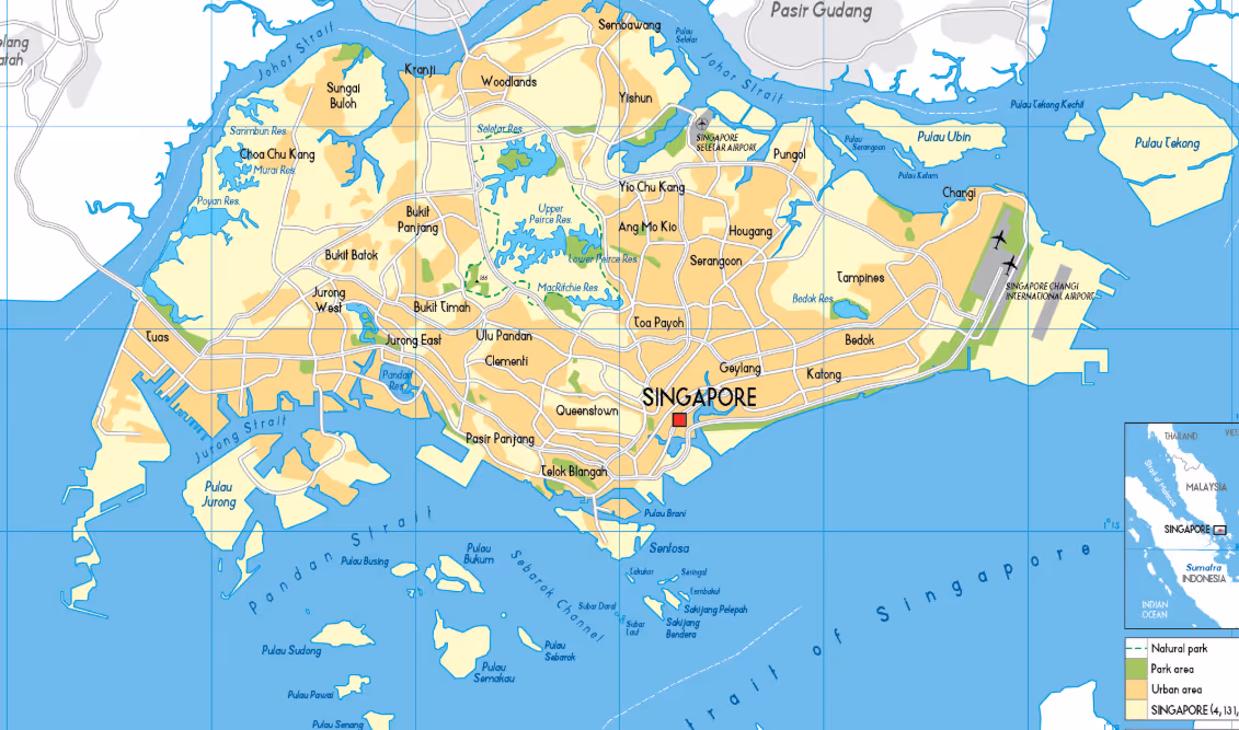
Singapore manages one of the world's most demanding road networks — 9,500 kilometres packed into 728 square kilometres, carrying 1.2 million vehicles under year-round tropical rainfall of 2,600 mm annually. Continuous AI Road Condition Monitoring Singapore calibrated to tropical conditions is the logical next step for LTA. Singapore Pavement Management Software and Singapore Highway Inspection AI that deliver real-time network intelligence are the operational standards the Singapore Smart Nation Road Asset Management Platform vision demands.
LTA is Singapore's single road authority — planning, building, operating, and maintaining the entire public road network. Singapore Expressway Network Condition Monitoring integrates directly with the Singapore Smart Nation Road Asset Management Platform, alongside advanced Singapore Pavement Management Software capabilities connected to OneMap, EMAS, and the national digital twin.
Singapore's 2,600 mm annual rainfall with no dry season accelerates pavement oxidation, stripping, and pothole formation continuously — not seasonally.
With 1.2 million vehicles on 728 km², Singapore roads carry traffic densities that compress pavement design life significantly.
LTA's digital twin, EMAS expressway management, and OneMap GIS platform require continuous, machine-readable road condition data.
Singapore's AV pilot programmes require validated, high-resolution pavement condition and road geometry data that traditional surveys cannot provide.
Singapore's dense underground utility network means frequent road reinstatement works — each creating micro-deterioration hotspots that accumulate invisibly.
LTA conducts most expressway maintenance in narrow overnight windows. Without current condition prioritisation, teams cannot optimise deployment.
Calibrated to LTA's technical specifications and Singapore's tropical road engineering requirements.
LTA's primary condition metric combining IRI, rutting depth, cracking percentage, and pothole count. RoadVision AI generates LTA PCR-compatible outputs.
Network-scale IRI aligned to LTA thresholds — Good <2.0 m/km | Fair 2.0-3.5 | Poor >3.5 m/km — with tropical temperature correction factors.
Distress detection and asset classification referenced to LTA's Road Design and Engineering standards — the definitive technical framework.
Condition outputs in GeoJSON and IFC-compatible formats for integration with LTA's national digital twin, OneMap GIS, and EMAS.
High-resolution pavement surface and geometry data outputs aligned to LTA's autonomous vehicle road readiness specifications.
Distress and material condition classification aligned with SS Singapore Standards for road construction and maintenance.
Tropical Humidity Calibration: Singapore's year-round heat & humidity (85%+ average RH) accelerates asphalt binder oxidation. RoadVision AI applies LTA-validated tropical deterioration curves for prediction.
Each agent configured to LTA workflows, tropical deterioration models, Smart Nation integration, and AV readiness.
Network-scale LTA PCR and IRI from dashcam and LiDAR — tropical humidity calibrated. Continuous coverage between LTA survey cycles at 80–90% lower cost per lane-km.
Network-scale LTA PCR and IRI from dashcam and LiDAR — tropical humidity calibrated. Continuous coverage between LTA survey cycles at 80–90% lower cost per lane-km.
LTA PCR thresholds; SS Singapore Standards compatible; direct LTA PMS export
SGD 400–900 / lane-km vs. SGD 3,500–8,000 traditional survey
Continuous — replacing fixed survey cycles
Real-time condition data feeds in GeoJSON and IFC formats for LTA's national digital twin, OneMap GIS, and EMAS — enabling machine-readable network intelligence.
Real-time condition data feeds in GeoJSON and IFC formats for LTA's national digital twin, OneMap GIS, and EMAS — enabling machine-readable network intelligence.
OneMap GIS, EMAS expressway management, national digital twin
GeoJSON / IFC machine-readable continuous feeds
Continuous PCR and IRI monitoring across all 10 Singapore expressways — PIE, CTE, ECP, AYE, BKE, KPE, MCE, SLE, TPE, KJE.
Continuous PCR and IRI monitoring across all 10 Singapore expressways — PIE, CTE, ECP, AYE, BKE, KPE, MCE, SLE, TPE, KJE.
LTA threshold tracking and night-maintenance prioritisation dashboards
Continuous — supports nightly maintenance windows
High-resolution pavement surface, geometry, and lane-marking condition outputs aligned to LTA's autonomous vehicle road readiness specifications.
High-resolution pavement surface, geometry, and lane-marking condition outputs aligned to LTA's autonomous vehicle road readiness specifications.
one-north, Jurong Island, and public road AV programmes
LTA AV Road Readiness Standards
Automated detection of road reinstatement quality degradation at utility trench locations.
Automated detection of road reinstatement quality degradation at utility trench locations.
LTA and Town Councils enforce utility contractor reinstatement standards before defects compound
Trench-level condition evidence with contractor attribution
Automated accident-prone location identification aligned with LTA road safety methodology.
Automated accident-prone location identification aligned with LTA road safety methodology.
Singapore's Road Safety Master Plan; MOT Vision Zero
Traffic Police and MOT Vision Zero reporting
Enabling continuous network coverage versus fixed survey cycles
Detects post-rain surface degradation before it compounds
Continuous machine-readable data multiplies Smart Nation investment
Road condition data for AV certification replaces bespoke surveys
Three phases aligned to LTA's GeBIZ procurement framework and Singapore's government technology standards.
Selected expressway and arterial road segments — 50-200 lane-km. Baseline PCR and IRI validated against LTA existing data. Digital twin format integration confirmed.
Full LTA network coverage. Integration with LTA PMS, OneMap GIS, EMAS, and national digital twin. AV-readiness data pipeline established.
Continuous tropical deterioration monitoring, expressway nightly maintenance prioritisation, digital twin real-time feeds, AV readiness certification support.
Procurement: Available through Singapore GeBIZ portal under ICT and professional services categories. Compatible with MOF government procurement framework and LTA term contract structures.
From LTA expressway performance to Smart Nation digital twin integration and AV readiness data — RoadVision AI delivers continuous intelligence.

The Autonomous Road Engineer
AI-powered road condition monitoring, asset management, & infrastructure intelligence helping agencies move from reactive maintenance to predictive road management.
RoadVision AI Private Limited,
Office No. 308 & 310, B Block, Ansal
Chamber - 1, Bhikaji Cama Place,
Near Engineers India Limited (EIL)
Bhawan, New Delhi - 110066