Greater Noida is one of India's most deliberately planned urban centres — wide roads, organised sectors, deliberate zoning. Yet the Greater Noida Industrial Development Authority (GNIDA) was managing its road network with tools that had not kept pace with the city's ambition: manual inspection teams, fragmented data formats, and no standardised condition baseline. The result was a planned city making unplanned decisions about its own infrastructure.
Manual field teams produced inconsistent outputs — different methods, different teams, no common format. Without standardised data, comparing conditions across roads or time periods was impossible, making objective budget prioritisation a fiction rather than a practice.
Without accurate condition data, GNIDA responded to visible deterioration and public complaints rather than anticipating defects. By the time action was triggered, surface failures had already escalated toward structural problems — multiplying both cost and disruption.
There was no GPS-verified, timestamped baseline of road condition — no road asset management system capable of sustaining institutional memory across personnel transitions, audit cycles, or contractor accountability reviews.
GNIDA was spending on road maintenance without the ability to verify whether interventions worked. Without before-and-after condition data, every repair order was an act of administrative faith rather than evidence-based governance.

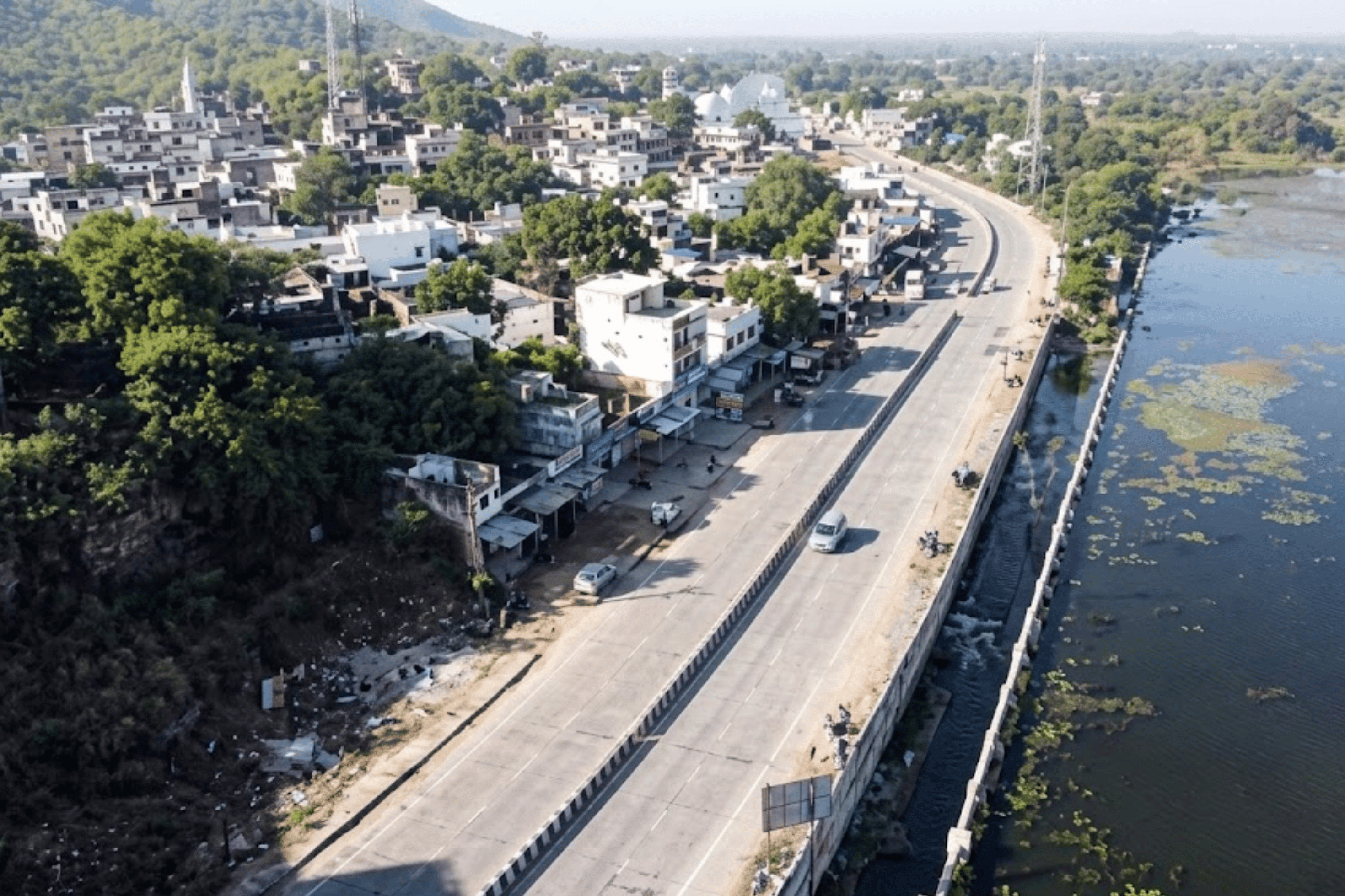
On 27 February 2024, RoadVision AI deployed its AI pavement inspection platform across a focused 5.24 km pilot of GNIDA's road network — designed to demonstrate real-world performance on actual roads, and to produce outputs GNIDA's engineering teams could immediately evaluate and act upon.
Engineers mounted the RoadVision AI data collection app on a standard vehicle windshield via a suction bracket. Driving at normal traffic speed, the setup captured continuous high-resolution video, GPS coordinates, and imagery across the full pilot stretch. No lane closures. No specialist vehicles. No mobilisation cost. Data collection was as unobtrusive as a routine patrol drive — and as rigorous as a formal engineering survey.
Collected footage was processed through RoadVision AI's intelligence engine, trained on multi-year, multi-geography road data. Every frame was automatically analysed — defects classified by type, severity, and GPS coordinate in line with IRC standards. This automated pavement distress detection eliminates the subjectivity and latency of manual annotation, producing consistent, auditable outputs in hours rather than weeks.
Beyond standard condition assessment, the platform constructed digital twins of every surveyed corridor — virtual replicas capturing road geometry, surface condition, and asset attributes. These digital models support both current planning decisions and predictive maintenance modelling, enabling GNIDA to simulate future deterioration scenarios rather than simply reacting to them.
Every defect was geotagged and exported in GeoJSON and other formats compatible with GNIDA's existing asset management systems. A live, web-based GIS platform visualised the assessed network in colour-coded condition layers — centralising road condition intelligence for planners, engineers, and management in a single, accessible command layer.

Across 5.24 km of Greater Noida's network, the AI engine catalogued 1,879 individual defects — classified by type, severity, and precise GPS coordinate. This was not a random distribution of wear. It was a network-wide signal of surface layer deterioration that, left unaddressed, transitions from a maintenance problem into a structural one.

RoadVision AI's deployment did not produce a single report. It produced a structured, five-layer intelligence system — each deliverable purpose-built for a different decision-making function within GNIDA's engineering and governance operations.
Every metre of the 5.24 km pilot network is documented in a permanent, GPS-timestamped video archive. Raw dashcam footage — organised by road and date — is paired with an AI-annotated version in which every detected defect is highlighted: bounding box, classification label, severity rating, and GPS coordinate overlaid in real time. This is the evidentiary foundation that makes every condition score auditable and every maintenance decision defensible.

Every surveyed road is assigned a persistent Road ID and a standardised IRC Pavement Condition Index score — computed automatically per road and per 100-metre chainage segment. This pavement analysis software output eliminates inspector subjectivity and gives GNIDA a defensible, year-on-year comparable rating for every corridor in the network. The Road Register is the authoritative infrastructure baseline — the document that makes budget requests evidence-based rather than opinion-based.
A web-based GIS platform gives GNIDA's planners, engineers, and management a real-time, colour-coded condition map of the assessed network. Every defect is a clickable map marker — revealing type, severity, GPS coordinate, and supporting photograph. The AI road condition analysis is not locked in a report on a desk; it is live, accessible, and filterable — enabling the entire organisation to operate from a shared, accurate picture of road health.
Beyond condition assessment, RoadVision AI constructed digital twins of every surveyed corridor — virtual replicas capturing road geometry, surface attributes, and condition data in a form that supports predictive modelling. This AI based pavement condition monitoring system is particularly significant for Greater Noida: unlike older cities retrofitting AI onto legacy infrastructure, GNIDA has the opportunity to build predictive maintenance into its operations from the start. The digital twin enables scenario modelling — forecasting where deterioration is heading before it becomes visible on the road surface.
Comprehensive road chainage and inspection reports give GNIDA's engineering teams the structured, defect-level data required for work order generation, contractor accountability, and budget justification. Every defect is classified by type and severity, assigned a GPS coordinate, and ranked by maintenance priority — enabling engineers to generate repair work orders directly from the platform without additional data preparation. This is the road asset management system that transforms infrastructure intelligence into operational action.
The February 2024 pilot demonstrated conclusively that RoadVision AI performs in Greater Noida's real-world conditions. The automated assessments, digital twin outputs, and GIS-integrated reports gave GNIDA a quality of infrastructure intelligence it had never previously accessed — and the pilot's success directly triggered the decision to pursue full-scale network deployment.
IRC-rated PCI scores transform maintenance budget requests from field observations into objective, auditable evidence. When presenting to elected bodies or state finance departments, a colour-coded network map with 100-metre condition granularity is far more persuasive than an engineer's memory.
Pre- and post-repair surveys create a timestamped, GPS-verified condition trail that cannot be disputed. A road that does not improve measurably after intervention cannot be signed off — making quality-based payment certification objectively possible for the first time. This is autonomous road safety
The persistent Road ID system ensures that every survey builds on the last. When engineering teams change — as they inevitably do — the full condition history of every road remains in the platform. GNIDA's infrastructure intelligence is now a property of the institution, not its individuals.
The digital twin capability enables GNIDA to model future deterioration rather than simply document current conditions. As the temporal database accumulates across surveys, the platform identifies deterioration curves — flagging corridors heading toward failure before they fail. Preventive treatment costs a fraction of emergency reconstruction. This is the smart city road safety solution Greater Noida was designed to support.
Greater Noida's deployment demonstrates that AI-grade infrastructure intelligence is not a luxury of scale — it is achievable in a single pilot, with standard equipment, in a single day of field collection. The model scales to any urban authority, development authority, or highway department seeking to replace reactive infrastructure management with evidence-based governance.

Field data collection for a network like GNIDA's pilot (5.24 km) takes a single day using a standard vehicle-mounted setup — no specialist equipment, no road closures, no traffic management. AI processing of the complete footage takes approximately 2 hours after upload. A full structured report with IRC condition scores, GIS layers, and digital twin outputs is typically delivered within 4–6 weeks of data collection. Larger networks are assessed proportionally faster as multiple survey vehicles can be deployed concurrently.
Manual inspection produces outputs that are inherently subjective — dependent on the experience, attention, and consistency of individual inspectors across different days and conditions. AI pavement inspection applies the same trained model to every frame of footage, producing classification outputs that are consistent, auditable, and reproducible. The same road surveyed six months apart will be assessed using identical criteria, making year-on-year comparison statistically valid rather than directionally indicative.
The digital safety audit platform creates a timestamped, GPS-verified condition baseline before any intervention and an independent measurement after — establishing an objective accountability trail that cannot be disputed by contractors. A road that does not improve measurably in IRC score after repair cannot be certified for payment. This makes quality-based payment a structurally enforceable standard rather than an aspirational policy.
Yes. The road asset management system exports condition data in GeoJSON, Excel, PDF, and other standard formats compatible with most existing asset management platforms. The live GIS layer is web-based and accessible across teams without specialist software. Integration with GNIDA's existing systems was achieved without custom development — the platform is designed to complement rather than replace existing operational infrastructure.
Standard pavement condition surveys focus on surface defects. AI highway accident analysis extends coverage to road safety features — signage condition, road marking visibility, crash barrier integrity, drainage obstruction, and encroachments — identifying the environmental and infrastructure factors that contribute to collision risk. Combined with blackspot identification and traffic pattern analysis, this gives authorities the full picture needed for evidence-based road safety investment.
The compounding value is in the temporal database. Each additional survey maps to the same persistent Road IDs established in the first survey — building a cumulative condition history for every corridor in the network. Over time, this enables the AI based pavement condition monitoring system to identify deterioration curves, predict maintenance windows, and optimise budget allocation based on projected condition trajectories rather than current complaint volumes. The first survey establishes a baseline; subsequent surveys transform that baseline into a predictive asset.
From survey design to live GIS platform — RoadVision AI delivers the full system, not just a report.

The Autonomous Road Engineer
AI that is transforming road infrastructure, from reactive to predictive.
%20(1).png)