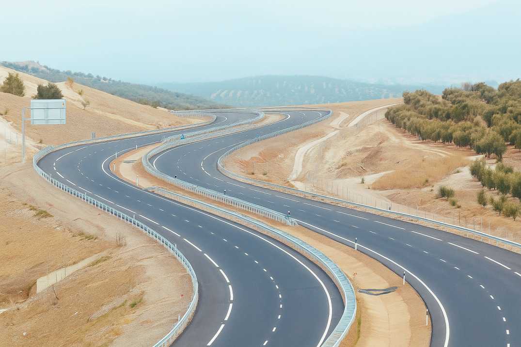
Precision is the backbone of successful highway development in India. Any deviation in alignment, cross slope, or super-elevation can lead to long-term safety concerns, poor ride quality, and costly maintenance. Traditional surveying methods—while widely used—are slow, labour-intensive, and prone to human inconsistencies.
Today, AI-powered highway construction monitoring is transforming quality assurance processes. With intelligent sensors, drones, LiDAR, and analytics, engineers can detect geometry deviations early, prevent rework, and ensure that every kilometre of roadway meets national standards. As the saying goes, "A small leak can sink a great ship"—and AI ensures those small deviations never go unnoticed.
Highway construction in India operates under dynamic conditions—large project scales, diverse terrains, tight construction schedules, and strict compliance requirements issued by the Indian Roads Congress (IRC). Any deviation from design geometry can:
With highways serving as critical economic corridors under programmes like Bharatmala and PMGSY, precision is not optional—it is mandatory.
2.1 Horizontal Alignment
2.2 Vertical Alignment
2.3 Cross-Section Elements
3.1 Horizontal Alignment Deviations
3.2 Vertical Alignment Deviations
3.3 Cross-Section Deviations
3.4 Stake and Layout Errors
IRC standards provide highly detailed specifications on geometric design, alignment quality, and slope accuracy for national and state highways. Key principles relevant to geometry deviation monitoring include:
4.1 Horizontal Alignment Compliance
IRC requires adherence to the designed horizontal curve radii, transition lengths, and sight distances to ensure safe vehicle operation at design speeds.
4.2 Vertical Profile Accuracy
The vertical gradient must follow approved drawings to ensure safety, comfort, and vehicle performance, particularly for heavy vehicles on steep grades.
4.3 Cross Slope and Super-Elevation
Proper slope ensures drainage efficiency and safe vehicle maneuvering on curves. The Road Safety Audit Agent verifies these parameters.
4.4 Lane and Shoulder Width Uniformity
Any inconsistency in width can disrupt lane discipline, especially in high-speed corridors where precise positioning is critical.
4.5 Compliance with Staking, Layout, and Leveling Procedures
Survey benchmarks must align precisely with approved geometric plans, with tolerances specified in IRC codes.
4.6 Sight Distance Requirements
Crest curves and horizontal curves must provide adequate stopping and decision sight distances for design speeds.
These principles ensure highways perform efficiently, offer smooth rides, and support long-term pavement durability.
AspectTraditional MethodsAI-Based MethodsData CollectionManual survey, total stationsLiDAR, drones, vehicle-mounted sensorsCoverageSample points onlyContinuous corridor coverageSpeedKilometres per dayHundreds of kilometres per dayAccuracyMillimetre precision possible but labour-intensiveMillimetre precision at scaleError DetectionDetected after completionReal-time detection during constructionDocumentationPaper records, CAD filesDigital twins, automated reports
RoadVision AI deploys cutting-edge AI-based systems to enhance geometry verification during construction through its integrated suite of AI agents. Its solutions integrate computer vision, LiDAR analytics, drones, and geospatial intelligence to ensure that every geometric parameter aligns with IRC benchmarks.
6.1 AI-Powered Real-Time Data Capture
The Pavement Condition Intelligence Agent uses high-resolution sensors and LiDAR-equipped drones to create accurate 3D surface models of under-construction road segments.
6.2 Automated Alignment and Slope Verification
AI algorithms through the Road Safety Audit Agent compare as-built conditions against design drawings, instantly flagging deviations in:
6.3 Predictive Geometry Monitoring
Machine learning models through the Pavement Condition Intelligence Agent detect patterns that signal potential future deviations, enabling proactive corrections before they become expensive to fix.
6.4 Digital Integration with Road Asset Management
Geometry data flows into RoadVision AI's digital twin environment through the Roadside Assets Inventory Agent, linking construction accuracy with long-term pavement performance and future maintenance planning.
6.5 Instant IRC-Compliant Reporting
Reports follow IRC guidelines for geometry verification, ensuring accountability, transparency, and uniform documentation across all construction phases.
6.6 Construction Progress Monitoring
AI tracks earthwork volumes, layer placement, and final geometry against design specifications, identifying deviations as they occur.
7.1 For Project Owners
7.2 For Contractors
7.3 For Engineers
Despite advancements, geometry monitoring presents several challenges:
8.1 Manual Surveys Are Slow and Prone to Errors
Human-led measurement increases the risk of inconsistencies, especially across long highway stretches where surveyors may fatigue or miss sections.
AI Solution: Continuous automated surveys through RoadVision AI cover entire corridors with consistent accuracy.
8.2 High Project Complexity
Varying terrain conditions and long linear projects make manual monitoring almost impossible at scale without extensive resources.
AI Solution: AI scales to projects of any length without proportional resource increases.
8.3 Difficulty in Integrating Multi-Source Data
Traditional methods cannot easily combine survey data, machine outputs, and design plans for comprehensive analysis.
AI Solution: Integrated platforms unify all data sources through the Roadside Assets Inventory Agent.
8.4 Limited Skilled Workforce
Advanced geometric verification requires skilled surveyors—often unavailable during peak construction cycles.
AI Solution: AI democratises geometric verification, providing expert-level analysis without requiring specialist on-site presence.
8.5 Documentation Gaps
Paper-based records are easily lost or damaged, creating gaps in as-built documentation.
AI Solution: Digital records through RoadVision AI provide permanent, accessible documentation.
8.6 Delayed Detection
Traditional methods often detect deviations only after significant work is complete, requiring expensive rework.
AI Solution: Real-time detection enables immediate correction before rework costs escalate.
AI addresses these roadblocks through speed, automation, and unprecedented precision.
9.1 Reduced Rework Costs
9.2 Extended Pavement Life
9.3 Safety Benefits
9.4 Project Schedule Adherence
AI-driven geometry deviation detection is "changing the rules of the game" for highway construction. By blending real-time monitoring, predictive insights, and automated quality checks through the Pavement Condition Intelligence Agent, Road Safety Audit Agent, and Roadside Assets Inventory Agent, engineers can ensure highways are built exactly as designed—safer, smoother, and more durable.
The platform's ability to:
transforms how highway construction quality is assured across India.
RoadVision AI is leading this transformation with cutting-edge road AI technology that enhances geometric accuracy, supports IRC-compliant construction, and strengthens long-term road safety. Its digital twin systems, computer vision platforms, and AI roadway inspection tools help detect alignment issues, potholes, cracks, and surface anomalies early—ensuring faster corrective action and improved lifecycle performance.
If you want to build smarter, safer, and more sustainable highways, RoadVision AI is the partner you need.
Book a demo with RoadVision AI today and discover how AI can elevate the quality, accuracy, and efficiency of your highway construction projects.
Q1. What types of geometry deviations can AI detect during highway construction?
AI detects horizontal misalignment, vertical profile inconsistencies, slope errors, lane width discrepancies, and super-elevation deviations.
Q2. How does AI improve construction quality control?
AI provides real-time monitoring, automated alignment verification, predictive analysis, and integrates construction data into road asset management systems.
Q3. Is AI-based monitoring compliant with national highway regulations?
Yes, AI systems ensure compliance with design plans and regulatory standards while improving accuracy and efficiency.

The Autonomous Road Engineer
AI that is transforming road infrastructure, from reactive to predictive.
.webp)
.webp)
.png)