Pavement subgrade failures remain one of the most persistent and costly challenges in Georgia's transportation network. According to the Georgia Department of Transportation Design Policy Manual, subgrade performance directly determines pavement lifespan, safety, and long-term maintenance needs. When subgrade layers fail, roads crack, rut, and deteriorate far earlier than expected—leading to expensive repairs and public frustration.
Traditional field surveys, manual soil testing, and periodic visual inspections have long been the backbone of subgrade evaluation. Yet these methods are inherently reactive and sometimes inconsistent. As Georgia's infrastructure expands, the need for reliable, science-driven subgrade design has never been greater.
This is where AI-based pavement testing and automated monitoring offer a timely solution. As the saying goes, "An ounce of prevention is worth a pound of cure," especially when it comes to designing roads that stand the test of time.
Despite strong guidelines in the GDOT Design Policy Manual, several practical challenges continue to impact subgrade reliability:
1.1 Highly Variable Soil Across the State
Georgia's geology shifts dramatically—red clay in the Piedmont region, sandy loam in the Coastal Plain, and coastal sediments near the Atlantic. This variability makes predictions difficult without extensive, site-specific data.
1.2 Manual Testing Limitations
Traditional moisture, density, and classification tests are prone to human error and variability in field execution, leading to inconsistent design inputs.
1.3 Delayed Identification of Compaction or Drainage Issues
By the time moisture buildup or subgrade softening becomes visible, damage has already begun beneath the surface, requiring expensive corrective measures.
1.4 Lack of Continuous Monitoring
Without real-time condition tracking, engineers cannot intervene early enough to prevent deep structural failures before they compromise the entire pavement system.
1.5 Construction Quality Variability
Even with proper design, field execution gaps in compaction, moisture control, and layer thickness can undermine subgrade performance.
These challenges highlight the need for real-time digital tools that improve accuracy, minimize delays, and eliminate guesswork.
2.1 What Is Subgrade?
The subgrade is the natural soil or prepared layer beneath the pavement structure. It provides the foundation upon which all pavement layers rest. Subgrade failure leads to accelerated deterioration of overlying layers.
2.2 Critical Subgrade Properties
2.3 Common Subgrade Failure Modes
While Georgia follows GDOT standards, many international engineering agencies reference the scientific framework of the Indian Roads Congress for advanced subgrade and pavement performance modeling. Key IRC principles relevant to Georgia include:
3.1 Mechanistic–Empirical Design Approach
Evaluates pavement response to loads using scientific models rather than empirical assumptions, providing more reliable predictions of subgrade behavior.
3.2 Soil Strength Characterization for Layer Thickness Design
CBR-based or modulus-based assessments ensure pavements are designed for actual subgrade conditions, not assumed values.
3.3 Climate & Moisture-Sensitive Subgrade Analysis
Moisture infiltration, drainage, and seasonal variations are factored into design reliability—critical for Georgia's rainfall patterns.
3.4 Quality Control Through Continuous Data Capture
Ongoing condition data is essential for maintaining long-term serviceability and validating design assumptions.
3.5 Subgrade Improvement Methods
Guidance on stabilization techniques for weak soils, including chemical treatment, geosynthetics, and drainage improvements.
These principles closely align with the goals of GDOT—and become significantly more practical with AI integration.
4.1 Soil Characterization
4.2 Moisture Monitoring
4.3 Compaction Quality Control
4.4 Performance Prediction
RoadVision AI brings GDOT and IRC-aligned subgrade design into a digital, data-driven era through its integrated suite of AI agents. Its best practices include:
5.1 Automated Soil Classification
The Pavement Condition Intelligence Agent uses machine learning to analyze geotechnical test data, moisture profiles, and soil imagery to classify soil types instantly—reducing the risk of human error and enabling consistent classification across projects.
5.2 Predictive Pavement Performance Modeling
AI models forecast rutting, cracking, and structural fatigue based on soil strength, expected traffic loading from the Traffic Analysis Agent, and environmental conditions—allowing design optimization before construction.
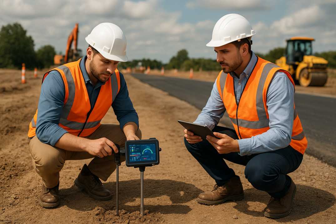
5.3 Moisture and Drainage Monitoring Through Sensors
Embedded or mobile sensors detect water infiltration before it compromises subgrade stability—crucial for Georgia's rainfall-heavy regions where seasonal saturation is common.
5.4 Digital Road Monitoring System
High-resolution imaging through the Pavement Condition Intelligence Agent and continuous surface scanning allow engineers to detect early distress, monitor compaction quality, and verify GDOT compliance throughout construction.
5.5 Integration With Road Inventory & Construction Logs
The Roadside Assets Inventory Agent connects soil data, design parameters, construction records, and performance history—creating a digital twin of each roadway that supports long-term asset management.
5.6 Construction Quality Assurance
AI monitors:
5.7 Subgrade Improvement Verification
When soil stabilization or geosynthetics are used, AI verifies the effectiveness of treatments through continuous monitoring.
Together, these tools ensure subgrade failures are addressed before they escalate, helping Georgia "stay one step ahead of the storm."
6.1 Piedmont Region (Atlanta Metro, North Georgia)
6.2 Coastal Plain (South Georgia)
6.3 Fall Line Zone
6.4 Mountain Region (North Georgia)
7.1 Data Fragmentation Across Agencies
Different districts may store soil and design data differently, complicating AI model integration and network-wide analysis.
AI Solution: Standardized data formats through RoadVision AI enable consistent analysis across districts.
7.2 Connectivity Limitations in Remote Regions
Rural stretches may lack the bandwidth needed for real-time sensor communication.
AI Solution: Offline-first data capture with automatic synchronization when connectivity returns.
7.3 Resistance to Shifting From Manual to Digital Workflows
Contractors and field teams may require training to adapt to AI-enabled processes.
AI Solution: Comprehensive training programs and user-friendly interfaces ensure successful adoption.
7.4 Ensuring Model Accuracy Across Georgia's Diverse Soil Types
AI models must be carefully calibrated to local geology for precise predictions.
AI Solution: Models trained on Georgia-specific soil data account for regional variations.
7.5 Procurement and Standardization Barriers
Government adoption of new technologies often requires updates in procurement guidelines and pilot validation procedures.
AI Solution: Phased implementation with pilot projects demonstrates ROI before full-scale deployment.
7.6 Legacy Data Integration
Historical project records may not be in digital formats compatible with AI analysis.
AI Solution: Data digitization services and flexible import tools enable legacy data integration.
These challenges are solvable—but require strategic planning and phased adoption.
8.1 Reduced Construction Costs
8.2 Extended Pavement Life
8.3 User Benefits
8.4 Safety Improvements
Georgia has a unique opportunity to modernize its pavement design strategy by integrating AI-based pavement testing through the Pavement Condition Intelligence Agent, continuous monitoring, and predictive analytics via the Traffic Analysis Agent. When paired with GDOT's solid design principles and informed by global standards like IRC, AI becomes the key to preventing premature subgrade failures.
The platform's ability to:
transforms how subgrade design is approached across the state.
RoadVision AI is leading this transformation with advanced computer vision tools that detect potholes, cracks, moisture issues, and structural anomalies in real time through the Pavement Condition Intelligence Agent. Fully aligned with GDOT requirements and informed by IRC frameworks, it empowers engineers and decision-makers to reduce risks, cut maintenance costs, and ensure smoother, safer transportation corridors across the state.
As the proverb goes, "Fix the roof while the sun is shining," and now is the perfect moment for Georgia to adopt AI-driven pavement design.
Ready to reshape Georgia's pavement design strategy? Book a demo with RoadVision AI today and discover how intelligent infrastructure can redefine your road network's future.
Q1. How does AI improve GDOT pavement subgrade design?
AI automates soil testing, predicts failures, and enables real-time monitoring to ensure stronger and longer-lasting pavements.
Q2. Can AI help reduce costs in Georgia’s road projects?
Yes, AI reduces manual errors, prevents early failures, and cuts down on expensive rehabilitation work.
Q3. Is AI compatible with GDOT’s existing regulations?
Absolutely. AI supports GDOT standards by enhancing compliance and providing more accurate data.

The Autonomous Road Engineer
AI that is transforming road infrastructure, from reactive to predictive.
.webp)
.webp)
.png)