
Road condition assessment used to mean a clipboard, a windshield survey, and a spreadsheet full of subjective notes. Today, it means something entirely different: purpose-built software platforms that ingest imagery, sensor data, and historical records to produce consistent, quantifiable, and continuously updated pictures of pavement health across an entire network. As agencies face growing pressure to justify infrastructure spending with hard data, road condition assessment software has shifted from a nice-to-have analytical tool to a core operational requirement.
But the market for this software has grown crowded and varied, spanning everything from lightweight mobile inspection apps to full AI-powered platforms integrated with GIS and asset management systems. In this blog, we'll break down what road condition assessment software actually does, the core features that separate basic tools from advanced platforms, how AI is reshaping the category, and what to look for when evaluating options for your agency.
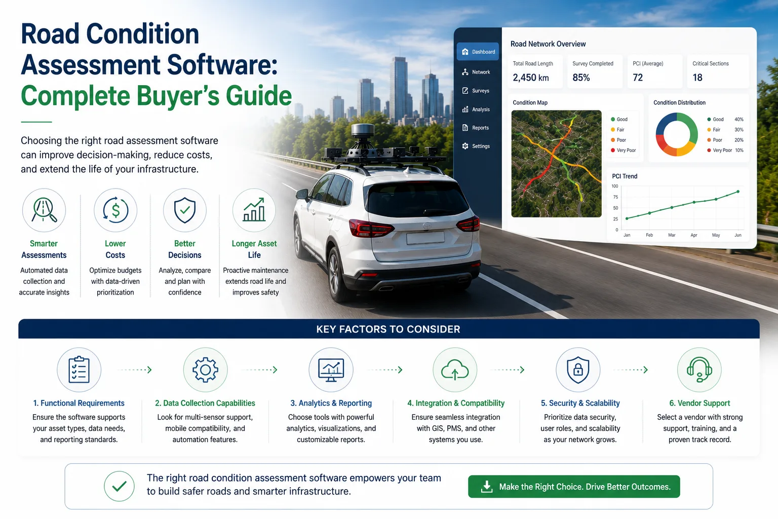
Road condition assessment software is a digital platform used to collect, process, analyze, and report on the physical condition of road surfaces. Depending on the platform, this can include everything from simple digital inspection checklists used by field crews to sophisticated AI-driven systems that automatically detect and classify defects from camera or sensor data, generate condition indices, and feed directly into long-term capital planning tools.
At its core, the software exists to solve one fundamental problem: transforming raw observations about road condition whether captured manually or automatically into structured, actionable, and comparable data that supports maintenance decisions and budget planning.
These are typically mobile or tablet-based applications that replace paper forms and spreadsheets for field inspectors, allowing standardized data entry, photo capture, and GPS tagging during manual inspections. They improve consistency and speed over paper-based methods but still rely fundamentally on human observation.
These platforms use computer vision to automatically detect and classify road defects from imagery captured by vehicle-mounted cameras, drones, or fleet dashcams, dramatically reducing the manual effort involved in data collection while improving consistency across large-scale surveys.
Broader in scope, pavement management systems combine condition data—whether collected manually or via AI—with deterioration modeling, budget scenario planning, and multi-year capital programming tools, supporting long-term strategic decision-making rather than just point-in-time condition capture.
The most comprehensive category combines road condition assessment with broader asset data—traffic, signage, drainage, bridges—into a unified intelligence layer, supporting cross-asset prioritization and holistic infrastructure planning.
Look for AI-powered computer vision capabilities that can automatically identify and classify common defect types potholes, cracking, rutting, raveling—reducing reliance on time-consuming manual visual assessment.
Strong platforms calculate recognized condition indices, such as the Pavement Condition Index (PCI) or International Roughness Index (IRI), ensuring output data is compatible with established engineering standards and comparable across different survey periods.
Effective software should provide clear, interactive geospatial visualization of condition data, allowing planners to easily identify problem areas, plan maintenance routes, and communicate findings visually to stakeholders.
More advanced platforms include predictive analytics capabilities that model how specific road segments are likely to deteriorate over time, supporting proactive rather than purely reactive maintenance planning.
Look for tools that allow planners to model different budget scenarios and see the projected network-wide condition impact, supporting more defensible capital planning conversations with decision-makers.
The ability to generate, assign, and track maintenance work orders directly from identified defects significantly reduces the administrative gap between detection and repair action.
Software should maintain a clear historical record of condition data over time for each road segment, supporting trend analysis and helping identify segments deteriorating faster than expected.
Look for flexible reporting tools that can generate different views for different audiences—detailed technical reports for engineers, summary dashboards for elected officials, and compliance documentation for regulatory reporting.
Ensure the platform supports data export in standard formats and offers API access or integration capabilities, avoiding vendor lock-in and supporting connections with other agency systems.
Even AI-driven platforms benefit from mobile accessibility, allowing field staff to verify flagged issues, update statuses, or capture supplementary data directly from the field.
The most significant shift in this software category over the past several years has been the integration of AI-powered automated pavement detection, which has changed the fundamental economics and scalability of road condition assessment:
As AI models, sensor technology, and data integration capabilities continue to advance, road condition assessment software is likely to become increasingly predictive, automated, and interconnected with broader infrastructure management systems. Emerging trends include:
Choosing the right road condition assessment software shouldn't mean choosing between speed, accuracy, and budget. RoadVision AI combines AI-powered defect detection, standardized condition indexing, and GIS-integrated reporting into a single platform built specifically for transportation agencies managing large, complex road networks helping you replace slow manual surveys with continuous, defensible condition data.
Ready to see how AI-powered assessment software can transform your road maintenance program? Get in touch with the RoadVision AI team to learn more or request a demo.
Road condition assessment software is a digital platform used to collect, process, analyze, and report on road surface condition data, ranging from simple digital inspection apps to AI-powered automated detection platforms.
AI enables automated defect detection from imagery, reducing manual data collection effort, improving measurement consistency, and supporting predictive deterioration modeling that basic manual tools can't provide.
Road condition assessment software focuses on collecting and analyzing condition data, while a pavement management system typically incorporates that data into broader deterioration modeling and multi-year capital planning tools.
Look for software that generates recognized, standardized indices such as the Pavement Condition Index (PCI) or International Roughness Index (IRI) to ensure compatibility with established engineering practices.

The Autonomous Road Engineer
AI-powered road condition monitoring, asset management, & infrastructure intelligence helping agencies move from reactive maintenance to predictive road management.


.webp)
.webp)
.webp)