
Ask any municipal engineer what keeps them up at night, and pavement condition is only part of the answer. A missing drain cover slab on a busy street is a serious injury risk waiting to happen. An unauthorized hoarding blocking sightlines at an intersection is a silent contributor to accidents nobody connects back to its actual cause. Illegal encroachment onto the road right-of-way a shop extension, a parked structure, an unpermitted stall quietly eats away at road width and safety margins over months and years, one small violation at a time, until it becomes a citywide problem too large to easily reverse.
These issues share a common thread: they're not pavement defects, but they're just as dangerous, and they've historically been even harder to systematically track than potholes. Nobody drives a dedicated survey vehicle specifically looking for illegal hoardings. Missing drain covers are often reported only after someone has already been hurt. AI-powered detection is changing that, extending the same computer vision techniques used for pothole and crack detection to a much broader category of road-adjacent hazards and compliance violations. This blog looks at how that detection actually works, asset by asset.
Before getting into the technology, it's worth understanding why encroachment, missing infrastructure components, and illegal hoardings have been so much harder to systematically monitor than pavement defects:
Right-of-way encroachment includes structures, extensions, parked vehicles, vendor stalls, or other physical objects that extend into road shoulders, footpaths, or the designated road right-of-way beyond what's legally permitted.
AI models trained for encroachment detection work by comparing captured roadside imagery against known right-of-way boundaries, typically established through GIS mapping and property line data. Computer vision identifies structures or objects present within the imagery, and geospatial analysis determines whether their location falls within the protected right-of-way zone.
One of the most effective techniques for encroachment monitoring is comparing successive imagery of the same location captured over time — a building extension or semi-permanent structure that wasn't present in an earlier survey pass but appears in a later one is flagged as a likely new encroachment, even without needing to define every possible encroaching object type in advance.
Encroachment detection is genuinely harder than pothole detection because "is this object legally permitted to be here" isn't a purely visual question it requires cross-referencing against permit records, zoning data, and right-of-way boundaries, not just recognizing an object's presence. Effective systems combine visual detection with this contextual data layer to distinguish permitted structures from actual violations.
A missing drain cover appears as an open, dark cavity along a drainage channel or catch basin visually distinct from surrounding pavement due to depth, shadow, and the absence of the expected surface covering.
Unlike a pothole, a missing drain cover represents an acute, severe safety hazard a pedestrian or cyclist can fall directly into an open drain, and vehicles can suffer serious damage or lose control. The severity-to-frequency ratio makes this a category where even relatively rare occurrences deserve high-priority automated flagging rather than waiting for routine inspection cycles.
AI models are trained specifically to recognize the visual signature of an open drain cavity versus a properly covered drain looking for the characteristic dark void, exposed edges, and surrounding structural context (proximity to known drainage infrastructure locations) that distinguishes a missing cover from other dark surface features like shadows or staining.
Because drain cover locations are typically known and mapped as part of a broader drainage asset inventory, detection systems can cross-reference this data flagging with high confidence when imagery shows an anomaly precisely at a known drain cover location, improving both detection accuracy and reducing false positives from unrelated dark surface features elsewhere.
Given the acute safety risk, well-designed systems treat missing drain cover detections differently from routine pavement defects triggering immediate, high-priority alerts rather than being folded into a standard periodic maintenance report.
Unauthorized hoardings include advertising billboards, banners, or signage installed without proper permits, often in locations that obstruct sightlines, distract drivers, or violate placement regulations near intersections, curves, or pedestrian crossings.
Computer vision models identify hoarding and signage structures within roadside imagery, similar to how they'd detect any other object, but the "unauthorized" determination requires cross-referencing detected signage against a database of permitted installations a hoarding present in the imagery but absent from the permit database is flagged as a likely violation.
Beyond simply identifying whether a hoarding is authorized, more advanced systems can assess whether its size, placement, and location create a sightline obstruction or driver distraction risk at intersections or curves a safety dimension distinct from, but related to, the permitting question.
Change detection across successive survey passes helps identify newly installed unauthorized hoardings quickly, rather than relying on the same issue eventually being noticed and reported by a member of the public or a passing inspector.
Beyond identifying hoardings, the same underlying detection approach extends to monitoring legitimate road signage and markings confirming they're present, correctly oriented, and in adequate condition, which is a distinct but related asset monitoring function.
AI-powered visual inspection can identify damaged, missing, or improperly positioned guardrails and safety barriers along a corridor, another category of road-adjacent asset that affects safety without being part of the pavement surface itself.
Visual and, where integrated with operational data, functional monitoring can help identify non-functioning streetlights or malfunctioning traffic signals as part of a broader automated asset monitoring program.
Computer vision can identify vegetation growth that's beginning to obscure signage, streetlights, or driver sightlines at intersections, supporting proactive trimming before visibility becomes a genuine safety concern.
While each of these asset types looks visually distinct, the underlying AI approach shares several common elements:
Potholes and cracking get most of the attention in road condition monitoring, but they're far from the only hazards lurking in the road environment. Missing drain covers pose acute, serious injury risk. Unauthorized hoardings quietly compromise intersection safety. Right-of-way encroachment gradually erodes public infrastructure one small violation at a time. AI-powered computer vision, combined with geospatial cross-referencing against permit and asset data, is increasingly capable of catching all of these issues proactively turning what has historically been reactive, complaint-driven, and department-siloed monitoring into a genuinely comprehensive, systematic program.
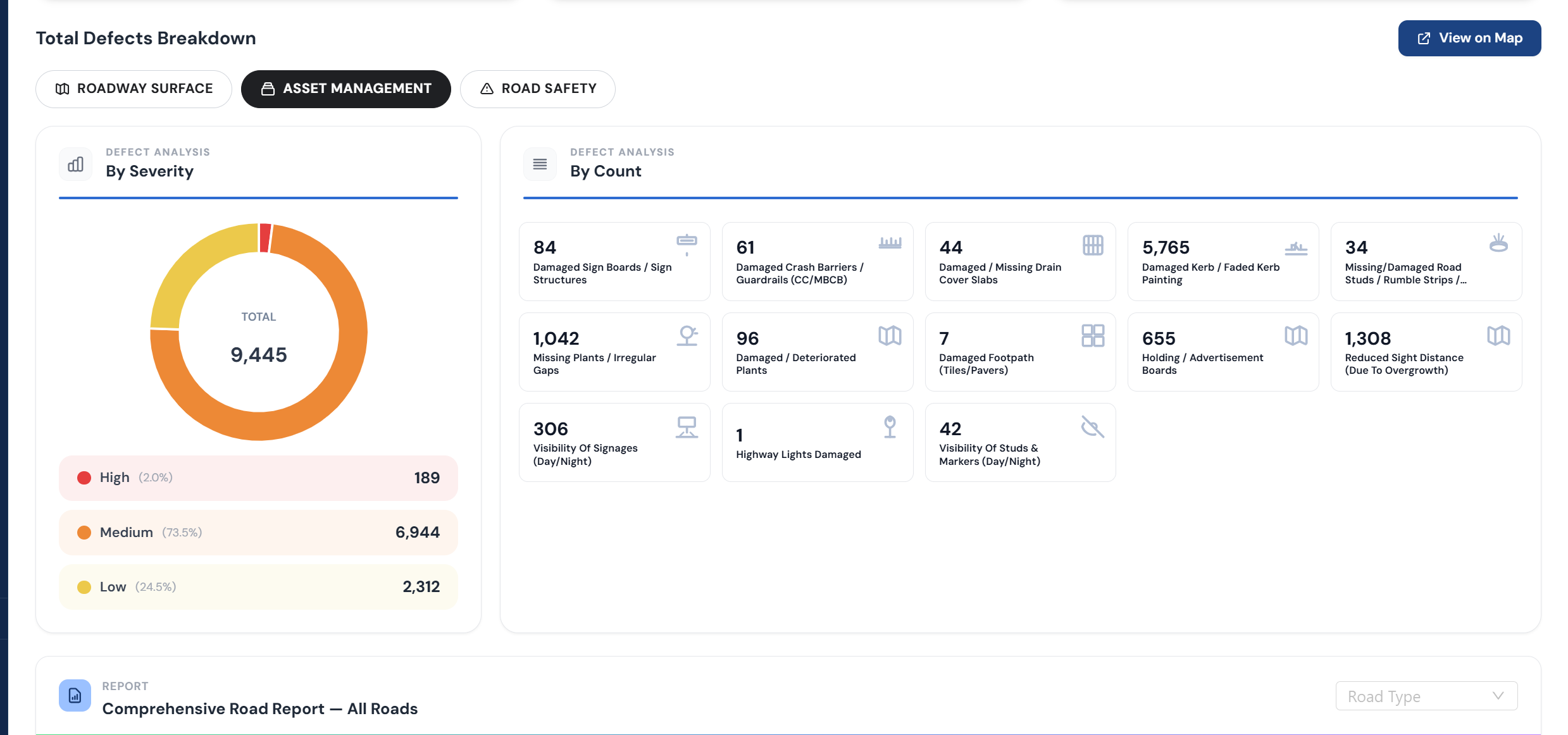
RoadVision AI extends AI-powered detection beyond pavement condition to cover the full range of road-adjacent hazards and compliance issues missing drain covers, unauthorized hoardings, right-of-way encroachment, and broader road asset condition all from the same data collection pipeline. Catch what routine inspection misses, before it becomes an accident or an enforcement backlog.
Want to see comprehensive AI-powered detection applied to your network? Talk to the RoadVision AI team to learn more or request a demo.
Yes, AI models can identify structures or objects in roadside imagery and cross-reference their location against known right-of-way boundaries, flagging likely encroachment, particularly effective when combined with change detection across successive survey passes.
AI models are trained to recognize the visual signature of an open drain cavity dark voids, exposed edges and cross-reference detections against known drainage infrastructure locations to confirm and prioritize these high-severity safety hazards.
Missing drain covers represent an acute, severe injury risk to pedestrians and cyclists, making even relatively rare occurrences a high-priority safety issue that typically triggers immediate alerts rather than routine reporting.
AI can detect the presence of hoardings and signage, but determining whether they're authorized typically requires cross-referencing detections against a permit database, since visual appearance alone doesn't indicate permit status.
AI can monitor signage presence and condition, guardrail and barrier condition, streetlight status, vegetation encroachment on sightlines, and general right-of-way compliance, in addition to core pavement condition.

The Autonomous Road Engineer
AI-powered road condition monitoring, asset management, & infrastructure intelligence helping agencies move from reactive maintenance to predictive road management.


%20(1).webp)
.webp)
.webp)