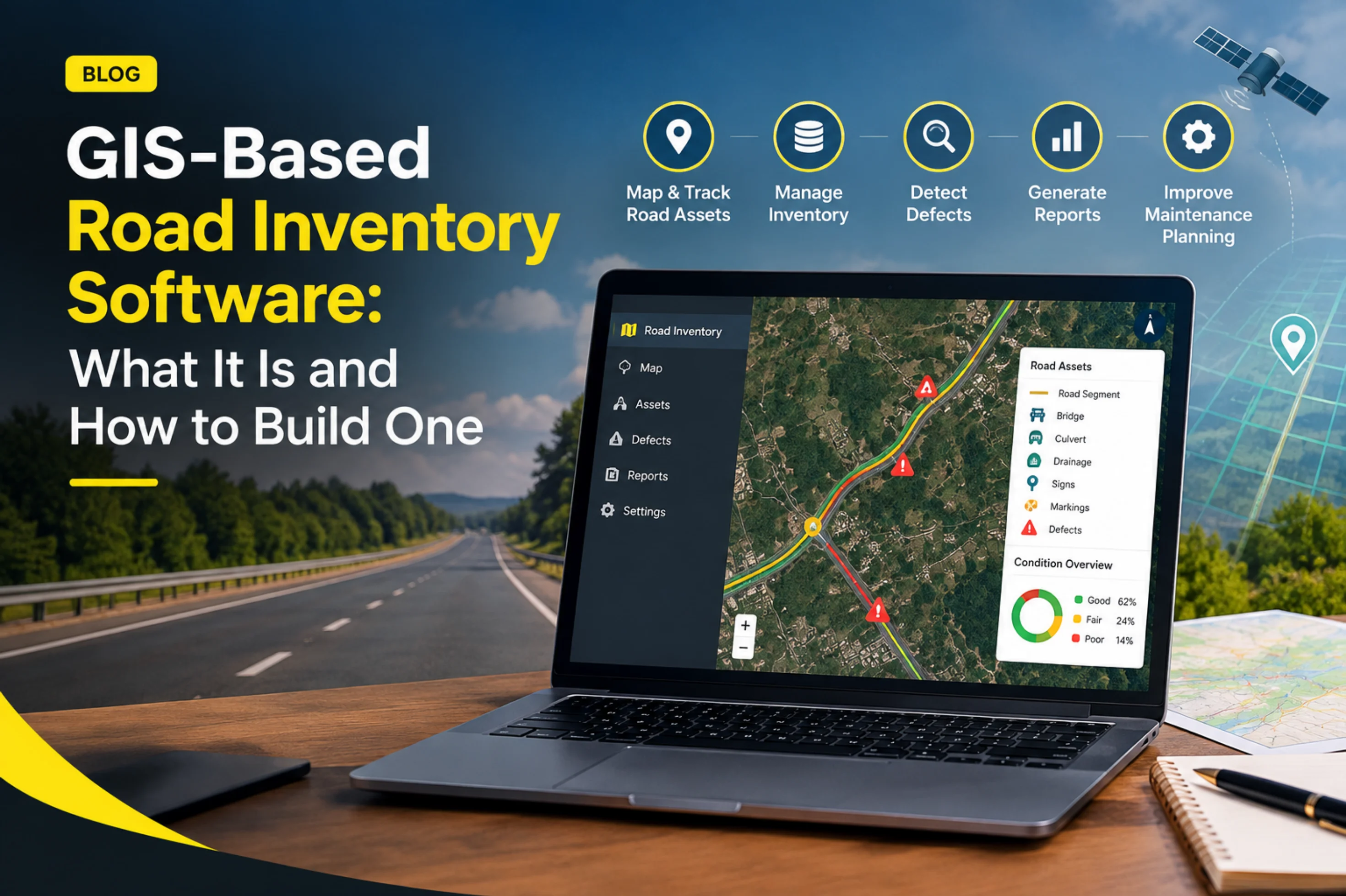
Road asset management software is purpose-built to inventory, inspect, score and maintain road assets such as pavements, signs, markings and drainage. A traditional GIS is a general-purpose mapping platform that stores and displays spatial data but does not natively assess road condition or plan maintenance. Most road agencies need both: GIS as the map layer, and road asset management software as the intelligence layer that tells them what to fix, where and when.
Road networks are ageing faster than budgets are growing. Highway authorities, municipal corporations, concessionaires and contractors are expected to keep roads safe, document their condition and justify every rupee or dollar spent on repairs.
Many organisations start with a GIS because maps feel like the natural first step. Over time, they discover that a map showing where a road is does not tell them how healthy it is. That gap is why the question of road asset management software versus traditional GIS systems keeps coming up in procurement meetings.
This guide explains what each system does, where each one falls short, and how to decide which one your road network needs.
A Geographic Information System (GIS) is software that captures, stores, analyses and visualises geospatial data. Platforms such as ArcGIS and QGIS let teams layer information on a map: road centrelines, administrative boundaries, land parcels, utilities and satellite imagery.
Strengths of traditional GIS
Limitations for road management
A GIS answers the question "where is it?" very well. It was not designed to answer "what condition is it in, and what should we do about it?"
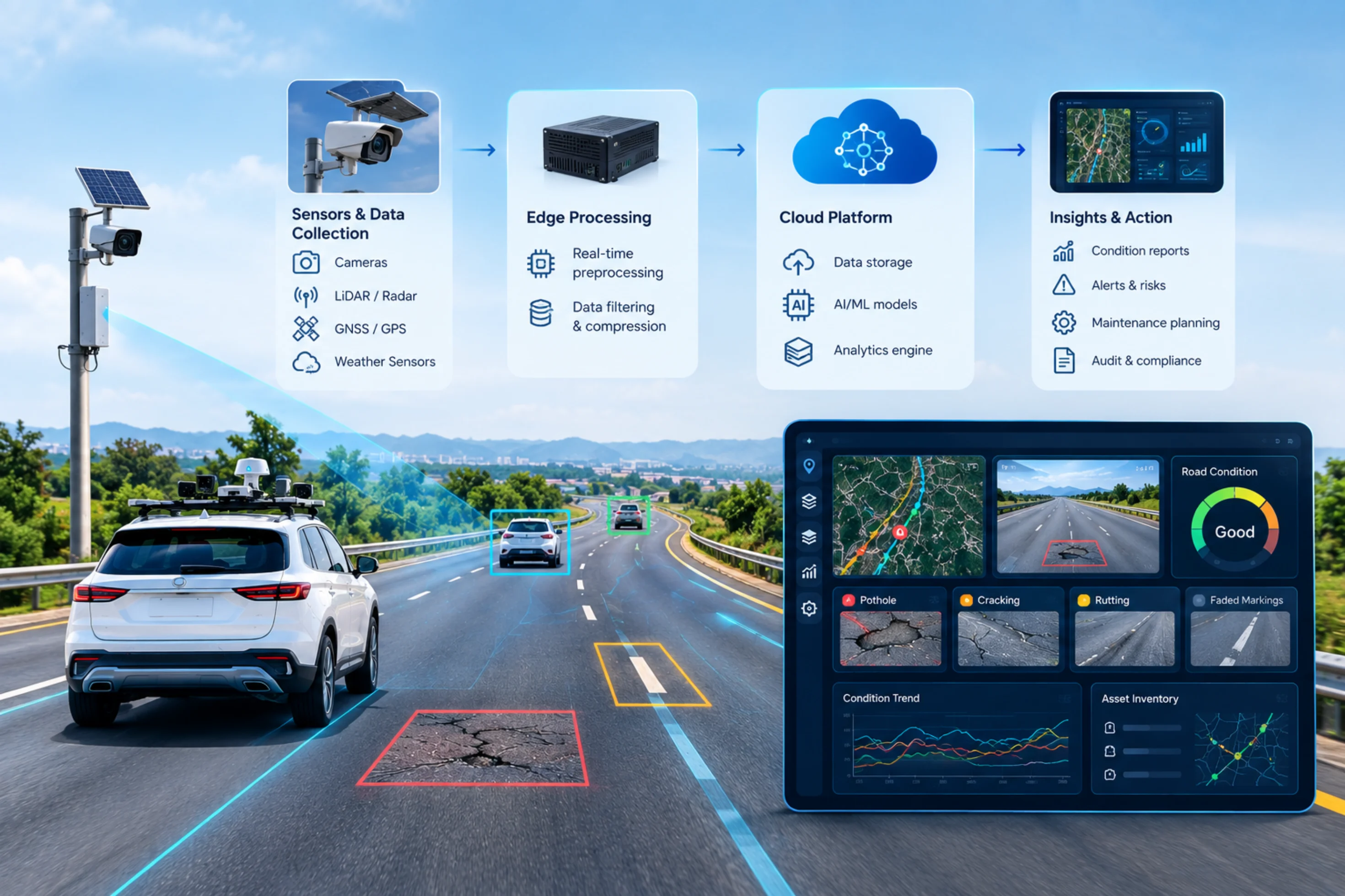
Road asset management software is a specialised platform that manages the full lifecycle of road assets: inventory, inspection, condition assessment, maintenance planning, work tracking and reporting. Modern platforms combine location data with computer vision and analytics.
Typical capabilities
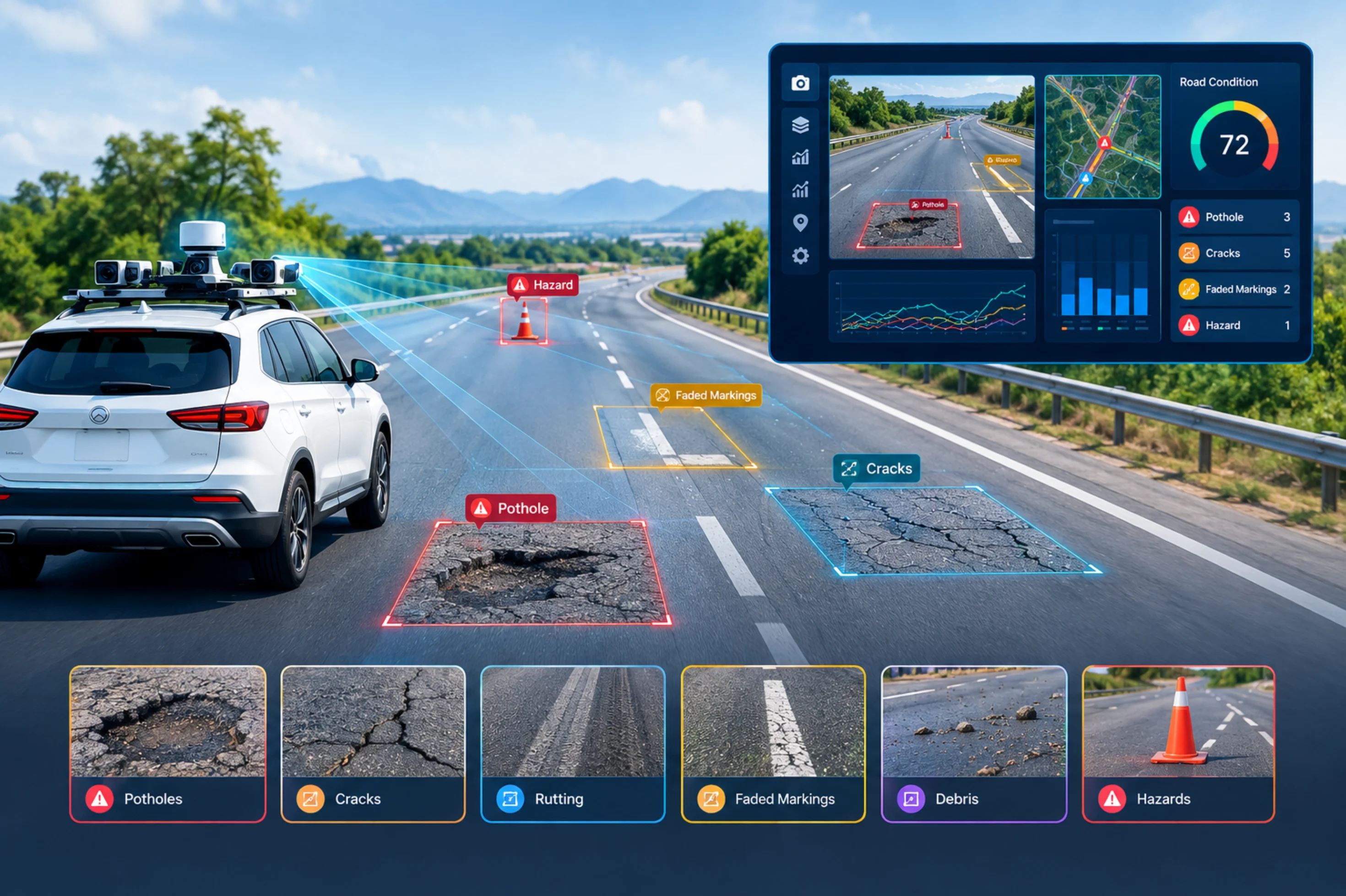
AI-enabled platforms go further. Using imagery from vehicle-mounted cameras or smartphones, they detect and classify defects automatically, tag them with GPS coordinates and feed the results straight into a maintenance workflow.
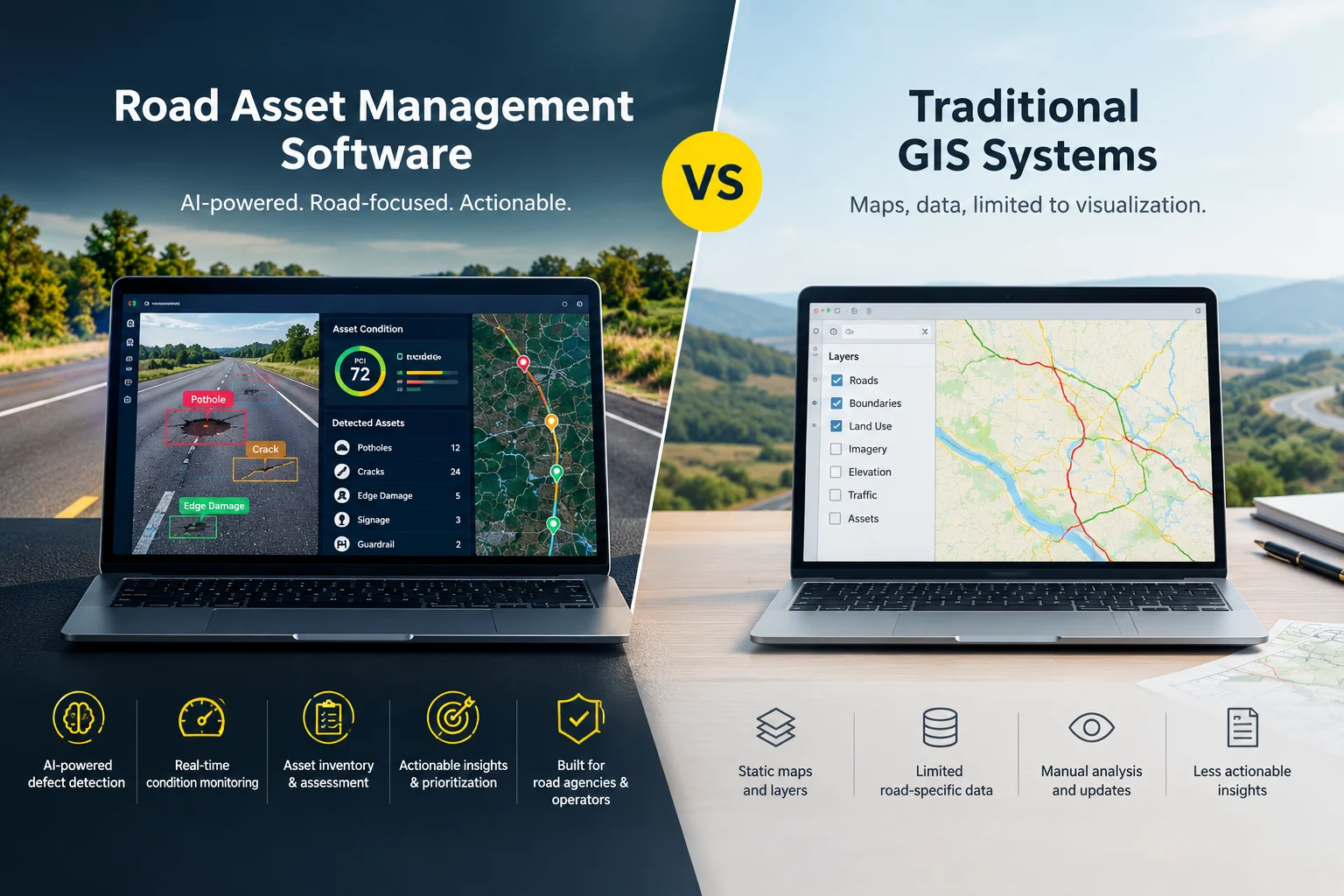
This is where the two approaches diverge most.
In a traditional GIS workflow, an inspector drives the road, notes defects on paper or a spreadsheet, and an analyst later digitises the findings. Weeks can pass between observation and map update, and subjective judgement varies from one inspector to the next.
Road asset management software with AI shortens that loop. Cameras capture the road as a vehicle drives at normal speed. Computer vision models flag potholes, cracks, damaged signs and worn markings, and each finding is geotagged automatically. The result is a consistent, repeatable dataset that can be compared survey after survey.
Consistency matters as much as speed. When every kilometre is assessed with the same criteria, trends become reliable and budget decisions become defensible.
A GIS can display a layer of potholes, but deciding which pothole to repair first requires additional logic: traffic volume, severity, road class, safety risk and available budget.
Road asset management software bakes that logic into the platform. It can:
This shifts teams from reactive repairs, fixing what residents complain about, to proactive maintenance, fixing small defects before they become expensive failures. Preventive treatment generally costs far less than major rehabilitation, which is why condition-driven planning pays off.
A GIS looks economical at first because licences can be affordable and open-source options exist. The hidden cost is customisation. Building inspection forms, condition scoring, dashboards and maintenance workflows on top of a GIS takes specialist developers and months of configuration.
Road asset management software usually involves a subscription or project fee, but much of the workflow is ready out of the box. Teams can often begin surveying and producing insights far sooner.
When comparing total cost of ownership, consider:
A standalone GIS can be sufficient when:
It is time to adopt dedicated software when:
The best-performing agencies treat GIS and road asset management software as complementary. GIS remains the shared geospatial backbone, holding base maps, boundaries and planning layers. Road asset management software sits on top, supplying live condition data, analytics and maintenance workflows.
Look for platforms that integrate with existing GIS environments through standard formats and APIs, so your investment in maps and spatial data continues to work.
RoadVision AI is built for teams that need to move from map-based record keeping to condition-based road management. By applying AI to road imagery, the platform helps agencies identify defects, build a geotagged inventory of road assets and prioritise maintenance using consistent, data-backed criteria.
Instead of replacing your GIS, RoadVision AI adds the missing intelligence layer: automated road inspection, defect detection and decision-ready dashboards that show where to act first.
Stop managing your road network from static maps. See how RoadVision AI turns road imagery into actionable maintenance insights, from automated defect detection to prioritised repair plans.
Book a free demo with RoadVision AI and discover how much faster, more consistent and more cost-effective road asset management can be.
GIS is a general-purpose tool for mapping and analysing spatial data. Road asset management software is purpose-built to inspect, score and maintain road assets. GIS shows where assets are; road asset management software shows what condition they are in and what to do next.
Yes, but with limits. A GIS can store road inventory and display defects, yet it needs significant customisation to handle condition scoring, maintenance prioritisation and work orders. Many agencies pair GIS with dedicated road asset management software instead.
No. The two work best together. GIS provides the base maps and spatial context, while road asset management software supplies condition data, analytics and maintenance workflows. Good platforms integrate with existing GIS systems.
AI analyses road imagery to detect defects such as potholes and cracks, and to identify assets like signs and markings, automatically and consistently. This reduces manual effort, removes inspector subjectivity and produces up-to-date, geotagged data for faster decisions.
National and state highway authorities, municipal corporations, smart city programmes, toll road concessionaires, road contractors and consultants all benefit, especially when managing large networks or needing audit-ready documentation.
Timelines vary by network size and data readiness, but cloud-based platforms with ready-made workflows can often start delivering insights within weeks, far faster than building custom tools on a GIS. A pilot on a single corridor is a practical starting point.
Pricing depends on network size, survey frequency and features. While software carries a cost, it is often offset by savings from earlier repairs, less manual inspection effort and better-justified budgets.
About RoadVision AI: RoadVision AI uses artificial intelligence to help road authorities, contractors and city teams inspect, monitor and maintain road infrastructure with speed and accuracy.

The Autonomous Road Engineer
AI-powered road condition monitoring, asset management, & infrastructure intelligence helping agencies move from reactive maintenance to predictive road management.