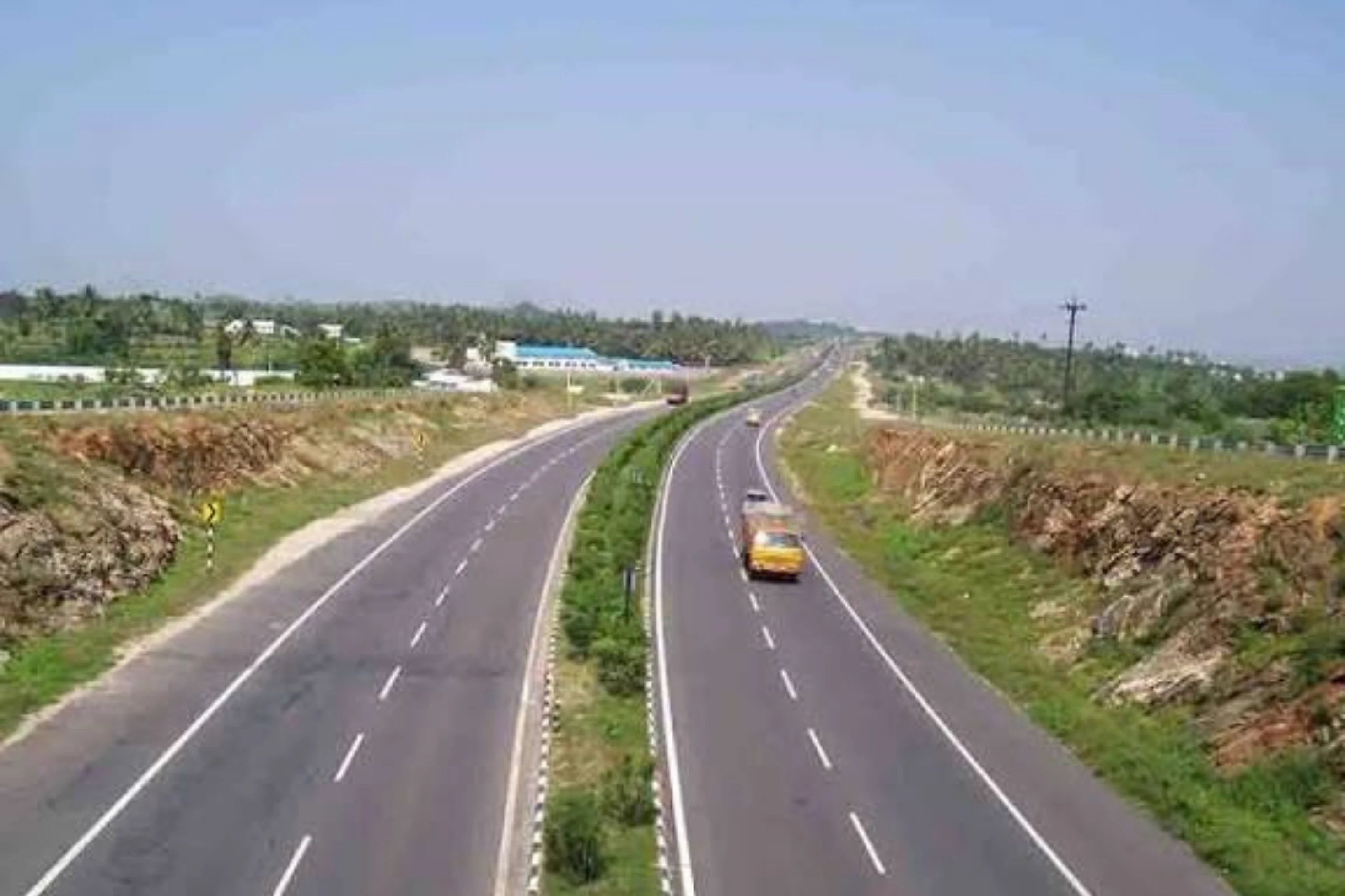
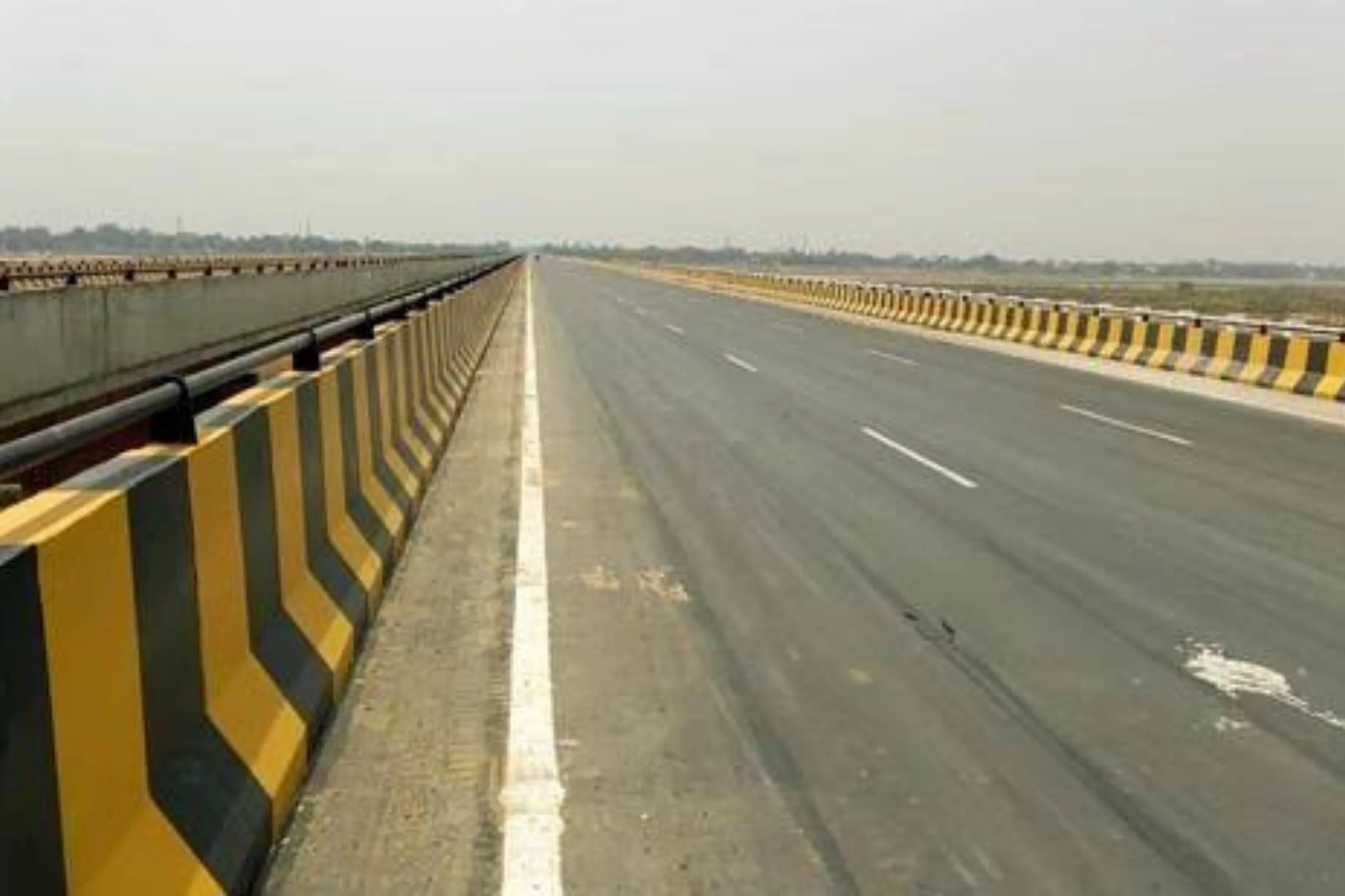
This is a project-level account from RoadVision AI's road survey programme for NHAI's Ranchi Regional Office, covering the 4-lane / 2-lane with paved shoulders (4L/2L PS) section of Govindpur (Raiganj) – Chas – West Bengal border, from km 0.00 to km 56.889 of NH-18 (old NH-32), in Jharkhand. It sets out what the survey window of 13 to 18 July 2026 found, and why a completed highway in operation is exactly where an independent condition record earns its keep.
This section of NH-18 (old NH-32) runs from Govindpur (Raiganj) through Chas to the West Bengal border, covering 56.889 km from km 0.00 to km 56.889. It is a mix of 4-lane and 2-lane carriageway with paved shoulders, passing through the Dhanbad and Chas region of Jharkhand. The survey record carries 56.70 km of road, divided into 567 segments at a 100 m chainage interval.
In the survey programme the corridor is tracked under the Dhanbad PIU of the Ranchi Regional Office, as one of three roads in Weekly-Cycle-2. Because every finding is tied to a chainage, the road can be read stretch by stretch rather than as a single average.
As publicly reported by NHAI, the section was awarded at ₹584.66 crore (total capital cost about ₹1,139.65 crore). The contractor was appointed on 10 December 2017, and the Provisional Certificate of Completion was issued on 30 April 2022 for a length of 54.15 km. The road is now operational, with short-term operation and maintenance tenders reported as active as of October 2026. Once a road is built and handed over, the work shifts from construction to keeping it in order, and the first things to wear are the ones road users depend on most after dark: markings, lighting and safety furniture. A consistent, chainage-tied record shows what is wrong, how urgent it is, and whether it has been put right by the next survey.
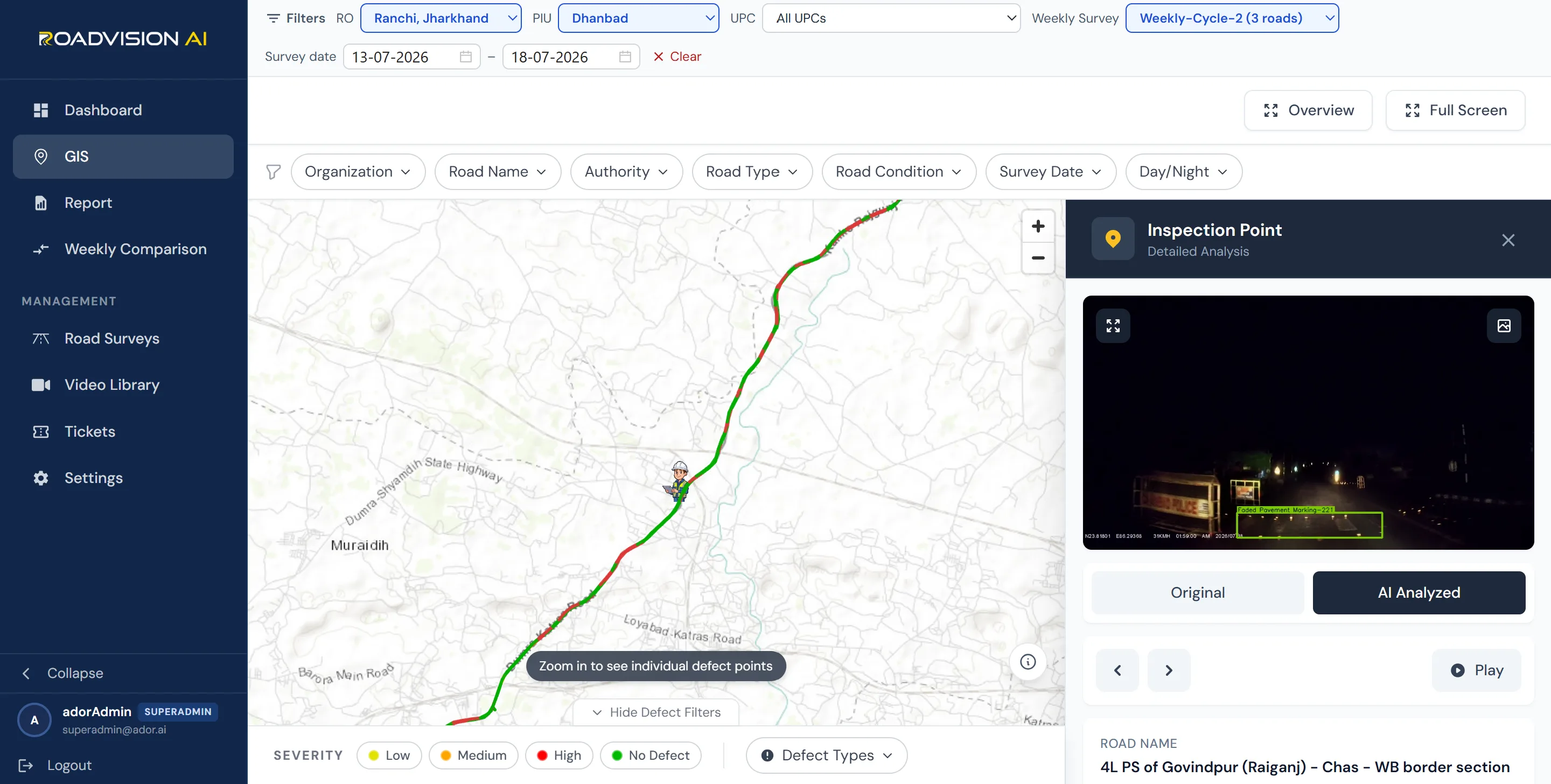
Every finding sits on a live GIS map, with each inspection point opening to its exact location, the defect flagged, and the frame behind it in both original and AI-annotated form. Figure 1 shows the highway for the survey window of 13 to 18 July 2026, with an inspection point captured in the dark at about 2 a.m. and flagging faded pavement marking. A night frame is a reminder that the survey records conditions as road users meet them, after dark as well as by day, and that it is after dark that fading markings and failed lights matter most.
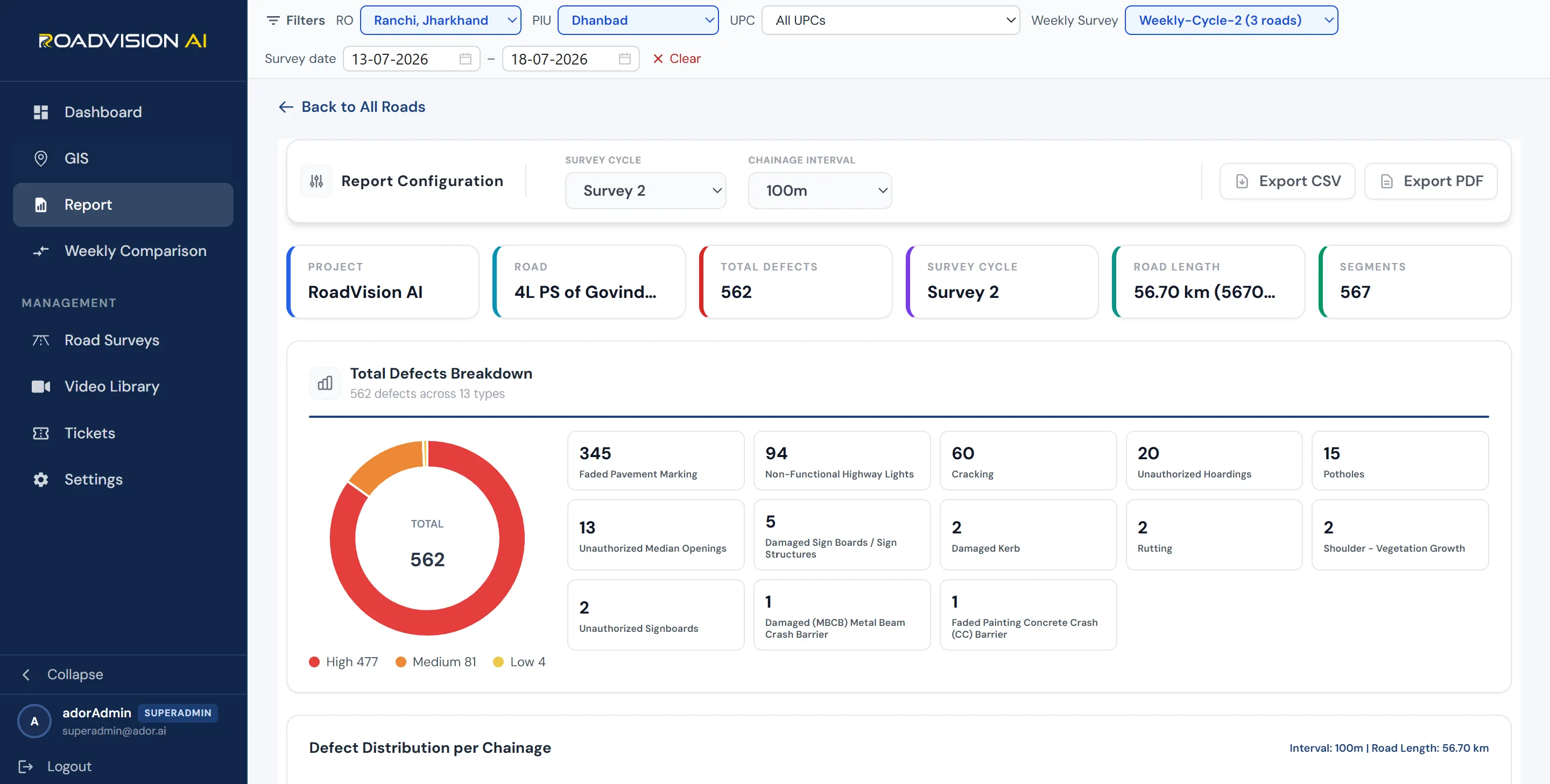
The survey window of 13 to 18 July 2026 (Survey 2, Weekly-Cycle-2) covered 56.70 km across 567 segments. RoadVision AI logged 562 defects across 13 defect types. Faded pavement marking accounts for 345 (61.4%), non-functional highway lights for 94 (16.7%), cracking for 60 (10.7%), unauthorized hoardings for 20 (3.6%), potholes for 15 (2.7%) and unauthorized median openings for 13 (2.3%), with seven further types making up the remaining 15. By severity, 477 defects are High (84.9%), 81 Medium (14.4%) and 4 Low (0.7%).
Each survey gives the Dhanbad PIU and the Ranchi Regional Office a defect ID, chainage and survey reference for every finding, independent of the agency doing the work. With operation and maintenance contracts active on the road, a later survey of the same chainage shows whether each finding has been closed out, so that verification does not rest on the maintaining agency's own account.
RoadVision AI is committed to continuous AI-based monitoring along NH-18 (old NH-32) from Govindpur through Chas to the West Bengal border, giving NHAI a consistent, chainage-level record of a corridor that carries traffic day and night. Keeping that record current, survey after survey, is how an operation and maintenance contract can be shown to be doing its job.

The Autonomous Road Engineer
AI-powered road condition monitoring, asset management, & infrastructure intelligence helping agencies move from reactive maintenance to predictive road management.