This is a project-level account from RoadVision AI's road survey programme for NHAI's Bhubaneswar Regional Office, covering the Operation and Maintenance (O&M) of the 4-lane Bhubaneswar – Puri section, from km 0.000 to km 56.500 of NH-316 (formerly old NH-203), in Odisha. It sets out what the survey of 14 to 15 August 2026 found, and why an O&M contract is exactly where an independent condition record earns its keep.
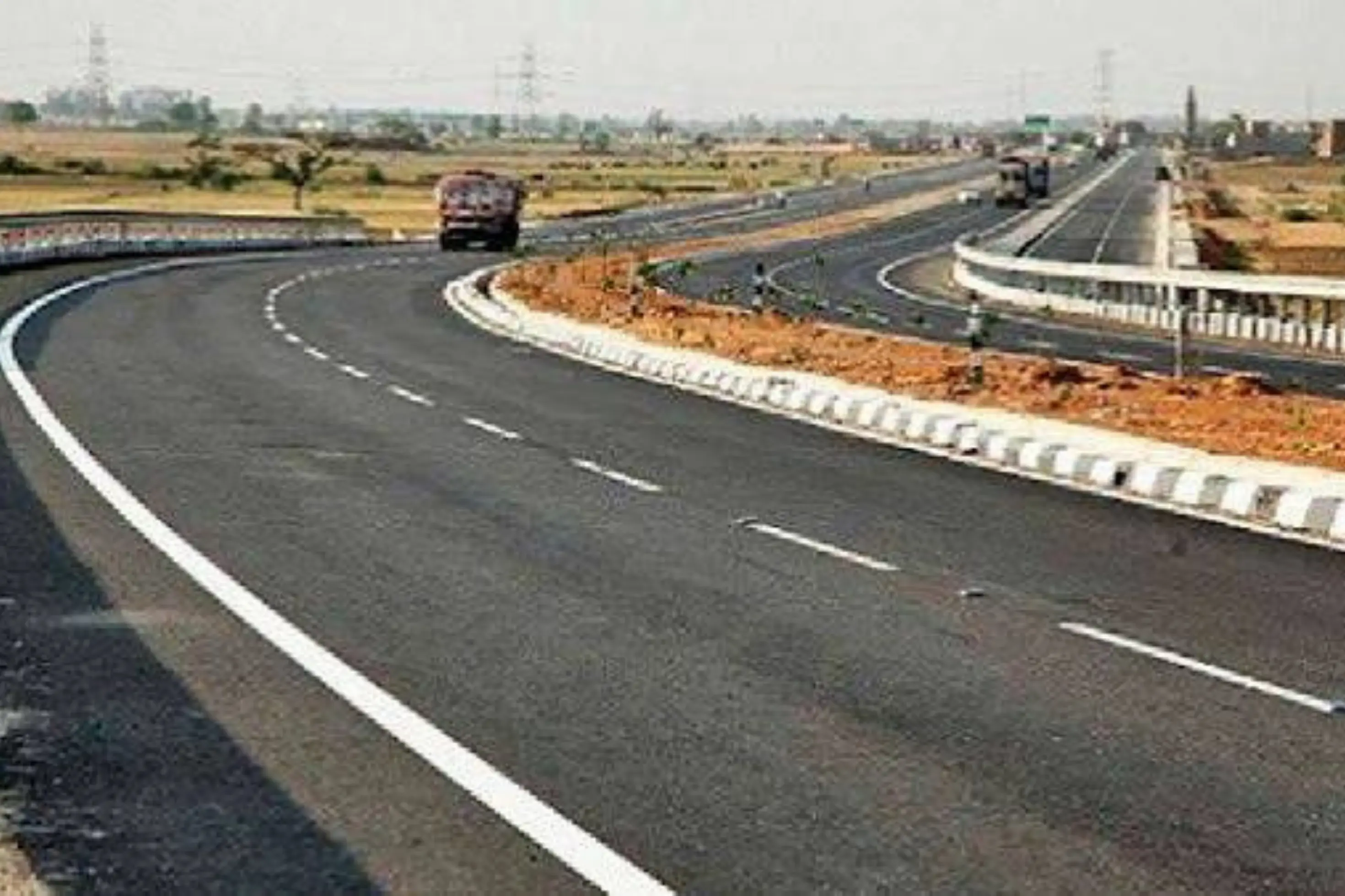
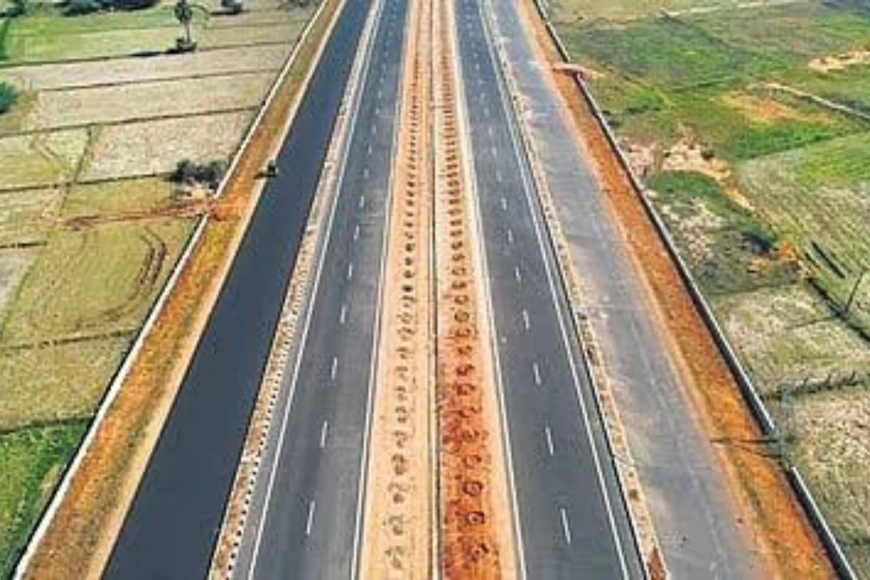
NH-316, formerly old NH-203, links Bhubaneswar to Puri in Odisha. The 4-lane section runs from km 0.000 to km 56.500, a length of 56.5 km, and carries pilgrims, tourists and local traffic to one of India's best-known pilgrimage towns. As publicly described, it is operated and maintained under an Operate-Maintain-Transfer (OMT) arrangement covering routine and regular maintenance.
In the survey programme the road is tracked under project code N/09060/01002/OR, under the Bhubaneswar Regional Office and PIU, as the single road in its weekly survey cycle. Because every finding is tied to a chainage, the road can be read stretch by stretch rather than as a single average.
Under an OMT arrangement, the operator keeps an existing highway in order over a concession period rather than building something new. That makes it hard to tell, from a desk or an occasional visit, whether upkeep is going where the need is, especially for things that change with the seasons, such as drainage and roadside vegetation. A consistent, chainage-tied record answers that: it shows what is wrong, how urgent it is, and whether it has been put right by the next survey.
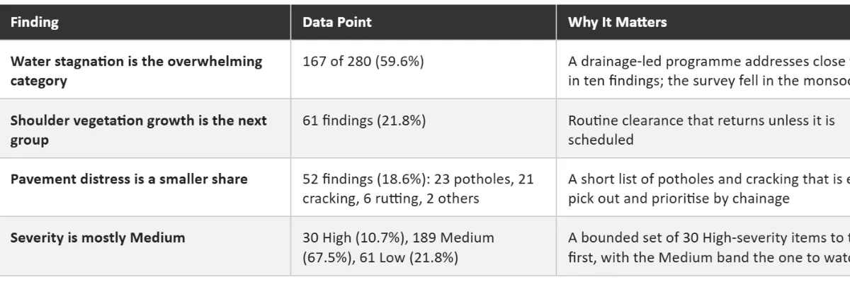
NH-316 is the 4-lane link between Bhubaneswar, the state capital and airport city, and Puri, one of India’s best-known pilgrimage destinations. It runs for 56.5 km and carries a mix of daily commuters, freight, pilgrims and tourists. Your project description also says it branches towards Konark and Satapada, so it works as the gateway to Odisha’s coastal tourism circuit. Traffic here is highly seasonal, with festival and holiday peaks, so even small defects such as a pothole, a faded marking or a stretch of standing water affect a lot of people. It is also a maintained road under an OMT arrangement, so the main question is not new construction but whether upkeep is keeping up. This survey points to drainage: 59.6% of the findings are water stagnation.
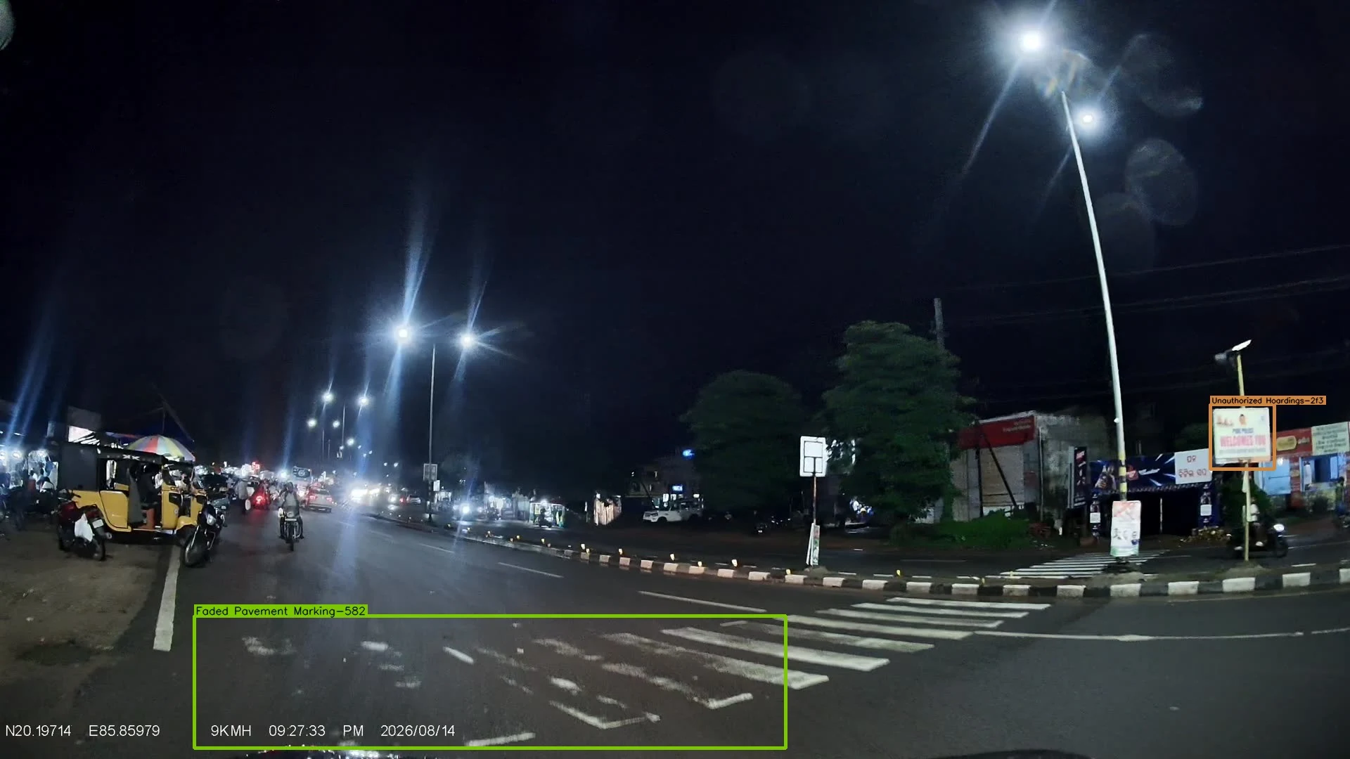
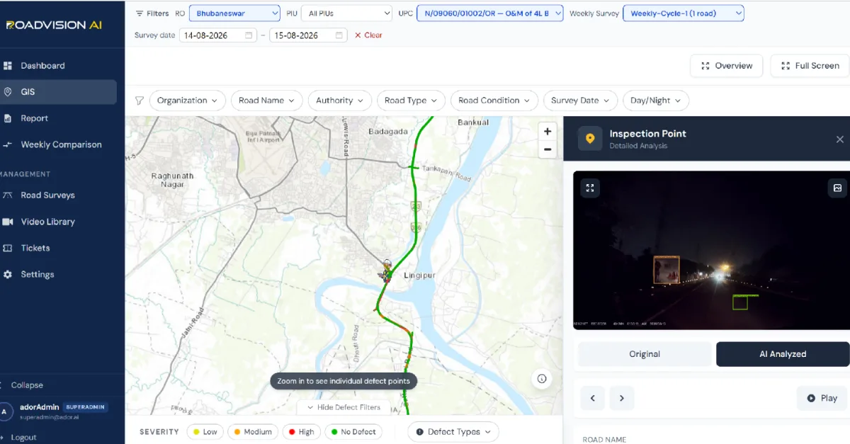
Every finding sits on a live GIS map, with each inspection point opening to its exact location, the defect flagged, and the frame behind it in both original and AI-annotated form. Figure 1 shows the route on the map around Bhubaneswar, passing Lingipur, for the survey of 14 to 15 August 2026, with an inspection point captured after dark, at about 1:30 am on 15 August, flagging unauthorized hoardings and faded pavement marking. A night frame is a reminder that the survey records conditions as road users meet them, after dark as well as by day.
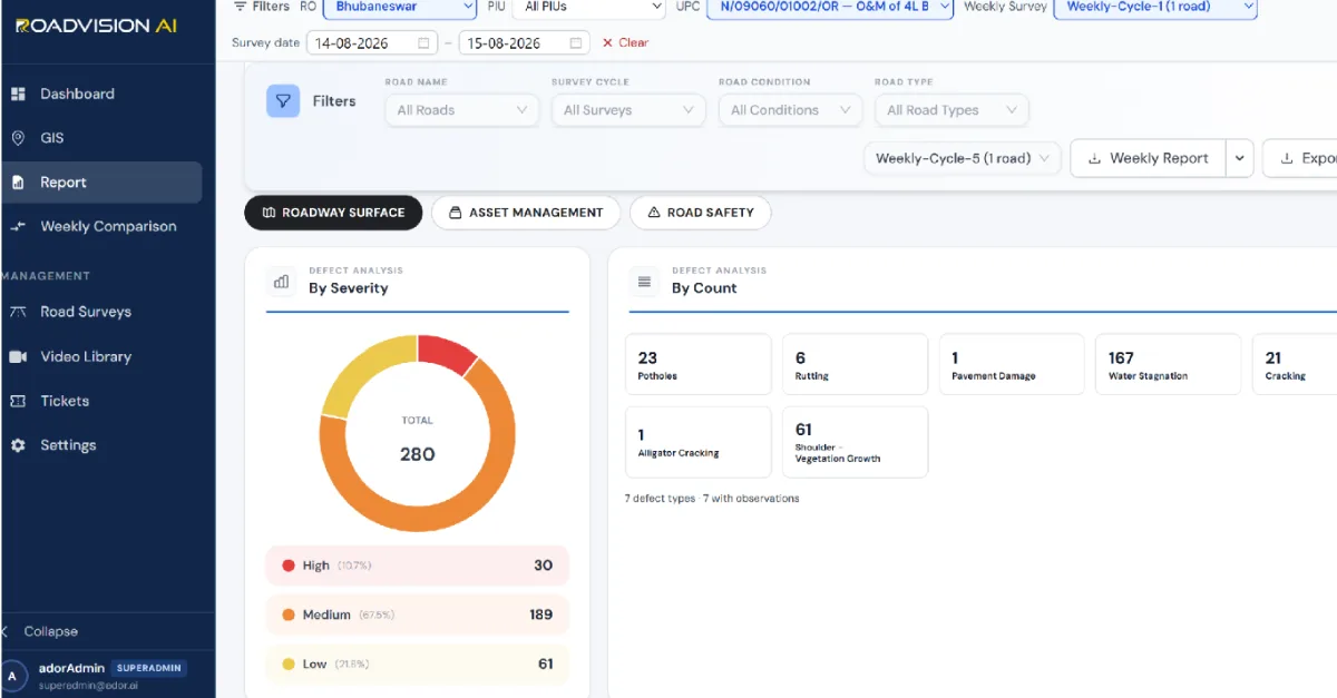
The survey of 14 to 15 August 2026 logged 280 findings in the roadway-surface view across seven defect types. Water stagnation accounts for 167 (59.6%), shoulder vegetation growth for 61 (21.8%), potholes for 23 (8.2%), cracking for 21 (7.5%) and rutting for 6 (2.1%), with pavement damage and alligator cracking making up the remaining 2 (0.7%). By severity, 30 are High (10.7%), 189 Medium (67.5%) and 61 Low (21.8%). The survey was taken in mid-August, within the monsoon season, when drainage performance is tested hardest.
Each survey gives the Bhubaneswar PIU and the Bhubaneswar Regional Office a defect ID, chainage and survey reference for every finding, independent of the agency doing the work. A later survey of the same chainage then shows whether the finding has been closed out, so that verification does not rest on the maintaining agency's own account.
RoadVision AI is committed to continuous AI road monitoring along NH-316 from Bhubaneswar to Puri, giving NHAI a consistent, chainage-level record of a road that carries pilgrims, tourists and local traffic day and night. Keeping that record current, survey after survey, is how an O&M contract can be shown to be doing its job.

The Autonomous Road Engineer
AI-powered road condition monitoring, asset management, & infrastructure intelligence helping agencies move from reactive maintenance to predictive road management.