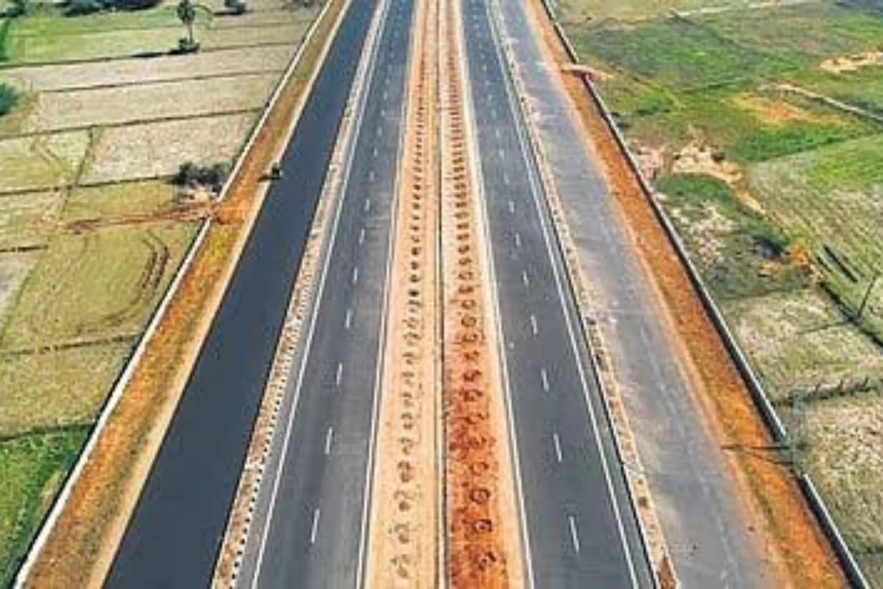
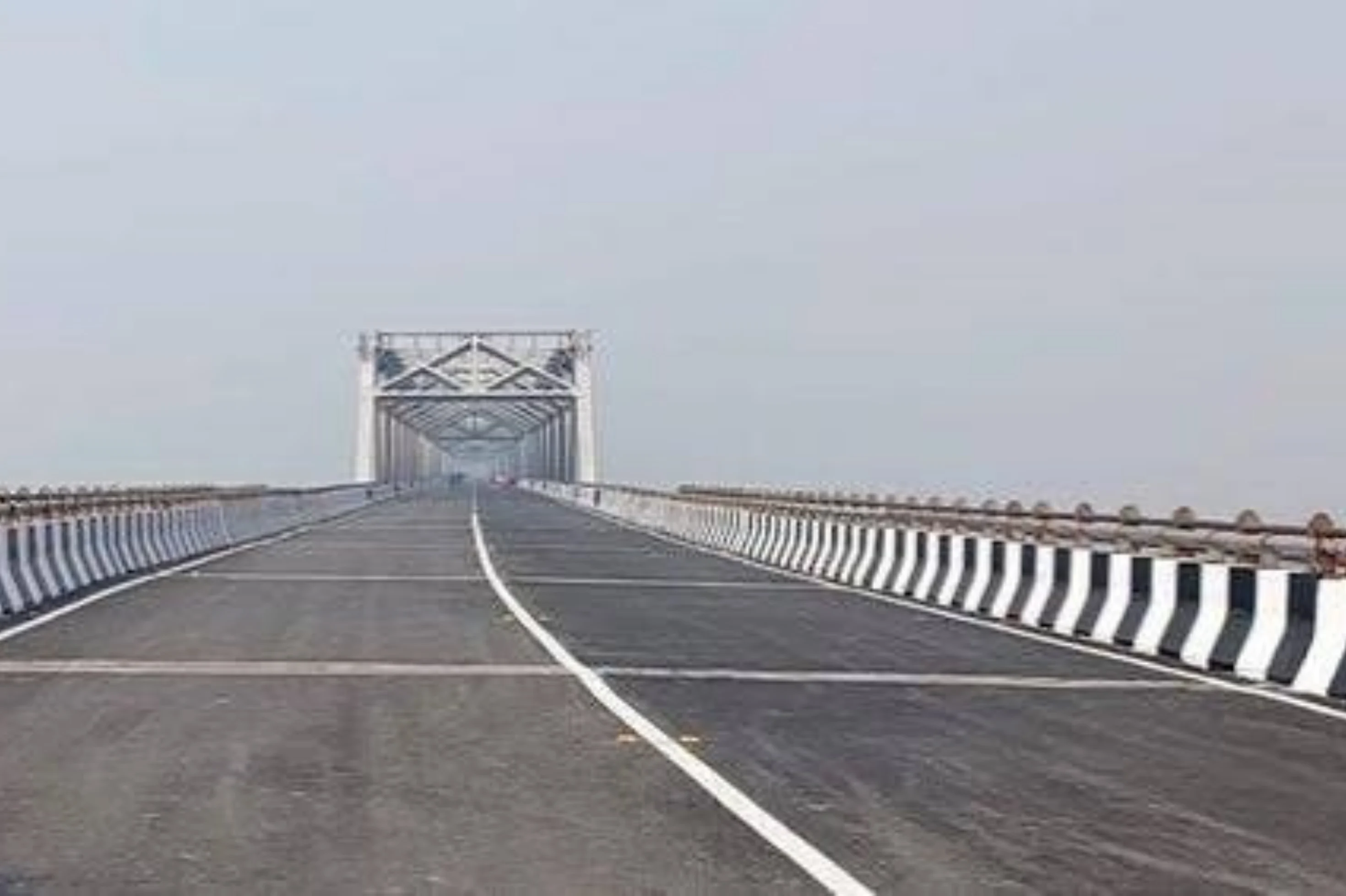
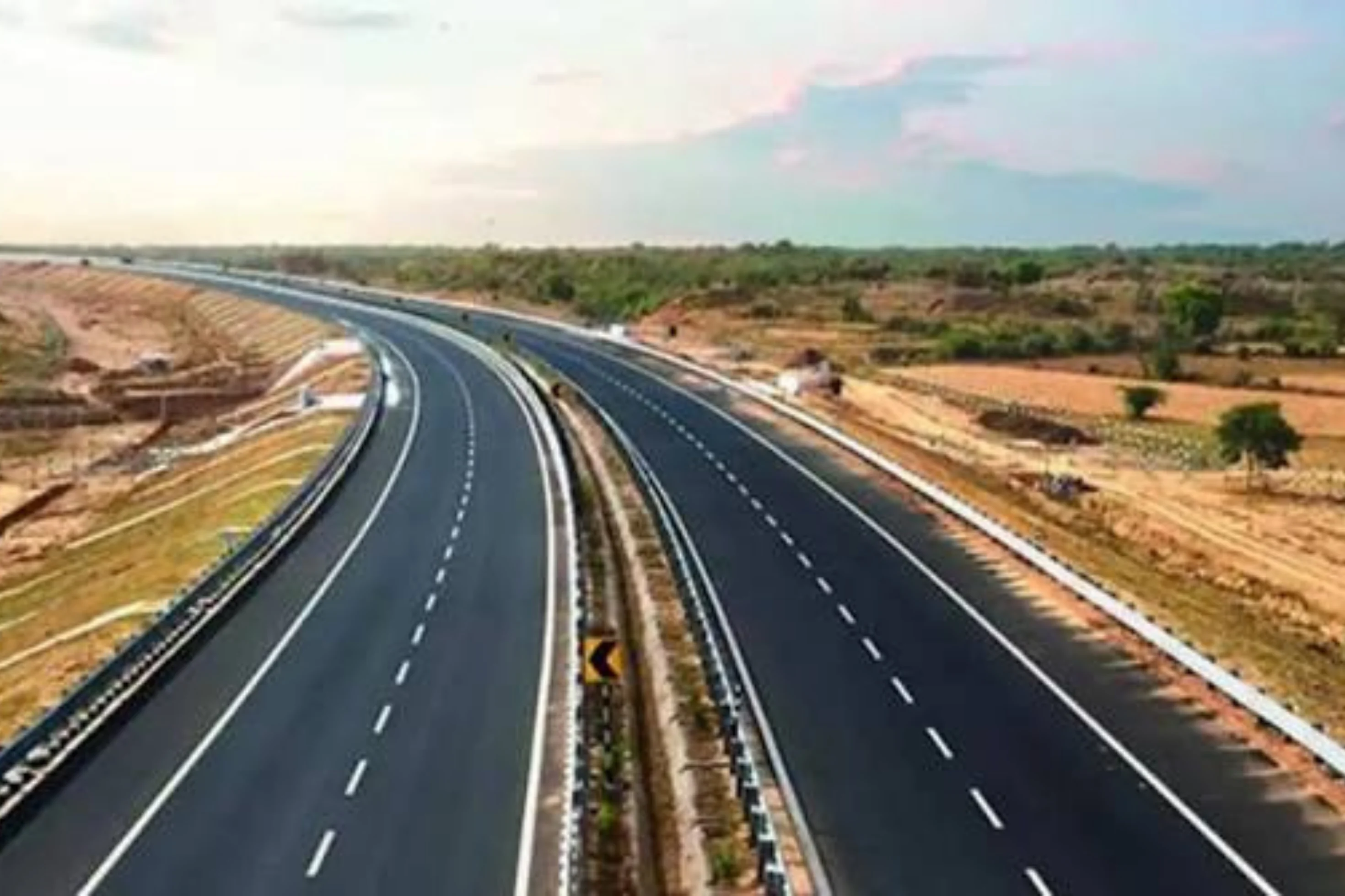
This is a project-level account from RoadVision AI's road survey programme for NHAI's Bhubaneswar Regional Office, covering three roads on NH-16 in Odisha surveyed in Weekly-Cycle-1: the 6-lane Bhubaneswar – Jagatpur – Chandikhole section, the Puintola to Tangi section (km 284.00 to km 355.00 of NH-5, new NH-16) and Tangi to Bhubaneswar. It sets out what the surveys found, and why a trunk corridor under continuous work is exactly where an independent condition record earns its keep.
NH-16, formerly NH-5, is publicly described as a key artery of the Golden Quadrilateral, spanning about 529 km in Odisha from Balasore and Bhadrak through Cuttack, Bhubaneswar and Berhampur towards Andhra Pradesh. This case study looks at three roads on the corridor: the 6-lane Bhubaneswar – Jagatpur – Chandikhole section of NH-16; Puintola to Tangi, from km 284.00 to km 355.00 of NH-5 (new NH-16); and Tangi to Bhubaneswar.
All three are tracked under the Bhubaneswar Regional Office in Weekly-Cycle-1. The survey records carry 74.98 km on Puintola to Tangi and 59.29 km on Tangi to Bhubaneswar at a 100 m chainage interval, while the 6-lane section is reported in the roadway-surface view. Because every finding is tied to a chainage, each road can be read stretch by stretch rather than as a single average.
As publicly reported, NHAI has expansion work planned around Bhubaneswar, towards Lingipur Square and along a 67 km stretch towards Chandikhol, and the corridor also carries local offshoots such as NH-316 towards Puri, Konark and Satapada. A trunk corridor with new works, routine maintenance and heavy use all at once changes from stretch to stretch and season to season. That makes it hard to tell, from a desk or an occasional visit, where the road is holding up and where it is not. A consistent, chainage-tied record answers that: it shows what is wrong, how urgent it is, and whether it has been put right by the next survey.
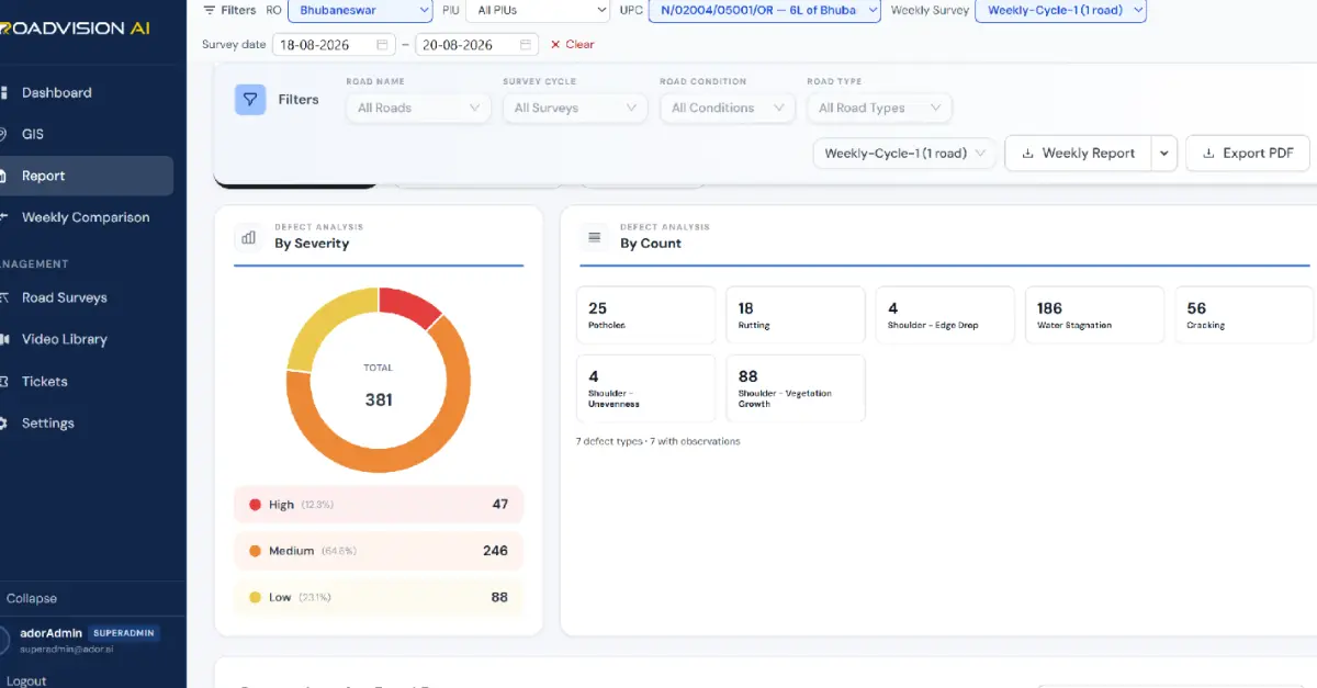
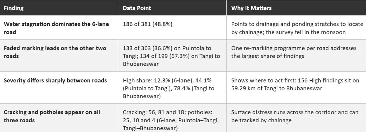
The report for the 6-lane Bhubaneswar – Jagatpur – Chandikhole section, covering the survey of 18 to 20 August 2026, logged 381 findings in the roadway-surface view across seven defect types, as Figure 1 shows. Water stagnation accounts for 186 (48.8%), shoulder vegetation growth for 88 (23.1%), cracking for 56 (14.7%), potholes for 25 (6.6%), rutting for 18 (4.7%), and shoulder edge drop and unevenness for 4 each (1.0%). By severity, 47 are High (12.3%), 246 Medium (64.6%) and 88 Low (23.1%). The survey was taken in August, within the monsoon season, when drainage performance is tested hardest.
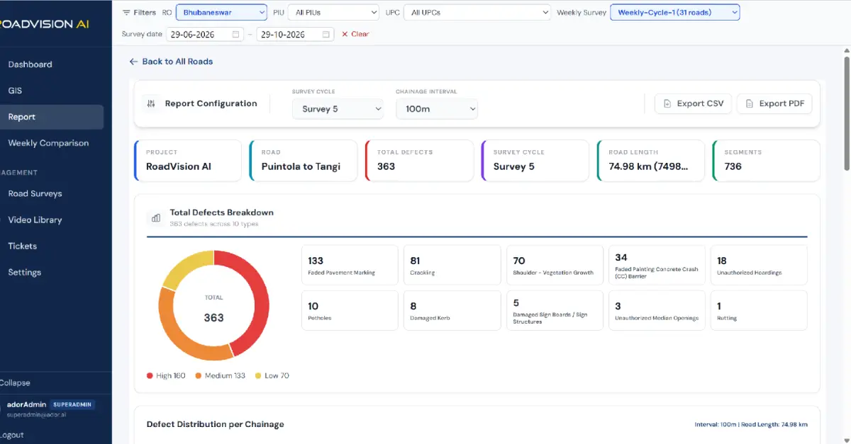
The Puintola to Tangi report for Survey 5 covered 74.98 km and logged 363 defects across 10 defect types, as Figure 2 shows. Faded pavement marking accounts for 133 (36.6%), cracking for 81 (22.3%), shoulder vegetation growth for 70 (19.3%), faded painting on concrete crash barriers for 34 (9.4%) and unauthorized hoardings for 18 (5.0%). By severity, 160 are High (44.1%), 133 Medium (36.6%) and 70 Low (19.3%).
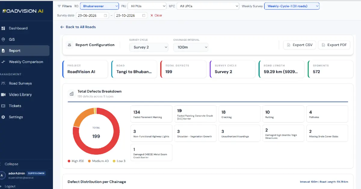
The Tangi to Bhubaneswar report for Survey 2 covered 59.29 km and logged 199 defects across 11 defect types, as Figure 3 shows. Faded pavement marking is by far the largest category with 134 (67.3%), followed by faded painting on concrete crash barriers with 19 (9.5%), cracking with 18 (9.0%) and rutting with 10 (5.0%). By severity, 156 are High (78.4%), 40 Medium (20.1%) and 3 Low (1.5%). Side by side, the reports show faded markings leading on both Puintola to Tangi and Tangi to Bhubaneswar, with almost identical counts (133 and 134), while the 6-lane section is led by water stagnation. The reports come from different survey cycles, and the 6-lane figure is the roadway-surface view only, so the comparison is a snapshot rather than a like-for-like trend.
Each survey gives the Bhubaneswar Regional Office a defect ID, chainage and survey reference for every finding, independent of the agency doing the work. A later survey of the same chainage then shows whether the finding has been closed out, so that verification does not rest on the maintaining agency's own account.
RoadVision AI is committed to continuous AI-based road condition monitoring along NH-16 through Odisha, giving NHAI a consistent, chainage-level record of a corridor where water, paint and pavement each tell a different story. Keeping that record current, survey after survey, is how upkeep along a trunk corridor can be shown to be doing its job

The Autonomous Road Engineer
AI-powered road condition monitoring, asset management, & infrastructure intelligence helping agencies move from reactive maintenance to predictive road management.