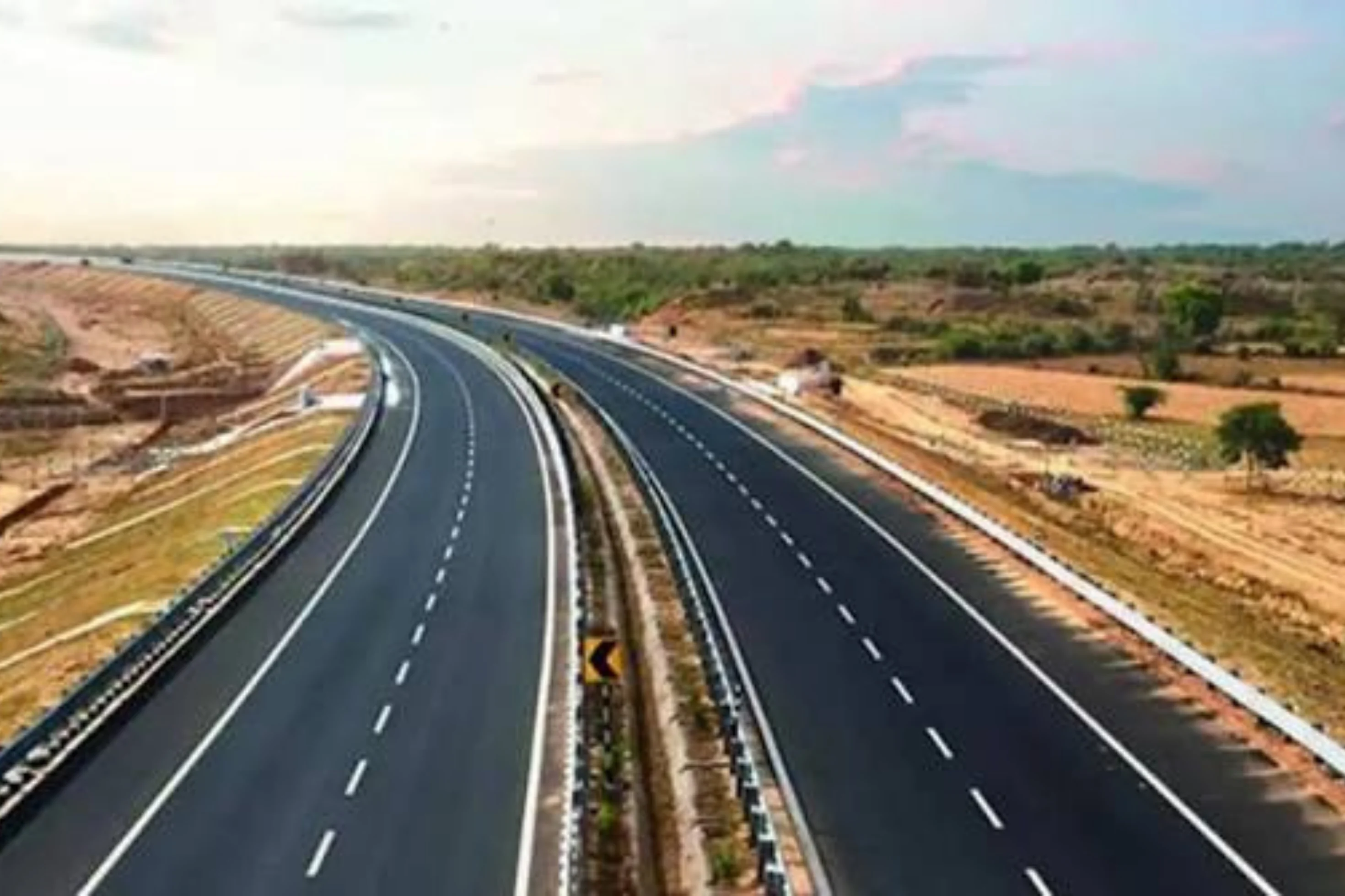
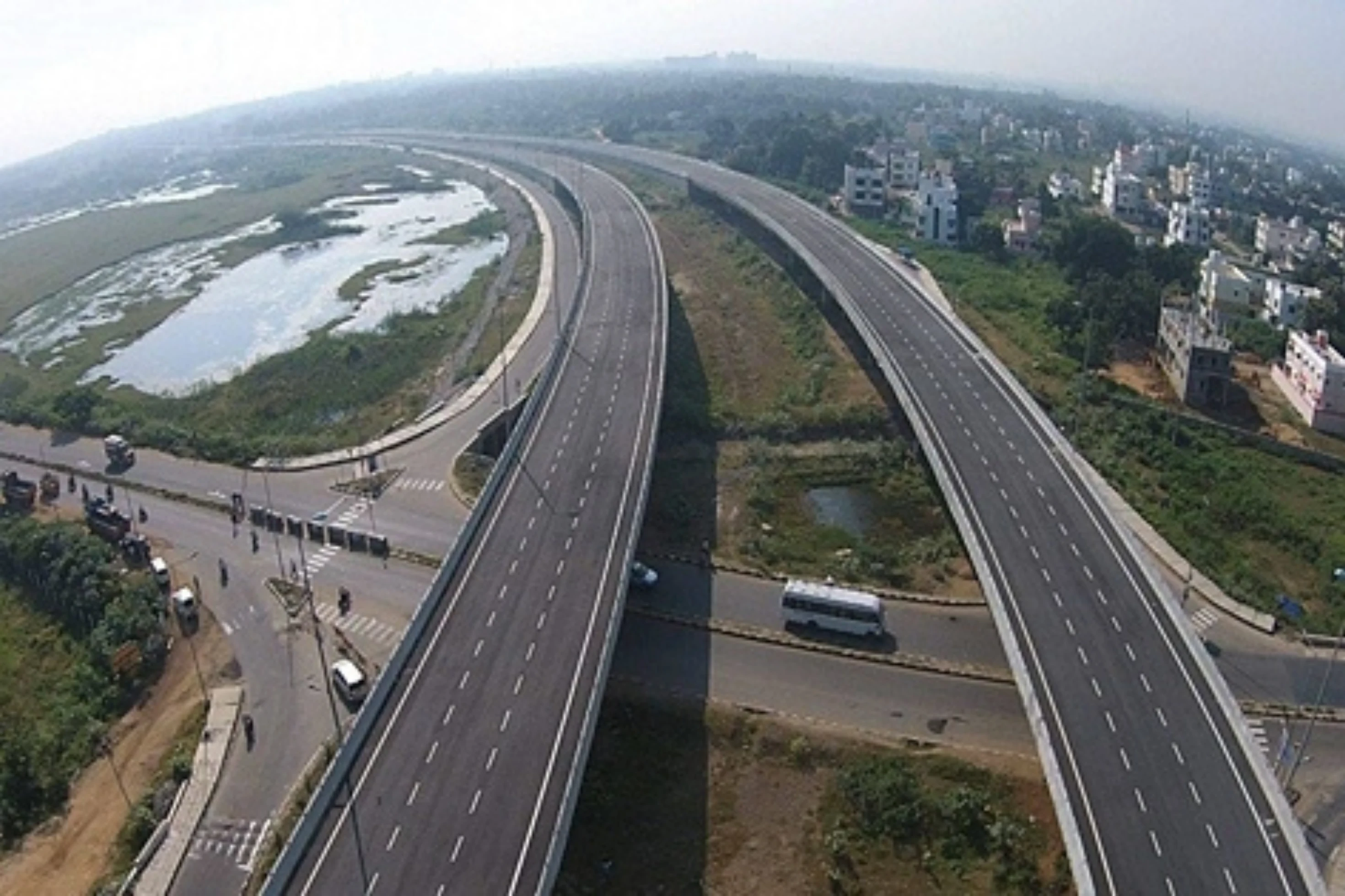
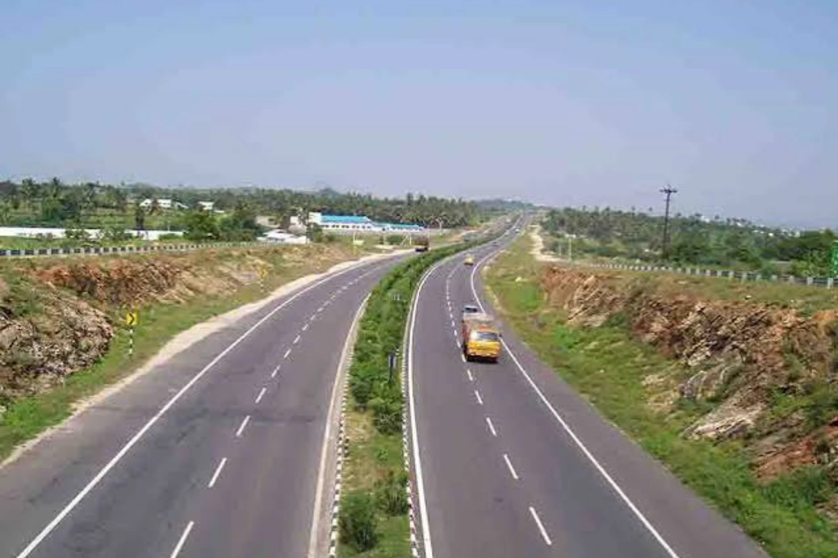
This is a project-level account from RoadVision AI's road survey programme for NHAI, covering the Construction of Approach Road to the Rail-cum-Road Bridge inspection across the River Ganga at Munger Ghat (NH-333B) in Bihar. It sets out what the survey of 24 July 2026 found, and why the approach road to a major bridge is exactly where an independent condition record earns its keep.
NH-333B in Bihar carries the approach road to the rail-cum-road bridge across the River Ganga at Munger Ghat. As publicly described, the project provides 14.52 km of road approaches, built to 2-lane national highway standard under Regular Civil Works in EPC mode. The survey record carries 18.02 km of road, divided into 181 segments at a 100 m chainage interval.
In the survey programme the road is tracked under project code, as the single road in Weekly-Cycle-5, and was surveyed in its third survey cycle. Because every finding is tied to a chainage, the road can be read stretch by stretch rather than as a single average.
As publicly reported, the work was awarded at ₹239.16 crore, within a project whose original capital cost of ₹538 crore has been revised to ₹634 crore, with about ₹574 crore spent to date. On a project of this size and visibility, the approach road decides how the bridge works for the people using it every day. That makes it hard to tell, from a desk or an occasional visit, whether what has been built is holding up. A consistent, chainage-tied record answers that: it shows what is wrong, how urgent it is, and whether it has been put right by the next survey.
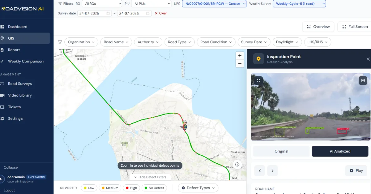
Every finding sits on a live GIS map, with each inspection point opening to its exact location, the defect flagged, and the frame behind it in both original and AI-annotated form. Figure 1 shows the route on the map around Munger and the Ganga for the survey of 24 July 2026, with an inspection point captured at midday, at about 12:47 pm, flagging shoulder vegetation growth, faded pavement marking and a pothole in a single frame, with a guard rail beside the carriageway. A frame like this is a reminder that the survey records conditions as road users meet them.
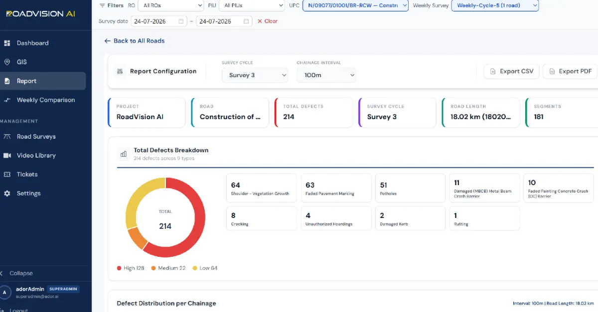
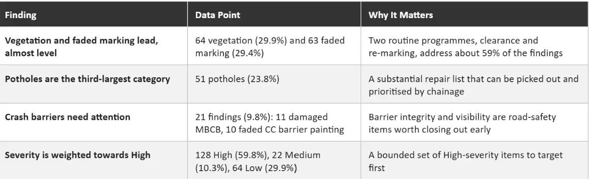
The Survey 3 record for 24 July 2026 covered 18.02 km across 181 segments. RoadVision AI logged 214 defects across 9 defect types. Shoulder vegetation growth accounts for 64 (29.9%), faded pavement marking for 63 (29.4%), potholes for 51 (23.8%), damaged metal beam crash barrier (MBCB) for 11 (5.1%) and faded painting on concrete crash barriers for 10 (4.7%), with cracking, unauthorized hoardings, damaged kerb and rutting making up the remaining 15 (7.0%). By severity, 128 are High (59.8%), 22 Medium (10.3%) and 64 Low (29.9%).
Each survey gives the responsible Regional Office and PIU a defect ID, chainage and survey reference for every finding, independent of the agency doing the work. A later survey of the same chainage then shows whether the finding has been closed out, so that verification does not rest on the contractor's own account.
RoadVision AI is committed to continuous AI road condition monitoring along the NH-333B approach road to the Munger rail-cum-road bridge, giving NHAI a consistent, chainage-level record of the road that connects people to a landmark crossing of the Ganga. Keeping that record current, survey after survey, is how a large project can be shown to be holding up.

The Autonomous Road Engineer
AI-powered road condition monitoring, asset management, & infrastructure intelligence helping agencies move from reactive maintenance to predictive road management.