
Australia's road network presents a genuinely distinctive management challenge: vast distances, widely varying climate zones from tropical north to temperate south, a mix of dense urban corridors and remote rural highways, and infrastructure spread across state, territory, and local government responsibility. Coordinating consistent road condition assessment and asset management across this landscape depends heavily on shared technical standards and in Australia, that shared reference point is largely provided by Austroads, the peak organisation representing Australian and New Zealand transport and road agencies.
As road survey software has evolved to incorporate AI-powered automated detection, Australian road authorities face a practical question: how does this new generation of technology align with established Austroads guidance on pavement condition assessment, asset management, and network monitoring? In this blog, we'll look at the role Austroads plays in shaping Australian road survey practice, how AI-powered software is being applied within that framework, and what agencies should consider when evaluating AI tools against Austroads-aligned requirements.
A note on accuracy: Austroads publishes and periodically updates a substantial library of guides, technical reports, and specifications covering pavement technology, asset management, and road survey methodology. This blog provides a general overview rather than a substitute for the current official Austroads publications. For specific compliance requirements relevant to a particular guide or state road authority specification, always refer directly to Austroads' published materials or your relevant state/territory road agency.
Austroads is the association of Australasian road transport and traffic agencies, bringing together state and territory road authorities, the Australian Government, and the New Zealand Transport Agency to develop shared technical guidance, research, and standards. Rather than functioning as a single national road authority, Austroads' role is largely to promote consistency and best practice across Australia's genuinely federated road management structure, where individual state and territory agencies such as Transport for NSW, VicRoads (now part of Victoria's Department of Transport and Planning), the Department of Transport and Main Roads in Queensland, and Main Roads Western Australia retain primary responsibility for their own networks.
Austroads' published guidance spans several areas directly relevant to road survey and condition assessment practice, including:
Because individual states and territories retain their own specific requirements and contractual specifications, agencies typically need to consider both Austroads' broader guidance and their own jurisdiction's specific technical requirements when evaluating road survey software.
Given Australia's federated road management structure, standardised guidance plays a particularly important role in enabling meaningful comparison and coordination across jurisdictions:
While specific technical requirements should always be verified against current Austroads publications, several broad concepts commonly appear across Austroads pavement and asset management guidance that road survey software should generally support:
Austroads guidance typically distinguishes between network-level condition surveys, which assess broad trends across an entire road network to support strategic planning, and project-level assessment, which involves more detailed investigation of specific road segments being considered for particular treatment.
Consistent with international practice, Australian road condition assessment commonly incorporates roughness measurement (often expressed via metrics conceptually aligned with the International Roughness Index) alongside surface distress documentation such as cracking, rutting, and ravelling.
Austroads' asset management guidance generally emphasises a lifecycle approach to infrastructure investment, incorporating condition data into broader strategic asset management planning rather than treating survey data as an isolated, standalone exercise.
Through frameworks associated with AusRAP, road safety assessment in Australia often incorporates structured, evidence-based risk rating methodologies that consider road design and safety features alongside pavement condition.
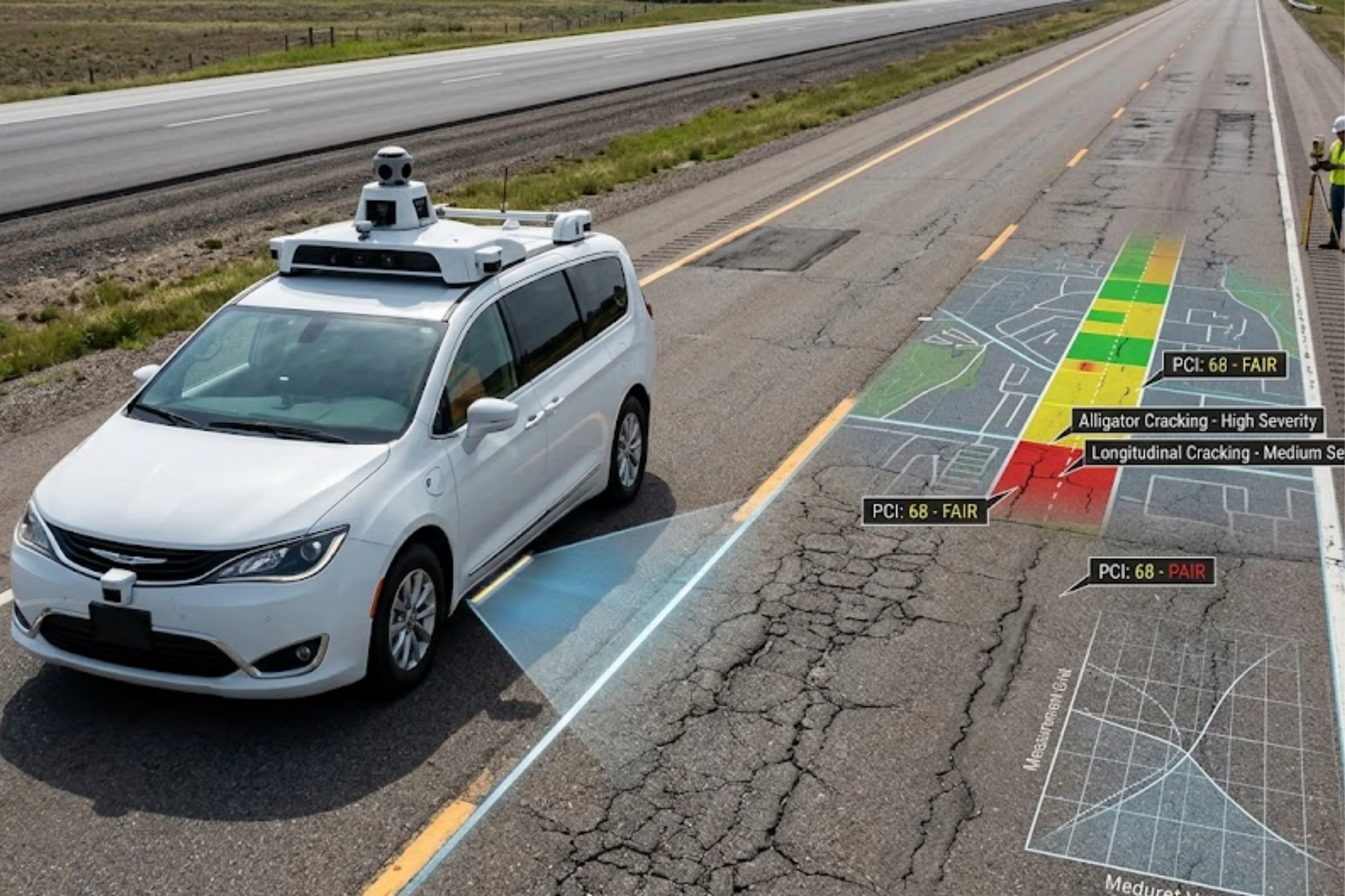
AI-powered road survey technology using vehicle-mounted cameras, sensors, or fleet-based data collection—can help Australian agencies achieve more comprehensive network-level coverage across vast and often remote road networks, supporting the kind of broad, strategic assessment that network-level guidance emphasises.
AI-based defect detection applies consistent classification criteria across every survey pass, helping support the comparability and consistency that cross-jurisdictional coordination depends on.
AI-powered systems can support more frequent condition monitoring than traditional periodic survey cycles, which is particularly valuable for extensive regional and remote networks that have historically been surveyed less frequently due to resource constraints.
Modern AI-powered platforms are generally designed to integrate with broader asset management systems, supporting the lifecycle-based planning approach central to Austroads' asset management guidance.
AI models trained specifically on Australian conditions—accounting for extreme heat, monsoonal rainfall, and other regionally distinct climate stressors—can help identify deterioration patterns specific to different climate zones across the country.
Computer vision-based analysis can support elements of road safety risk assessment by helping identify and document relevant road design and condition features alongside traditional pavement condition data.
As AI technology matures and Austroads guidance continues to evolve, several trends are likely to shape road survey software adoption across Australia:
Australia's federated road management structure, combined with its vast geographic scale and diverse climate conditions, makes consistent, efficient, and scalable road condition assessment particularly valuable and particularly challenging to deliver through traditional methods alone. Austroads' guidance provides an important shared reference point for pavement technology, asset management, and road safety assessment practice across Australian and New Zealand road agencies, and AI-powered road survey software offers a genuine opportunity to extend the reach, frequency, and consistency of condition monitoring within that framework. Agencies evaluating AI tools should confirm alignment with relevant Austroads guidance, validate performance specifically for Australian conditions, and always verify current, authoritative requirements directly through Austroads' official publications and their own state or territory road authority.
RoadVision AI helps Australian road authorities extend condition monitoring across vast and remote networks using AI-powered detection built to handle the country's distinct climate and terrain challenges from tropical monsoon regions to arid outback highways. Our platform is designed to integrate with existing asset management systems and support the kind of consistent, network-wide data that strategic, Austroads-aligned planning depends on.
Want to explore how AI-powered road survey technology could support your agency's network? Connect with the RoadVision AI team to learn more or request a demo.
1. What is Austroads?
Austroads is the association of Australasian road transport and traffic agencies, bringing together Australian state and territory road authorities, the Australian Government, and the New Zealand Transport Agency to develop shared technical guidance and standards.
2. Does Austroads set mandatory national road survey requirements?
Austroads primarily develops shared guidance and best practice resources; individual state and territory road authorities retain responsibility for their own specific technical requirements and specifications, which agencies should verify directly.
3. How does AI-powered road survey software align with Austroads guidance?
AI-powered software can support Austroads-aligned practices by providing consistent, objective condition measurement, broader network-level coverage, and data compatible with lifecycle-based asset management frameworks referenced in Austroads guidance.
4. Why is remote and regional road monitoring particularly challenging in Australia?
Australia's vast geographic scale, limited connectivity in remote areas, and diverse climate zones make comprehensive, frequent monitoring of regional and remote roads logistically difficult and costly using traditional survey methods alone.
5. What is AusRAP?
AusRAP, the Australian Road Assessment Program, applies structured, evidence-based methodology to assess road safety risk, considering road design and safety features as part of a broader risk rating framework.
6. Should AI road survey vendors be validated specifically for Australian conditions?
Yes, given Australia's distinct climate zones and road environments, agencies should confirm that AI models have been validated on data representative of Australian conditions rather than relying solely on international performance data.

The Autonomous Road Engineer
AI-powered road condition monitoring, asset management, & infrastructure intelligence helping agencies move from reactive maintenance to predictive road management.


.webp)
.webp)