
Road infrastructure software is a platform that helps transportation agencies manage the full lifecycle of road-related assets pavement, bridges, drainage, signage, lighting, and safety infrastructure in one connected system. It typically combines condition data collection (often AI-powered), a centralized asset inventory, deterioration forecasting, budget and capital planning tools, GIS mapping, and maintenance work order management. Instead of tracking pavement, bridges, and drainage through separate spreadsheets or disconnected departmental systems, road infrastructure software gives agencies a single source of truth for what they own, what condition it's in, what it will cost to maintain, and where limited budget should go first.
The phrase gets used loosely in the market, so it's worth being precise: road infrastructure software isn't just a fancier name for a pavement condition tracker. Real infrastructure software is defined by its scope it manages the road as an ecosystem of interdependent assets, not a single surface to inspect. A pothole tracker tells you where the potholes are. Infrastructure software tells you where the potholes are, whether they're linked to a failing culvert two hundred meters away, what it will cost to fix both properly, and how that decision compares against every other maintenance priority competing for the same budget line.
That broader scope is exactly what makes the category valuable and exactly what separates it from narrower inspection or condition-monitoring tools that solve a smaller piece of the same problem.
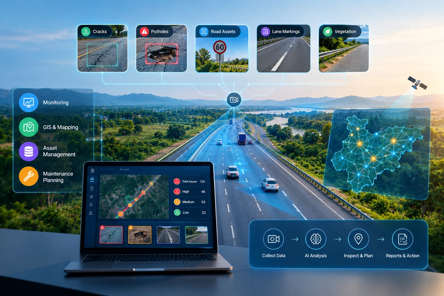
A structured, geospatially accurate digital record of every relevant asset pavement segments, bridges, culverts, signage, lighting, guardrails including installation date, material, specifications, and condition history. This is the foundational layer everything else is built on.
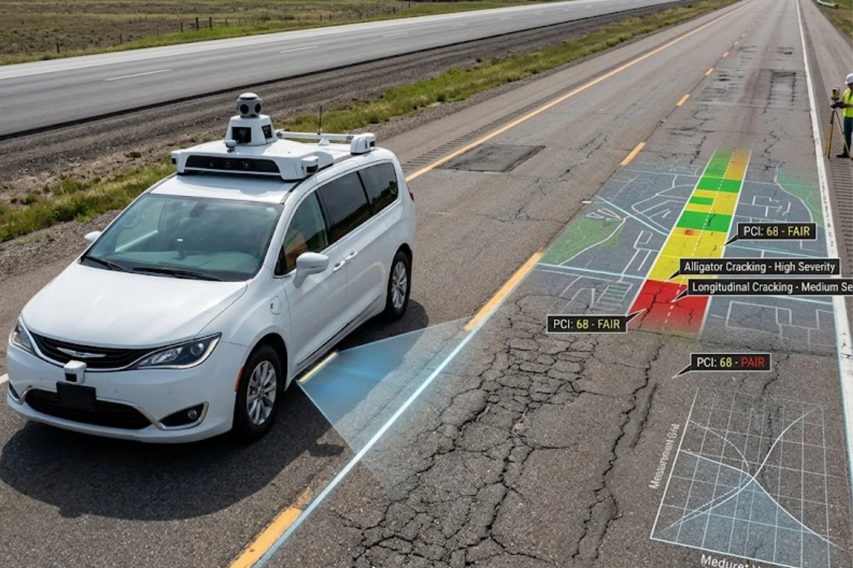
The software needs a reliable way to keep that inventory's condition data current, whether through manual inspection input, AI-powered automated detection from vehicle-mounted cameras, or a combination of both feeding into the same system.
Analytical tools that forecast how each asset category is likely to decline over time, based on age, material, traffic loading, and environmental exposure —turning static inventory data into a genuinely predictive planning tool.
Scenario-modeling capabilities that let planners see the network-wide condition impact of different funding levels, supporting evidence-based, defensible investment decisions rather than ad hoc prioritization.
An interactive, spatial view of the entire asset portfolio condition, maintenance history, and risk that makes patterns visible in a way tables and spreadsheets never do.
The ability to generate, assign, and track maintenance work tied directly to specific assets, closing the loop between what the system identifies and what actually gets fixed.
Logic that factors in more than raw condition scores traffic volume, proximity to schools or hospitals, safety history to generate genuinely risk-informed maintenance priorities rather than a simple worst-first list.
Flexible reporting suited to different audiences: technical detail for engineers, plain-language summaries for elected officials, and structured documentation for regulatory or grant reporting requirements.
AI has moved this category well past simple record-keeping into genuinely predictive territory:
Road infrastructure software exists to solve a specific, expensive problem: managing a large, interdependent portfolio of road-related assets without the fragmentation, guesswork, and reactive firefighting that spreadsheets and disconnected systems inevitably produce. Done well, it combines accurate, current condition data increasingly AI-generated with predictive modeling and budget planning tools that turn infrastructure management from a reactive scramble into a genuinely strategic, defensible discipline. The right platform for your agency depends on your asset scope, existing systems, and how far along you already are in that shift but the underlying goal is the same regardless of scale: one reliable source of truth for what you own, what shape it's in, and what to do about it next.
RoadVision AI combines AI-powered condition detection, GIS-integrated asset inventory, and predictive deterioration modeling into a single road infrastructure software platform giving your agency genuine, network-wide visibility instead of fragmented spreadsheets and disconnected departmental records.
Ready to see what a unified infrastructure platform could do for your network? Talk to the RoadVision AI team to learn more or request a demo.
Road infrastructure software is a platform that helps agencies manage the full lifecycle of road-related assets — including pavement, bridges, drainage, and signage combining condition data, deterioration modeling, budget planning, and maintenance management in one system.
Comprehensive platforms typically also cover bridges, culverts and drainage, signage and markings, lighting, guardrails, and other roadside safety infrastructure, not just the pavement surface.
AI enables automated asset detection and condition assessment from imagery, more accurate predictive deterioration modeling, cross-asset prioritization intelligence, and automated, natural-language reporting.
No, increasingly scalable and modular platforms make road infrastructure software accessible and valuable for county agencies and municipal departments as well, not just large state or regional authorities.
Cost varies significantly based on asset scope and network size, so agencies should evaluate total cost of ownership including implementation and ongoing fees rather than comparing only initial licensing costs.
Yes, standardized condition data and scenario planning tools give agencies objective, data-backed evidence to support infrastructure funding requests, which is one of the most common reasons agencies adopt this software.
Yes, testing on a limited asset category or geographic area is strongly recommended to validate accuracy, integration, and staff adoption before committing to network-wide rollout.

The Autonomous Road Engineer
AI-powered road condition monitoring, asset management, & infrastructure intelligence helping agencies move from reactive maintenance to predictive road management.


.webp)
.webp)