
Picture a village road built a little over a decade ago under PMGSY. On the day it opened, it was a genuine milestone the first all-weather connection that village ever had to the nearest market town, school, and primary health center. There was probably a small ceremony. Someone probably gave a speech about how this road would change lives. And for a few years, it did exactly that.
Then the ribbon-cutting photos faded, the road became just... the road, and the systematic attention that built it quietly stopped following it. No dedicated inspection team drives out that way regularly. No sensor network watches it. The only feedback loop left is informal: villagers noticing it's gotten worse, maybe someone mentioning it to a local official, maybe not. Meanwhile, the same forces working on every road everywhere traffic, monsoon rain, thermal cycling, aging materials have been quietly working on this one too, for over a decade, mostly unobserved.
This is the story of an enormous number of rural roads, not a rare exception. And it points to a structural gap in how rural connectivity programs have generally been designed: enormous focus on construction, comparatively little on what happens for the twenty or thirty years after.
Programs like PMGSY were built around a genuinely difficult and important goal connecting unconnected rural habitations to the all-weather road network and the construction achievement itself deserves real credit. But building a road is a project with a defined start and end date. Maintaining a road is not a project; it's an ongoing operational responsibility with no natural end date, and that distinction matters enormously for how well it tends to get resourced and prioritized.
Construction phases come with dedicated budgets, contractor accountability structures, and clear success metrics kilometers built, habitations connected. Maintenance, by contrast, competes every single year against new construction priorities, urban infrastructure demands, and other budget pressures, with much less visible, much less celebrated outcomes. A pothole that doesn't form because of good maintenance never makes headlines. A new road that opens does.
The informal feedback loop a resident mentioning a bad stretch of road to a local official, who eventually escalates it works occasionally, but it has structural weaknesses that matter enormously at the scale of a rural road network:
The good news is that the same AI-powered monitoring approaches that make sense for urban and highway networks translate reasonably well to rural connectivity arguably even more valuably, given how thin traditional inspection coverage has been in these areas.
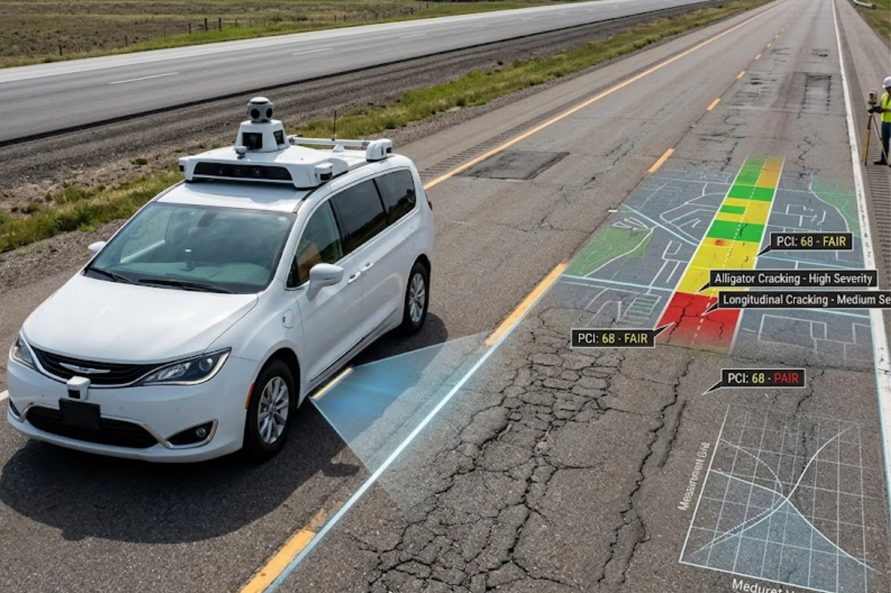
Fleet-based passive data collection. Rural areas are served by buses, government vehicles, agricultural transport, and other vehicles that already travel these routes regularly. Equipping even a modest number of these vehicles with dashcams and AI-based defect detection turns routine travel into continuous condition data collection, without requiring dedicated survey vehicles to reach every remote stretch.
Periodic drone-based assessment for the most remote segments. For roads too remote or low-traffic for reliable fleet coverage, periodic drone surveys can efficiently assess condition, drainage, and structural features without requiring a ground team to physically travel there each time.
Consolidated digital asset records instead of fragmented paper files. Bringing thousands of kilometers of rural road data into a structured, searchable digital system rather than scattered paper records across many local offices is itself a significant step forward, enabling the kind of trend tracking and prioritization that's simply not possible with disconnected local records.
Risk-based prioritization tuned to rural realities. Not every rural road segment needs the same monitoring intensity AI-based prioritization can help direct limited monitoring and maintenance resources toward segments serving the largest populations, connecting to essential services, or already showing early signs of accelerated deterioration.
Drainage-focused monitoring, given monsoon exposure. Given how much rural road damage traces back to drainage failure compounded by monsoon rainfall, monitoring programs that specifically flag drainage-related distress patterns can catch a disproportionately damaging failure mode early.
It might seem intuitive that lower-traffic rural roads deserve less monitoring investment than busy urban corridors but the actual maintenance economics often argue the opposite:
Continuous, AI-powered monitoring doesn't require treating every rural road exactly like a national highway. It means building a monitoring layer proportional to the scale of the network and the stakes involved using low-cost, passive data collection wherever possible (fleet vehicles already on the road), targeted higher-cost methods (drones) where ground access is limited, and risk-based prioritization to direct limited maintenance budgets to where they matter most. The goal isn't perfection; it's simply making sure that a decade after a village road opens, someone or something is still paying attention to it.
RoadVision AI helps extend continuous, AI-powered condition monitoring to rural and connectivity road networks turning existing fleet vehicles into passive data collectors and giving agencies a consolidated, risk-prioritized view of roads that have historically gone unmonitored long after construction wrapped up.
Want to explore how continuous monitoring could work for your rural road network? Book a Demo now!
Pavement deteriorates continuously due to traffic, weather, and material aging regardless of how well it was built, and without ongoing monitoring, this gradual decline can go undetected until it becomes an expensive, urgent problem.
Fleet-based monitoring using vehicles already traveling these routes (buses, government vehicles), combined with periodic drone assessment for the most remote segments, offers a low-cost way to extend monitoring coverage without dedicated survey infrastructure.
Rural areas typically have fewer travelers per road segment, less clarity on reporting pathways, and gradual deterioration that doesn't trigger the sense of urgency needed to prompt individual reporting, meaning many problems go unreported until they're severe.
Drainage failure, often compounded by monsoon rainfall, is a major contributor to accelerated rural road damage, making drainage-focused monitoring particularly valuable for catching a disproportionately damaging failure mode early.
Yes rural communities often lack alternative routes, meaning road failure can cut off access to essential services entirely, and tighter rural maintenance budgets make early, low-cost intervention even more valuable relative to available funding.

The Autonomous Road Engineer
AI-powered road condition monitoring, asset management, & infrastructure intelligence helping agencies move from reactive maintenance to predictive road management.


.webp)
.webp)