India's national highways carry a disproportionate share of the country's road fatalities. The underlying reasons are well understood — high speeds, heavy freight, mixed traffic, and infrastructure that deteriorates faster than it is maintained. But the specific hazards on any given stretch are rarely documented in a consistent, actionable form. Faded lane markings, damaged crash barriers, missing road studs, misplaced signage, and unauthorised road cuts accumulate quietly — until they contribute to an accident that the data could have prevented. This is precisely the gap that AI road safety audit technology is designed to close.
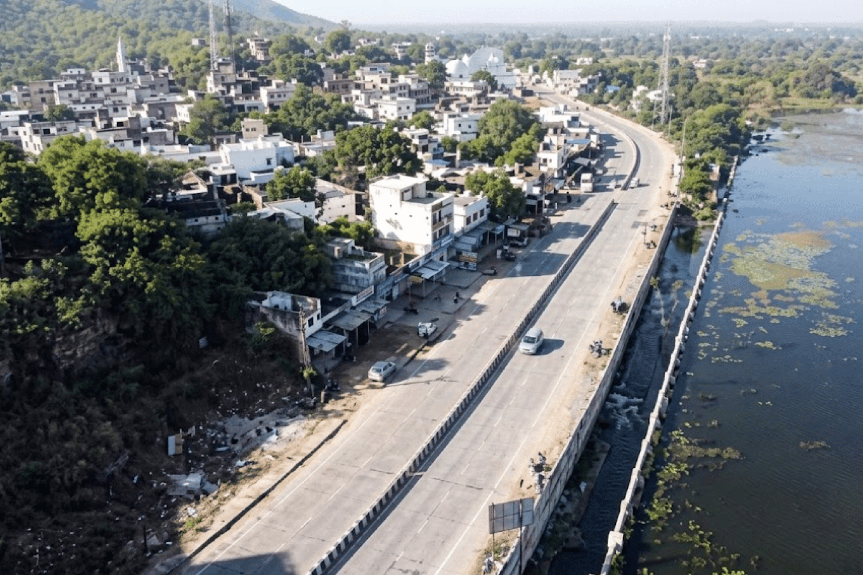
SaveLIFE Foundation (SLF), India's leading road safety non-profit, identified a 115-kilometre stretch of NH-48 in Maharashtra as a priority for comprehensive safety evaluation. The challenge was not merely identifying hazards — it was doing so at scale, consistently, with enough precision to generate IRC-aligned intervention recommendations that highway authorities could directly implement. Manual audits were too slow, too subjective, and too expensive to cover both carriageways of a national highway with the rigour the task demanded.
SLF needed an approach that could cover 230 kilometres of active highway — both directions — with the speed, consistency, and evidential rigour that a genuinely effective safety intervention requires. The answer was a digital safety audit platform capable of transforming continuous video capture into structured, geotagged, standards-referenced safety intelligence.
“Hazards on India's highways don't appear overnight. They accumulate gradually — a faded marking here, a missing stud there — until the combination becomes fatal. Systematic, AI-powered detection is the only way to get ahead of them.”
RoadVision AI deployed its AI road condition analysis platform to conduct a detailed technical safety audit across both carriageways of NH-48 — evaluating 115 kilometres of highway in each direction for a total assessed length of 230 kilometres. The audit went significantly beyond standard pavement condition assessment, evaluating the full spectrum of road safety infrastructure against IRC compliance standards. Every finding was produced through automated pavement distress detection and computer vision analysis — not manual observation.
Engineers used the RoadVision AI smartphone application to collect continuous real-time imagery and GPS data across both sides of NH-48. Vehicles drove at normal traffic speed in each direction, capturing visual data without specialist equipment, lane closures, or disruption to highway traffic. The mobile-first approach made deployment possible at a fraction of traditional audit cost.
Captured footage was processed by RoadVision AI's computer vision engine — the same AI pavement inspection technology used across urban and highway networks in India and internationally. The platform automatically detected and classified hazards across five categories, tagging each finding with precise GPS coordinates and severity classifications.

The audit's first layer evaluated road alignments, cross-sections, sight distances, and median barrier configurations for design-level safety compliance — identifying structural risk factors that standard maintenance inspections never capture.
The second layer systematically assessed placement, condition, and compliance of road signs, signal infrastructure, and lane markings — including faded paint, missing retroreflective elements, and signage that fails IRC: 67-2022 positioning standards.
The third layer identified conditions with guardrails, pedestrian crossings, crash barriers, road studs, and unauthorised access points — the hazard categories that rarely appear in maintenance logs but frequently appear in accident investigation reports. This layer was powered by RoadVision AI's
The 230-kilometre audit of NH-48 revealed a highway carrying a significant and varied hazard load. Over 500 individual safety issues were catalogued across five categories — each geotagged to a precise location, assigned a severity classification, and linked to a specific IRC-compliant intervention. For the first time, SaveLIFE Foundation had a structured, evidence-based picture of exactly what was wrong, where it was, and what the standard required to fix it. This is what AI highway accident analysis looks like when applied at real infrastructure scale.

“Over 500 hazards across 230 kilometres — none of them invisible, all of them fixable. The audit didn't discover a broken highway. It gave decision-makers the precise coordinates to repair one.”
The RoadVision AI automated pavement condition monitoring system doesn't produce a single report. It produces a structured set of five interlocking deliverables — each designed for a different user and a different decision. Together, they give highway authorities, safety advocates, and contractors everything they need to move from finding to fixing.
Full visual evidence record for every kilometre, both carriageways
The definitive structured record of every safety gap on the corridor
Spatial intelligence that turns a report into a decision tool
The formal audit output that highway authorities can act on without additional interpretation
The bridge between audit output and contractor execution
The SaveLIFE Foundation collaboration produced something rare in Indian road safety work: a technically rigorous, GPS-tagged, IRC-aligned audit of a major national highway that gives both the non-profit sector and highway authorities the evidence they need to act. The outcomes of this autonomous road safety deployment extend well beyond the 230 kilometres surveyed.
IRC-classified findings with GPS coordinates and severity ratings give advocacy organisations and highway authorities an irrefutable basis for prioritising capital expenditure — more persuasive than field reports and more precise than accident statistics alone.
Every one of the 500+ findings is structured for direct conversion into field instructions. No additional interpretation, no manual GPS lookup, no ambiguity about what IRC standard applies. Intervention begins faster and targets the right locations.
3. Structural Accountability Framework
Pre- and post-intervention surveys using the same AI road safety audit methodology create a measurement layer that contractors cannot dispute. A barrier section that is repaired incorrectly will show the same hazard flag in the next survey cycle.
The NH-48 deployment demonstrates a corridor audit model that scales to any national highway in India. The methodology, platform, and IRC-aligned output structure are consistent regardless of network length — enabling systematic national rollout.
As temporal survey data accumulates across corridors, the pavement analysis software identifies deterioration patterns — flagging stretches heading toward hazard accumulation before they contribute to accidents. Prevention replaces post-accident response.
The collaboration model between SLF and RoadVision AI — non-profit advocacy plus AI infrastructure technology — is a repeatable blueprint for every state where road safety intervention is constrained by evidence gaps rather than political will.
“SaveLIFE Foundation didn’t just audit a highway. It demonstrated what evidence-based road safety intervention looks like at scale — and proved the model is ready for every corridor in India.”
India has over 140,000 kilometres of national highways. The concept of auditing them systematically — both carriageways, every hazard category, IRC-aligned recommendations — has always been theoretically desirable and practically unachievable with manual methods. The NH-48 deployment changes that calculus fundamentally by demonstrating what AI pavement inspection combined with a structured road asset management system can actually deliver at operational scale.
RoadVision AI's smartphone-based platform covered 230 kilometres of one of Maharashtra's busiest highways with no specialist vehicles, no lane closures, and no weeks of mobilisation. The output was not a general report but a structured, geotagged, standards-referenced audit document that highway authorities, contractors, and safety advocates can act on directly. The pavement analysis software processed footage from both carriageways in hours — not weeks — and produced five interlocking deliverables where traditional methods produce one.
Every national highway corridor in India has a version of the hazard profile found on NH-48. The question is not whether the hazards exist — it is whether they have been found and documented before they become part of an accident report. Smart city road safety solutions that combine mobile data collection, computer vision, and IRC-aligned analytics now make it possible to answer that question for every corridor, not just the ones where tragedy has already occurred.
Field data collection for both carriageways of a 115 km highway stretch takes 2–3 days using smartphone-equipped vehicles driven at normal traffic speed in each direction. No lane closures or specialist mobilisation are required. AI processing of complete footage is completed within hours of upload. A formal IRC-aligned audit report with the complete five-deliverable output is typically ready within 4–6 weeks of data collection.
A traditional manual audit requires trained specialists to physically walk or drive the corridor, manually record observations, and produce a report that reflects their individual judgements. An AI road safety audit using the RoadVision platform captures continuous visual data, processes it through computer vision to detect and classify hazards against IRC standards, and produces GPS-tagged, severity-rated findings linked directly to specific remediation actions. The output is more comprehensive, faster, cheaper per kilometre, and fully replicable — the same methodology produces comparable outputs across any corridor.
Yes. Every finding in the RoadVision AI output is linked to a specific IRC standard reference. The hazard register, compliance report, and intervention action plan are structured for direct submission to NHAI, state PWD authorities, and third-party safety certification bodies. The IRC-aligned methodology ensures that the audit output meets the evidential standard required for regulatory use, contractor accountability, and court-admissible safety documentation.
The RoadVision AI platform evaluates five layers of highway safety infrastructure in a single survey pass: pavement distress (cracking, rutting, potholes, surface failures), road markings and delineation (paint condition, stud presence, retroreflectivity), traffic control devices (signage placement, condition, and IRC compliance), crash safety infrastructure (guardrails, barriers, median conditions), and roadside hazards (sight-line obstructions, unauthorised access points, drainage conditions). Over 35 individual parameters are captured per survey — far beyond the scope of a standard pavement condition inspection.
Yes — and this is where the AI road safety audit approach fundamentally changes what national-scale highway safety programming looks like. Because the RoadVision platform uses standard smartphone equipment and a mobile data collection application, multiple survey teams can operate across different corridors simultaneously. The AI processing pipeline handles multiple corridors in parallel. This makes it feasible to conduct systematic safety audits across entire state highway networks within a single budget cycle — something that is operationally impossible with traditional specialist audit teams.
The initial audit establishes a geotagged hazard baseline for the corridor. Re-surveys — monthly, quarterly, or post-monsoon — map automatically to the same GPS reference points, creating a temporal database that tracks hazard emergence, intervention effectiveness, and corridor deterioration curves. The AI based pavement condition monitoring system flags stretches where hazard accumulation is accelerating, enabling preventive intervention before accident risk reaches critical levels. The platform shifts highway safety management from periodic auditing to continuous risk intelligence.
RoadVision AI delivers the complete AI road safety audit system — from mobile data collection to IRC-aligned hazard register, GIS dashboard, and intervention action plan. Contact us to design a corridor audit for your network.

The Autonomous Road Engineer
AI that is transforming road infrastructure, from reactive to predictive.
%20(1).png)