India's road network is one of the largest in the world, supporting the movement of millions of passengers and billions of tonnes of freight every year. At the heart of this transportation ecosystem are the busiest highways in India, which serve as critical corridors for trade, logistics, tourism, and economic development.
From connecting major metropolitan cities to enabling interstate commerce, these highways handle enormous traffic volumes daily. However, increasing urbanization, growing vehicle ownership, and expanding freight movement have also created significant challenges, including congestion, safety concerns, and infrastructure strain.
Understanding the busiest highways in India provides valuable insight into the country's transportation network and highlights the growing need for advanced technologies such as AI traffic monitoring to improve mobility and safety.

National highways account for a relatively small percentage of India's total road network but carry a significant share of the country's traffic.
These corridors are vital because they:
As traffic volumes continue to increase, effective digital highway traffic management has become essential for maintaining operational efficiency and minimizing congestion.
NH-48 is one of the most important transportation corridors in India, connecting Mumbai and Delhi through Gujarat, Rajasthan, and Haryana.
Stretching approximately 1,280 kilometres, the highway passes through major industrial and commercial hubs, including Surat, Ahmedabad, Udaipur, and Jaipur.
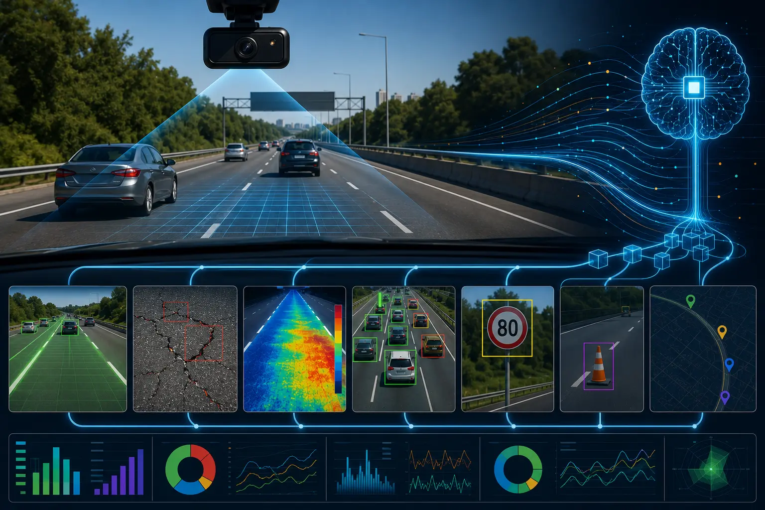
To better understand traffic patterns along corridors like NH-48, authorities are increasingly adopting AI-based traffic analytics software that helps identify congestion hotspots and optimize traffic flow.
NH-44 stretches approximately 3,745 kilometres from Srinagar to Kanyakumari, making it the longest highway in the country.
The route connects numerous major cities, including Delhi, Nagpur, Hyderabad, Bengaluru, and several regional economic centers.
Managing a corridor of this scale increasingly requires automated transportation systems that provide visibility into traffic conditions across multiple regions.
NH-16 connects Kolkata and Chennai along India's eastern coastline.
The highway plays a major role in supporting industrial activity, agricultural trade, and port connectivity across West Bengal, Odisha, Andhra Pradesh, and Tamil Nadu.
Many transportation agencies are now implementing real-time traffic monitoring solutions to improve incident response and reduce disruptions along major economic corridors.
NH-19 forms a critical section of India's Golden Quadrilateral network and connects Delhi with Kolkata through Uttar Pradesh, Bihar, Jharkhand, and West Bengal.
The route supports large-scale movement of goods between northern and eastern India.
To address these challenges, many agencies are leveraging AI-powered traffic analysis to identify traffic patterns and improve operational decision-making.
NH-27 is India's second-longest highway, stretching more than 3,500 kilometres from Gujarat to Assam.
The highway connects several major cities and serves as a vital route for agricultural, industrial, and commercial transportation.
Highways such as NH-27 benefit from automated traffic surveys, which help transportation agencies collect accurate traffic data for planning and infrastructure upgrades.
Despite their economic importance, the busiest highways in India face several common challenges.
Increasing vehicle ownership and freight movement continue to place pressure on highway capacity.
High traffic density often contributes to increased accident risks, making AI road safety solutions an important focus area for transportation authorities.
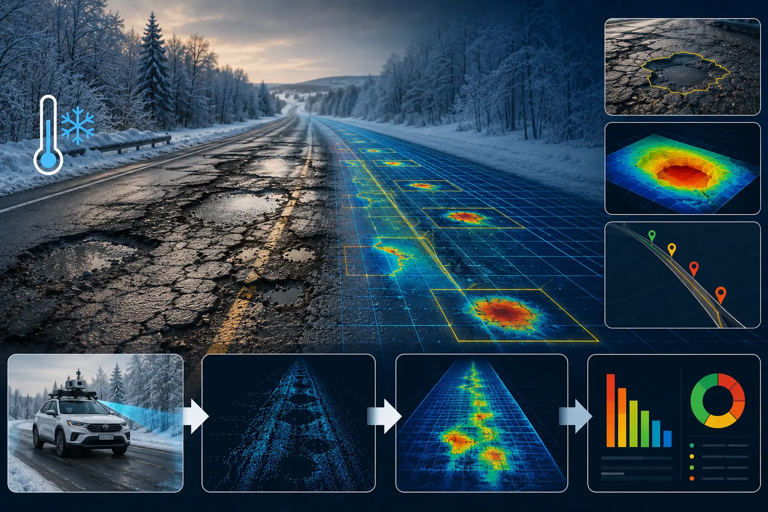
Maintaining thousands of kilometres of roadway infrastructure requires continuous monitoring and investment.
Many agencies still rely on periodic surveys rather than continuous traffic intelligence, limiting their ability to respond proactively.
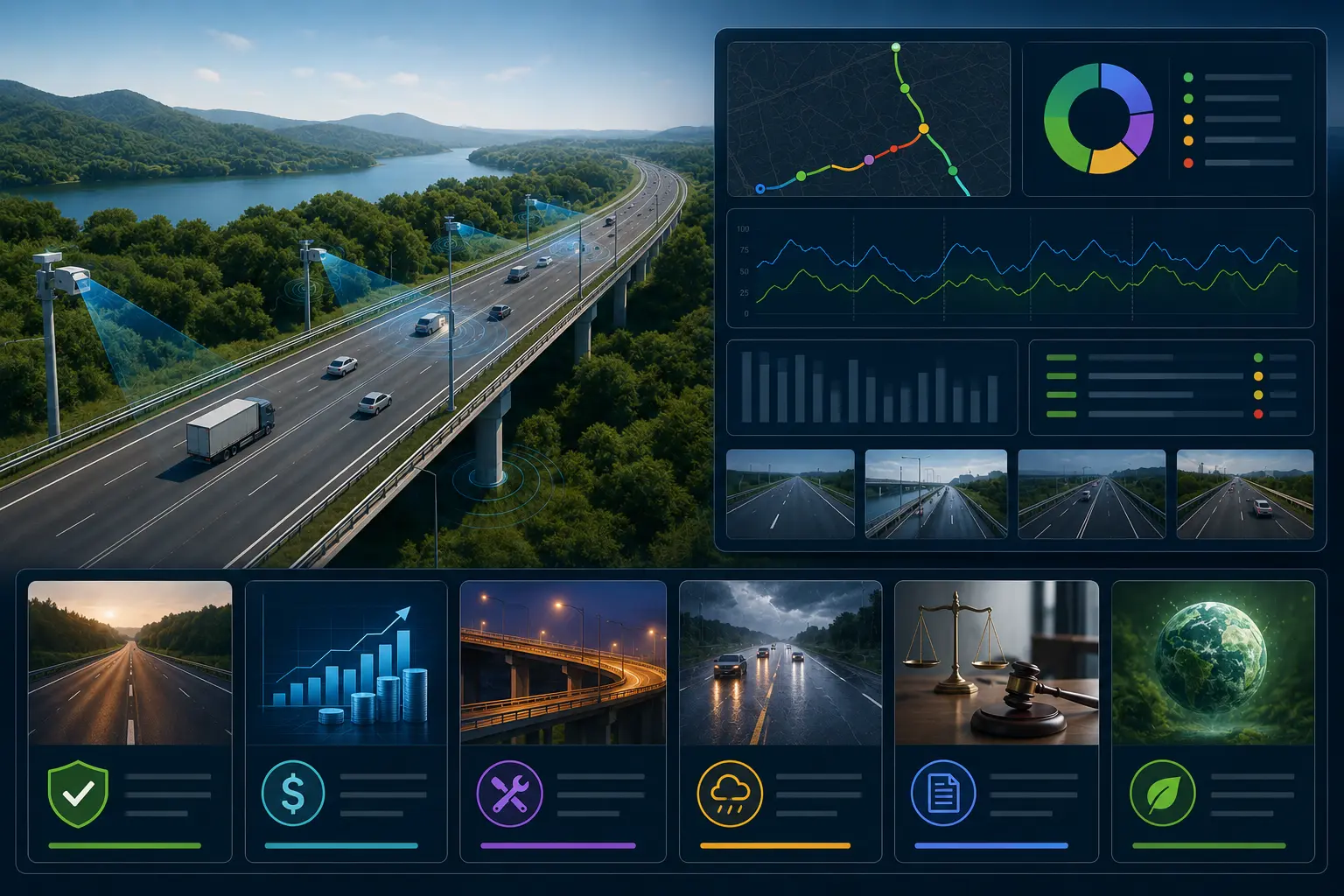
Digital technologies are reshaping how transportation agencies manage traffic and infrastructure.
Modern solutions can provide:
Platforms powered by smart highway monitoring enable authorities to gain real-time visibility into roadway conditions and operational performance.
At the same time, traffic congestion analysis tools help identify bottlenecks and support more efficient traffic management strategies.
As India's highway network continues to expand, transportation agencies are increasingly adopting data-driven approaches to improve mobility and safety.
Future highway programs are expected to include:
Technologies such as AI infrastructure analytics are helping agencies convert large volumes of roadway data into actionable insights, enabling smarter investment and operational decisions.
Similarly, road safety audit software is helping authorities identify safety risks and prioritize corrective measures before incidents occur.
The busiest highways in India are the backbone of the nation's transportation network, supporting economic growth, trade, logistics, and passenger mobility. Corridors such as NH-48, NH-44, NH-16, NH-19, and NH-27 handle enormous traffic volumes every day and play a vital role in connecting industries, cities, and communities across the country.
However, growing traffic demand also brings challenges related to congestion, safety, infrastructure performance, and operational efficiency. This is where advanced technologies are making a significant impact. Through solutions such as AI traffic monitoring, highway traffic management, and AI-powered traffic analysis, organizations can improve traffic flow, enhance safety, and optimize highway operations.
RoadVision AI supports this transformation through intelligent transportation analytics, infrastructure monitoring, and data-driven decision-making. By leveraging computer vision and real-time roadway intelligence, transportation agencies can build safer, smarter, and more efficient highway networks for the future.
NH-48, connecting Mumbai and Delhi, is widely considered one of the busiest highways in India due to its high freight and passenger traffic volumes.
NH-44 is the longest highway in India, stretching approximately 3,745 kilometres from Srinagar to Kanyakumari.
AI can analyze traffic patterns, detect incidents, monitor congestion, support safety audits, and provide real-time insights that help transportation agencies improve highway operations and road safety.

The Autonomous Road Engineer
AI that is transforming road infrastructure, from reactive to predictive.